Directions to Angra Tur (Angra Dos Reis) with public transportation
The following transit lines have routes that pass near Angra Tur
 Bus: 102, 230, B206, T10, T11.
- Ferry: ANGRA DOS REIS - ILHA GRANDE, ANGRA DOS REIS - ILHA GRANDE.
How to get to Angra Tur by bus?
Click on the bus route to see step by step directions with maps, line arrival times and updated time schedules.
From Andorinha Lanches, Jacuecanga
70 minFrom Pousada do Engenho de Bracuhy, Cunhambebe
87 minFrom Corca Transporte, Cunhambebe
46 minFrom Caputera I, Jacuecanga
69 minFrom A G Amaral, Jacuecanga
58 minFrom Malu Presentes, Jacuecanga
45 minFrom Angra-Monsuaba, Jacuecanga
67 minFrom Ariró, Angra dos Reis, Cunhambebe
62 min
Bus stops near Angra Tur in Angra Dos Reis
Ferry station near Angra Tur in Angra Dos Reis
- Estação Santa Luzia (Angra Dos Reis) ⛴, 28 min walk,VIEW
Bus lines to Angra Tur in Angra Dos Reis
- C05, Retiro,VIEW
- T11, Ponta Leste (via Jacuecanga),VIEW
- B106, Jacuecanga (via Morro da Cruz),VIEW
- 206, Banqueta,VIEW
- 207, Japuíba (via Morro da Cruz - Circular),VIEW
- B207, Japuíba (via Rio-Santos / Circular),VIEW
- 224, Vila Nova,VIEW
- 225, Campo Belo,VIEW
- C05B, Centro (via Balneário),VIEW
- 205, Areal,VIEW
- B203, Serra D'Agua (Túnel),VIEW
- 208, Belém (Circular),VIEW
- A220, Japuíba (Via Gamboa - Circular),VIEW
- B220, Japuíba (Via Balneário / Ribeira - Circular),VIEW
- 221, Nova Angra,VIEW
- B221, Nova Angra (via Gamboa / Ribeira),VIEW
- C01, Centro (Circular),VIEW
- C01B, Circular (via Pestalozzi),VIEW
- C03, Marinas,VIEW
- C03B, Marinas (via Balneário),VIEW
What are the closest stations to Angra Tur?
The closest stations to Angra Tur are:
- Rua Coronel Carvalho, 230a is 168 meters away, 3 min walk.
- Ponto De Embarque 04 - Praça Do Porto is 227 meters away, 3 min walk.
- Centro / Praça Do Porto is 239 meters away, 4 min walk.
- Ponto De Embarque 06 - Praça Do Porto is 253 meters away, 4 min walk.
- Avenida Júlio Maria, 289-385 is 313 meters away, 5 min walk.
- Ponto Final - Angra Dos Reis (Colitur) is 336 meters away, 5 min walk.
- Estação Santa Luzia (Angra Dos Reis) ⛴ is 2171 meters away, 28 min walk.
Which bus lines stop near Angra Tur?
These bus lines stop near Angra Tur: 102, 230, B206, T10, T11, T21.
What’s the nearest bus station to Angra Tur in Angra Dos Reis?
The nearest bus stations to Angra Tur in Angra Dos Reis are Rua Coronel Carvalho, 230a and Ponto De Embarque 04 - Praça Do Porto. The closest one is a 3 min walk away.
What’s the nearest ferry station to Angra Tur in Angra Dos Reis?
The nearest ferry station to Angra Tur in Angra Dos Reis is Estação Santa Luzia (Angra Dos Reis) ⛴. It’s a 28 min walk away.
What time is the first bus to Angra Tur in Angra Dos Reis?
The T11 is the first bus that goes to Angra Tur in Angra Dos Reis. It stops nearby at 4:50 AM.
What time is the last bus to Angra Tur in Angra Dos Reis?
The T11 is the last bus that goes to Angra Tur in Angra Dos Reis. It stops nearby at 2:00 AM.
What time is the first ferry to Angra Tur in Angra Dos Reis?
The ANGRA DOS REIS - ILHA GRANDE is the first ferry that goes to Angra Tur in Angra Dos Reis. It stops nearby at 8:35 AM.
What time is the last ferry to Angra Tur in Angra Dos Reis?
The ANGRA DOS REIS - ILHA GRANDE is the last ferry that goes to Angra Tur in Angra Dos Reis. It stops nearby at 6:30 PM.
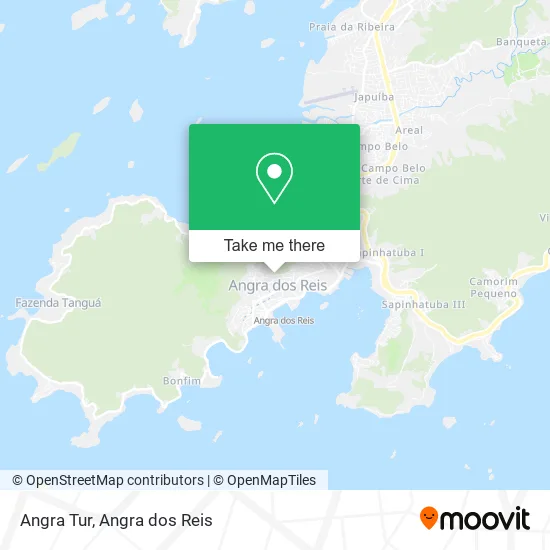
See Angra Tur, Angra Dos Reis, on the map
Public Transit to Angra Tur in Angra Dos Reis
Wondering how to get to Angra Tur in Angra Dos Reis? Moovit helps you find the best way to get to Angra Tur with step-by-step directions from the nearest public transit station.
Moovit provides free maps and live directions to help you navigate through your city. View schedules, routes, timetables, and find out how long does it take to get to Angra Tur in real time.
Looking for the nearest stop or station to Angra Tur? Check out this list of stops closest to your destination: Rua Coronel Carvalho; Ponto De Embarque 04 - Praça Do Porto; Centro / Praça Do Porto; Ponto De Embarque 06 - Praça Do Porto; Avenida Júlio Maria; Ponto Final - Angra Dos Reis (Colitur); Estação Santa Luzia (Angra Dos Reis) ⛴.
Bus: 102, 230, B206, T10, T11, T21, C05, B106, 206, 207, C05B, 205, B203, 208, A220, B220, 221, B221, C01, C01B, C03, C03B.Ferry: ANGRA DOS REIS - ILHA GRANDE, ANGRA DOS REIS - ILHA GRANDE.
Want to see if there’s another route that gets you there at an earlier time? Moovit helps you find alternative routes or times. Get directions from and directions to Angra Tur easily from the Moovit App or Website.
We make riding to Angra Tur easy, which is why over 1.5 million users, including users in Angra Dos Reis, trust Moovit as the best app for public transit. You don’t need to download an individual bus app or train app, Moovit is your all-in-one transit app that helps you find the best bus time or train time available.
For information on prices of bus, costs and ride fares to Angra Tur, please check the Moovit app.
Use the app to navigate to popular places including to the airport, hospital, stadium, grocery store, mall, coffee shop, school, college, and university.
Angra Tur Address: Rua Salomão Reseck, 530 Morro do Carmo Angra dos Reis-RJ 23903-125 street in Angra Dos Reis
- Bar da Maria,
- 6 J.F.C,
- Mercearia do Rubinho,
- Anika Loja,
- Fp Ilhas Angra Tour,
- L.A.M.S. Servicos de Construção e Reparos,
- Maria Bonita,
- Salgados Maria Bonita,
- Rosangela Franca,
- Snap&Net Telecom,
- Janaina Aluguel de Fantasias,
- Medusa Tattoo,
- Coopertur-RJ - Cooperativa dos Profissionais de Turismo do e,
- Armarinho de Graca,
- Rodovia Rio-Santos s/n,
- Grupo Espirita Caminho Verdade e Vida,
- Hot Dog Joao Lanches,
- Tr2 Prestadora de Servicos,
- Barbearia do Wellington,
- POINT DA AMIZADE
Places Near Angra Tur (Angra Dos Reis)
- Rua Cônegos Bittencourt, Angra Dos Reis,
- Centro Histórico de Paraty, Parati,
- Rua Prefeito João Gregório Galindo, Cunhambebe,
- Verolme, Jacuecanga,
- Cachoeira do Tobogã, Parati,
- Praia do Laboratório, Angra Dos Reis,
- Vila Residencial De Mambucaba, Mambucaba,
- BR 101, Km 508 s/n, Cunhambebe,
- Condominio Laranjeiras, Parati Mirim,
- Mambucaba, Mambucaba,
- Vila Galé Eco Resort De Angra, Angra Dos Reis,
- Rodovia Procurador Haroldo Fernandes Duarte, Km 513,5 s / n, Cunhambebe,
- praia jabaquara - parati, Parati,
- Alambique Engenho D'Ouro, Parati,
- Avenida Almirante Jair Carneiro Toscano de Brito 110, Angra Dos Reis,
- Garatucaia, Angra Dos Reis,
- Praia de Paraty Mirim, Parati,
- Rodovia BR 101, Km 533 s/n, Mambucaba,
- Avenida Antônio Bertholdo da Silva Jordão 7346, Jacuecanga,
- Rua Prefeito João Gregório Galindo 2487, Angra Dos Reis
How to get to popular places in Angra dos Reis with public transit
Get around Angra Dos Reis by public transit!
Traveling around Angra Dos Reis has never been so easy. See step by step directions as you travel to any attraction, street or major public transit station. View bus and train schedules, arrival times, service alerts and detailed routes on a map, so you know exactly how to get to anywhere in Angra Dos Reis.
When traveling to any destination around Angra Dos Reis use Moovit's Live Directions with Get Off Notifications to know exactly where and how far to walk, how long to wait for your line, and how many stops are left. Moovit will alert you when it's time to get off — no need to constantly re-check whether yours is the next stop.
Wondering how to use public transit in Angra Dos Reis or how to pay for public transit in Angra Dos Reis? Moovit public transit app can help you navigate your way with public transit easily, and at minimum cost. It includes public transit fees, ticket prices, and costs. Looking for a map of Angra Dos Reis public transit lines? Moovit public transit app shows all public transit maps in Angra Dos Reis with all Bus and Ferry routes and stops on an interactive map.
Angra dos Reis has 2 transit type(s), including: Bus and Ferry, operated by several transit agencies, including Viação Senhor do Bonfim, Colitur Transportes Rodoviários, Cooparatyense (Vans), Costa Verde Transportes, Barcas Rio, Objetiva Tour, Vilanova Tour, Rodoviário Oceano, BusUFF and Colitur (Tarifa Zero - Paraty)