Directions to Edmund Reardon House (Cambridge) with public transportation
The following transit lines have routes that pass near Edmund Reardon House
 Bus: 47, 64, 85, BB, EZRIDE.
- Train: FITCHBURG, FRAMINGHAM/WORCESTER.
- Subway: RED LINE, GREEN LINE B.
How to get to Edmund Reardon House by bus?
Click on the bus route to see step by step directions with maps, line arrival times and updated time schedules.
From Lower Mills, Boston
80 minFrom Best Western Adams Inn Quincy - Boston, Quincy
96 minFrom Vertex Pharmaceuticals (Fan Pier), Boston
53 minFrom Boda Borg, Malden
80 minFrom VFW Parkway, Boston
75 minFrom Uscis Biometrics Office, Revere
69 minFrom Constitution Beach, Boston
77 minFrom Dorchester, Boston
67 minFrom Mount Ida College, Newton
80 minFrom Winthrop, Winthrop Town
138 min
How to get to Edmund Reardon House by train?
Click on the train route to see step by step directions with maps, line arrival times and updated time schedules.
How to get to Edmund Reardon House by subway?
Click on the subway route to see step by step directions with maps, line arrival times and updated time schedules.
Bus stops near Edmund Reardon House in Cambridge
Subway stations near Edmund Reardon House in Cambridge
Bus lines to Edmund Reardon House in Cambridge
What are the closest stations to Edmund Reardon House?
The closest stations to Edmund Reardon House are:
- Erie St. is 129 yards away, 2 min walk.
- Pearl St @ Putnam Ave is 295 yards away, 4 min walk.
- Western Ave @ Kinnaird St is 536 yards away, 7 min walk.
- Amory Street is 1608 yards away, 19 min walk.
- Central is 1913 yards away, 23 min walk.
Which bus lines stop near Edmund Reardon House?
These bus lines stop near Edmund Reardon House: 47, 64, 85, BB, EZRIDE.
Which train lines stop near Edmund Reardon House?
These train lines stop near Edmund Reardon House: FITCHBURG, FRAMINGHAM/WORCESTER.
Which subway line stops near Edmund Reardon House?
RED LINE (Alewife)
What’s the nearest subway station to Edmund Reardon House in Cambridge?
The nearest subway station to Edmund Reardon House in Cambridge is Amory Street. It’s a 19 min walk away.
What’s the nearest bus station to Edmund Reardon House in Cambridge?
The nearest bus station to Edmund Reardon House in Cambridge is Erie St.. It’s a 2 min walk away.
What time is the first subway to Edmund Reardon House in Cambridge?
The GREEN LINE B is the first subway that goes to Edmund Reardon House in Cambridge. It stops nearby at 5:20 AM.
What time is the last subway to Edmund Reardon House in Cambridge?
The GREEN LINE B is the last subway that goes to Edmund Reardon House in Cambridge. It stops nearby at 2:20 AM.
What time is the first bus to Edmund Reardon House in Cambridge?
The 70 is the first bus that goes to Edmund Reardon House in Cambridge. It stops nearby at 4:27 AM.
What time is the last bus to Edmund Reardon House in Cambridge?
The 70 is the last bus that goes to Edmund Reardon House in Cambridge. It stops nearby at 1:11 AM.
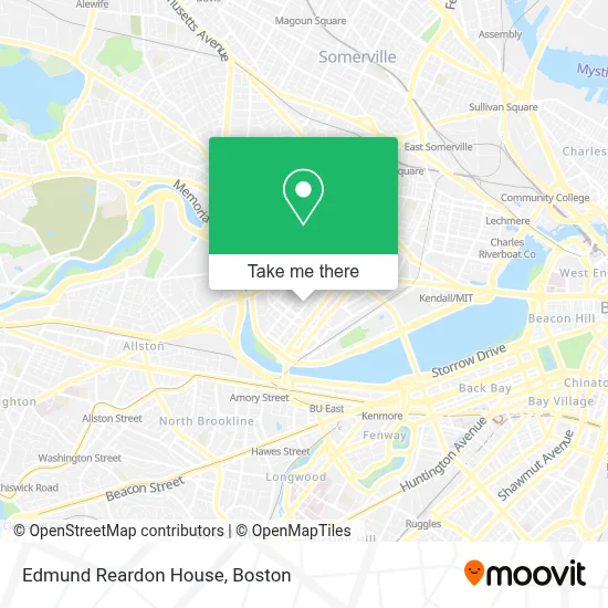
See Edmund Reardon House, Cambridge, on the map
Public Transit to Edmund Reardon House in Cambridge
Wondering how to get to Edmund Reardon House in Cambridge? Moovit helps you find the best way to get to Edmund Reardon House with step-by-step directions from the nearest public transit station.
Moovit provides free maps and live directions to help you navigate through your city. View schedules, routes, timetables, and find out how long does it take to get to Edmund Reardon House in real time.
Looking for the nearest stop or station to Edmund Reardon House? Check out this list of stops closest to your destination: Erie St.; Pearl St @ Putnam Ave; Western Ave @ Kinnaird St; Amory Street; Central.
Bus: 47, 64, 85, BB, EZRIDE, 70.Train: FITCHBURG, FRAMINGHAM/WORCESTER.Subway: RED LINE, GREEN LINE B.
Want to see if there’s another route that gets you there at an earlier time? Moovit helps you find alternative routes or times. Get directions from and directions to Edmund Reardon House easily from the Moovit App or Website.
We make riding to Edmund Reardon House easy, which is why over 1.7 million users, including users in Cambridge, trust Moovit as the best app for public transit. You don’t need to download an individual bus app or train app, Moovit is your all-in-one transit app that helps you find the best bus time or train time available.
For information on prices of bus, subway and train, costs and ride fares to Edmund Reardon House, please check the Moovit app.
Use the app to navigate to popular places including to the airport, hospital, stadium, grocery store, mall, coffee shop, school, college, and university.
Edmund Reardon House Address: 195 Erie St street in Cambridge
- Veterans Memorial Stadium,
- Stephen Funk Pearson,
- dartmouth college,
- 24m Technologies,
- Idera Pharmaceuticals, Inc.,
- Wofford John G,
- Seres Therapeutics,
- BMO Harris Bank,
- Abbvie,
- Sermo,
- The Massachusetts Institute of Technology,
- The Longwood Apartments,
- Intellia Therapeutics,
- Flour Bakery,
- MIT Sidney-Pacific Graduate Residence (Building NW86),
- Pleasant Street Condominiums,
- Shawmut Design and Construction,
- Walgreens,
- WESTERN UNION,
- Skyline Realty (Larue Barbara Skyline Properties Cambridge)
Places Near Edmund Reardon House (Cambridge)
- House Of Blues, Boston,
- Prudential Center, Boston,
- Wang Theater, Boston,
- Boston Convention & Exhibition Center, Boston,
- Wilbur Theatre, Boston,
- Boston Children's Hospital, Boston,
- North End, Boston,
- Boston Medical Center, Boston,
- Boston Common, Boston,
- Museum Of Science, Boston,
- Td Garden, Boston,
- Mgm Music Hall, Boston,
- Massachusetts General Hospital, Boston,
- Faneuil Hall, Boston,
- Seaport District, Boston,
- Quincy Market, Boston,
- Isabella Stewart Gardner Museum, Boston,
- Cheers, Boston,
- Leader Bank Pavilion (Leader Bank Pavillion), Boston,
- Castle Island, Boston
How to get to popular places in Boston with public transit
Get around Cambridge by public transit!
Traveling around Cambridge has never been so easy. See step by step directions as you travel to any attraction, street or major public transit station. View bus and train schedules, arrival times, service alerts and detailed routes on a map, so you know exactly how to get to anywhere in Cambridge.
When traveling to any destination around Cambridge use Moovit's Live Directions with Get Off Notifications to know exactly where and how far to walk, how long to wait for your line, and how many stops are left. Moovit will alert you when it's time to get off — no need to constantly re-check whether yours is the next stop.
Wondering how to use public transit in Cambridge or how to pay for public transit in Cambridge? Moovit public transit app can help you navigate your way with public transit easily, and at minimum cost. It includes public transit fees, ticket prices, and costs. Looking for a map of Cambridge public transit lines? Moovit public transit app shows all public transit maps in Cambridge with all Bus, Train, Subway and Ferry routes and stops on an interactive map.
Boston has 4 transit type(s), including: Bus, Train, Subway and Ferry, operated by several transit agencies, including MBTA, Southeastern Regional Transit Authority, MetroWest Regional Transit Authority, Rhode Island Public Transit Authority, WRTA, Lowell Regional Transit Authority, Merrimack Valley Transit, Montachusett Regional Transit Authority, Cape Cod Regional Transit Authority, Brockton Area Transit Authority, Martha's Vineyard Transit Authority, the WAVE - Nantucket Regional Transit Authority, GATRA, Cape Ann Transportation Authority and Massport