How to get to FIRATPEN by bus?
Click on the bus route to see step by step directions with maps, line arrival times and updated time schedules.
From Tema World, Küçükçekmece
105 minFrom Kayaşehir, Basaksehir
125 minFrom Atatürk Olimpiyat Stadyumu, Basaksehir
115 minFrom İkitelli, Küçükçekmece
89 minFrom Mustafa Kemal Paşa Metrobüs Durağı, Avcilar
42 minFrom Armoni park, Küçükçekmece
84 minFrom Mehmet Akif Ersoy Hastanesi Küçükçekmece Semt Polikliniği, Küçükçekmece
87 minFrom Mehmet Akif Ersoy, Küçükçekmece
104 minFrom Avcılar, Avcilar
49 min
Bus stops near FIRATPEN in Esenyurt
Dolmus & Minibus stations near FIRATPEN in Esenyurt
Bus lines to FIRATPEN in Esenyurt
- A43, Boğazköy,VIEW
- A43, Hadımköy,VIEW
- A43, Avcılar,VIEW
- A43, Deliklikaya,VIEW
- A43, Karaağaç,VIEW
- BL101, Büyükçekmece,VIEW
- 76D, Bahçeşehir-Gümüşsuyu Peron,VIEW
- 142, Aqua Dolphin-İ.Ü. Cerrahpaşa Avc. Kamp.,VIEW
- 142B, Kanuni Sultan Süleyman-Gürpınar Caddesi,VIEW
- 142E, Esenyurt Kiptaş 4.Etap-Aksaray Peron,VIEW
- 144A, Heybetli Sokak-İ.Ü. Cerrahpaşa Avc. Kamp.,VIEW
- 146, Boğazköy Son Durak-11.Cadde,VIEW
- 146F, Şehir Hastanesi-Fizik Tedavi Ve Rehabilitasyon-Kıraç Köprü,VIEW
- 147, İgtot-Cihangir Mahallesi,VIEW
- 142A, İ.Ü. Cerrahpaşa Avc. Kamp.-Hoşdere Kavşağı,VIEW
- 142ES, Şehit Ömer Halisdemir-İ.Ü. Cerrahpaşa Avc. Kamp.,VIEW
- A43, Avcılar(Küçükçekmece) - Kıraç,VIEW
- A43, Avcılar(Küçükçekmece) - Kıraç 2,VIEW
- 142T, Tüyap Metrobüs-K.S.S Hastanesi,VIEW
- BL101, Sanayi,VIEW
What are the closest stations to FIRATPEN?
The closest stations to FIRATPEN are:
- Sağlık Ocağı - Esenyurt Yönü is 138 meters away, 2 min walk.
- Ispartakule Cad. is 360 meters away, 5 min walk.
- Kiptaş Esenyurt - Esenyurt Yönü is 415 meters away, 6 min walk.
- 661 Sk is 699 meters away, 10 min walk.
- Merkez Mahallesi - H.Dere-Örnek Mah. Yönü is 863 meters away, 12 min walk.
- Esenyurt Geçit - Bakırköy Yönü is 933 meters away, 12 min walk.
- Salı Pazarı - H.Dere-Örnek Mah. Yönü is 936 meters away, 12 min walk.
Which bus lines stop near FIRATPEN?
These bus lines stop near FIRATPEN: 142, 142B, 146, 147, 76D.
Which Dolmus & Minibus lines stop near FIRATPEN?
These Dolmus & Minibus lines stop near FIRATPEN: A43, BL101.
What’s the nearest bus station to FIRATPEN in Esenyurt?
The nearest bus station to FIRATPEN in Esenyurt is Sağlık Ocağı - Esenyurt Yönü. It’s a 2 min walk away.
What’s the nearest Dolmus & Minibus station to FIRATPEN in Esenyurt?
The nearest Dolmus & Minibus station to FIRATPEN in Esenyurt is Ispartakule Cad.. It’s a 5 min walk away.
What time is the first bus to FIRATPEN in Esenyurt?
The 146 is the first bus that goes to FIRATPEN in Esenyurt. It stops nearby at 3:00 AM.
What time is the last bus to FIRATPEN in Esenyurt?
The 146 is the last bus that goes to FIRATPEN in Esenyurt. It stops nearby at 2:53 AM.
What time is the first Dolmus & Minibus to FIRATPEN in Esenyurt?
The BL101 is the first Dolmus & Minibus that goes to FIRATPEN in Esenyurt. It stops nearby at 5:10 AM.
What time is the last Dolmus & Minibus to FIRATPEN in Esenyurt?
The A43 is the last Dolmus & Minibus that goes to FIRATPEN in Esenyurt. It stops nearby at 1:00 AM.
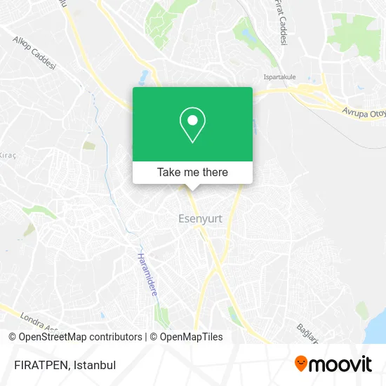
See FIRATPEN, Esenyurt, on the map
Public Transit to FIRATPEN in Esenyurt
Wondering how to get to FIRATPEN in Esenyurt? Moovit helps you find the best way to get to FIRATPEN with step-by-step directions from the nearest public transit station.
Moovit provides free maps and live directions to help you navigate through your city. View schedules, routes, timetables, and find out how long does it take to get to FIRATPEN in real time.
Looking for the nearest stop or station to FIRATPEN? Check out this list of stops closest to your destination: Sağlık Ocağı - Esenyurt Yönü; Ispartakule Cad.; Kiptaş Esenyurt - Esenyurt Yönü; 661 Sk; Merkez Mahallesi - H.Dere-Örnek Mah. Yönü; Esenyurt Geçit - Bakırköy Yönü; Salı Pazarı - H.Dere-Örnek Mah. Yönü.
Bus: 142, 142B, 146, 147, 76D, A43, A43, A43, A43, A43, 142A, 142ES, BL101, A43, A43, 142T.Dolmus & Minibus: A43, BL101, ES4.
Want to see if there’s another route that gets you there at an earlier time? Moovit helps you find alternative routes or times. Get directions from and directions to FIRATPEN easily from the Moovit App or Website.
We make riding to FIRATPEN easy, which is why over 1.5 million users, including users in Esenyurt, trust Moovit as the best app for public transit. You don’t need to download an individual bus app or train app, Moovit is your all-in-one transit app that helps you find the best bus time or train time available.
For information on prices of bus, Dolmus & Minibus and metro, costs and ride fares to FIRATPEN, please check the Moovit app.
Use the app to navigate to popular places including to the airport, hospital, stadium, grocery store, mall, coffee shop, school, college, and university.
FIRATPEN Address: 604. Sokak, 34510 Yenikent, Esenyurt street in Esenyurt
- Ermetsan Çelik Kapı,
- Saadet Büfe,
- Ak-El Yapi,
- Yenikent Erkek Kuaförü,
- Keyfcase,
- Ups,
- Prof Tesisat,
- Esenyurt Karakol Parkı,
- Esenyurt Polis Merkezi,
- Yapı Kredi Bankası,
- Esenyurt İlçe Emniyet Müdürlüğü İç Yolu 32 A,
- Furat Market,
- Esenyurt İlçe Emniyet Müdürlüğü,
- Herbal724life,
- esenyurt yargı akademi,
- Demir Park Esenyurt,
- West Garage Oto Yıka,
- ESENYURT CUMHURİYET MEYDANI METROBÜS DURAĞI,
- Tiki Eğlence Dünyası,
- Yenikent saglik ocagi
Places Near FIRATPEN (Esenyurt)
- VİALAND AVM, Eyüp,
- Şehit Prof. Dr. İlhan Varank Eğitim Ve Araştırma Hastanesi, Sancaktepe,
- İstanbul,
- Gebze-Harem Minibüs Hattı, Gebze,
- Hilltown AVM, Maltepe,
- Bakırköy Sosyete Pazarı, Bakirköy,
- Gebze Koop Durağı, Gebze,
- Mall Of İstanbul, Basaksehir,
- Mehmet Emin Tokadî Hz. Türbesi, Fatih,
- Tersane İstanbul, Beyoğlu,
- Topkule Kışlası 47.Komando Tugay Komutanlığı, Esenler,
- Hz. Yuşa Tepesi, Beykoz,
- METROPOL IsTaNBuL, Ataşehir,
- 212 AVM, Bagcilar,
- Başakşehir Çam Ve Sakura Şehir Hastanesi, Basaksehir,
- Karaköy Genelevi, Karaköy, Beyoğlu,
- İstinye Park, Sariyer,
- Beylikdüzü - 4 Nolu Minibüs Hattı, Beylikduzu,
- 2 Nolu Minibüss, Beylikduzu,
- 41 Burda AVM, Kocaeli Merkezi
How to get to popular places in Istanbul with public transit
Get around Esenyurt by public transit!
Traveling around Esenyurt has never been so easy. See step by step directions as you travel to any attraction, street or major public transit station. View bus and train schedules, arrival times, service alerts and detailed routes on a map, so you know exactly how to get to anywhere in Esenyurt.
When traveling to any destination around Esenyurt use Moovit's Live Directions with Get Off Notifications to know exactly where and how far to walk, how long to wait for your line, and how many stops are left. Moovit will alert you when it's time to get off — no need to constantly re-check whether yours is the next stop.
Wondering how to use public transit in Esenyurt or how to pay for public transit in Esenyurt? Moovit public transit app can help you navigate your way with public transit easily, and at minimum cost. It includes public transit fees, ticket prices, and costs. Looking for a map of Esenyurt public transit lines? Moovit public transit app shows all public transit maps in Esenyurt with all Bus, Train, Metro, Tram, Ferry, Metrobus and Dolmus & Minibus routes and stops on an interactive map.
Istanbul has 7 transit type(s), including: Bus, Train, Metro, Tram, Ferry, Metrobus and Dolmus & Minibus, operated by several transit agencies, including Marmaray, Metro İstanbul, Metrobüs, UAB, İETT, İETT ÇIFT KATLI HATLAR, İETT BÖLGESEL HATLAR, TCDD, Şehir Hatları, Dentur Avrasya, Beyden, Turyol, Mavi Marmara, Havaist and Prenstur
