How to get to Fernandez (Family Restaurant) by bus?
Click on the bus route to see step by step directions with maps, line arrival times and updated time schedules.
From Palladium, Worcester
107 minFrom Foxwoods, Worcester
131 minFrom Polar Park, Worcester
103 minFrom Saint Vincent Hospital at Worcester Medical Center, Worcester
103 minFrom Registry Of Motor Vehicles (Rmv) Branch Office, Worcester
106 minFrom Gardner, MA, Gardner
244 minFrom South High Community School, Worcester
198 minFrom Dcu Center, Worcester
104 minFrom Worcester, MA, Worcester
102 min
How to get to Fernandez (Family Restaurant) by train?
Click on the train route to see step by step directions with maps, line arrival times and updated time schedules.
Bus stops near Fernandez (Family Restaurant) in Boston
Train station near Fernandez (Family Restaurant) in Boston
- Holyoke Amtrak, 25 min walk,VIEW
Bus lines to Fernandez (Family Restaurant) in Boston
- B23, Holyoke Trans. Ctr. Via Hcc,VIEW
- P20, Holyoke Trans. Ctr. Via Holyoke Mall,VIEW
- P21, Union Station Via Meetinghouse/Meadow,VIEW
- P21E, Holyoke Trans Center Via I-391 Express,VIEW
- R22, Holyoke Via Grattan,VIEW
- R24, Holyoke Trans. Ctr.,VIEW
- T24, Beech St Via Main-Maple,VIEW
- G19, Holyoke Via Montcalm,VIEW
- R29, Mount Holyoke College,VIEW
- B48, Holyoke Trans. Ctr. Via Rt. 5,VIEW
- B49, Ware,VIEW
What are the closest stations to Fernandez (Family Restaurant)?
The closest stations to Fernandez (Family Restaurant) are:
- High / Dwight is 24 yards away, 1 min walk.
- Dwight / Front is 178 yards away, 3 min walk.
- Holyoke Transportation Center is 179 yards away, 3 min walk.
- Holyoke Amtrak is 2034 yards away, 25 min walk.
Which bus line stops near Fernandez (Family Restaurant)?
P21E (Holyoke Trans Center Via I-391 Express)
Which train line stops near Fernandez (Family Restaurant)?
VERMONTER (St Albans)
What’s the nearest train station to Fernandez (Family Restaurant) in Boston?
The nearest train station to Fernandez (Family Restaurant) in Boston is Holyoke Amtrak. It’s a 25 min walk away.
What’s the nearest bus station to Fernandez (Family Restaurant) in Boston?
The nearest bus station to Fernandez (Family Restaurant) in Boston is High / Dwight. It’s a 1 min walk away.
What time is the first train to Fernandez (Family Restaurant) in Boston?
The VALLEY FLYER is the first train that goes to Fernandez (Family Restaurant) in Boston. It stops nearby at 6:45 AM.
What time is the last train to Fernandez (Family Restaurant) in Boston?
The VALLEY FLYER is the last train that goes to Fernandez (Family Restaurant) in Boston. It stops nearby at 9:51 PM.
What time is the first bus to Fernandez (Family Restaurant) in Boston?
The P21 is the first bus that goes to Fernandez (Family Restaurant) in Boston. It stops nearby at 5:15 AM.
What time is the last bus to Fernandez (Family Restaurant) in Boston?
The P20 is the last bus that goes to Fernandez (Family Restaurant) in Boston. It stops nearby at 11:28 PM.
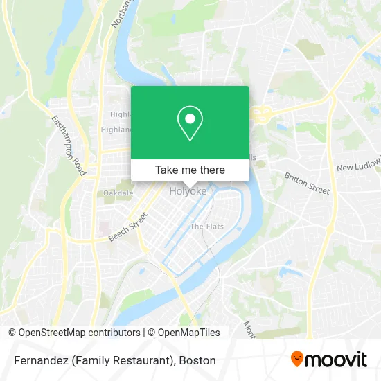
See Fernandez (Family Restaurant), Boston, on the map
Public Transit to Fernandez (Family Restaurant) in Boston
Wondering how to get to Fernandez (Family Restaurant) in Boston? Moovit helps you find the best way to get to Fernandez (Family Restaurant) with step-by-step directions from the nearest public transit station.
Moovit provides free maps and live directions to help you navigate through your city. View schedules, routes, timetables, and find out how long does it take to get to Fernandez (Family Restaurant) in real time.
Looking for the nearest stop or station to Fernandez (Family Restaurant)? Check out this list of stops closest to your destination: High / Dwight; Dwight / Front; Holyoke Transportation Center; Holyoke Amtrak.
Bus: P21E, B23, P20, P21, R22, G19, R29, B48, B49.Train: VERMONTER, VALLEY FLYER.
Want to see if there’s another route that gets you there at an earlier time? Moovit helps you find alternative routes or times. Get directions from and directions to Fernandez (Family Restaurant) easily from the Moovit App or Website.
We make riding to Fernandez (Family Restaurant) easy, which is why over 1.7 million users, including users in Boston, trust Moovit as the best app for public transit. You don’t need to download an individual bus app or train app, Moovit is your all-in-one transit app that helps you find the best bus time or train time available.
For information on prices of bus and train, costs and ride fares to Fernandez (Family Restaurant), please check the Moovit app.
Use the app to navigate to popular places including to the airport, hospital, stadium, grocery store, mall, coffee shop, school, college, and university.
Fernandez (Family Restaurant) Address: 161 High St street in Boston
- Pete's Non-Stop Cuts Unisex,
- Commonwealth of Massachusetts,
- First Choice Academy, Inc,
- Brooks and Buyers,
- Holyoke High Realty,
- Intra,
- Expert Staffing,
- Recover Project,
- Herrick Robert,
- Greyhound Bus,
- Head Start-Holyoke Maple St,
- Pops Cafe,
- Totally Baked 413,
- Undefeated Cuts,
- Amaranta's Salon Studio,
- House of Glam,
- Holyoke St Patrick's Road Race,
- United States Government,
- Union-News/Sunday Republican,
- Veterans' Memorial Park
Places Near Fernandez (Family Restaurant) (Boston)
- Quincy Market, Boston,
- Boston Convention & Exhibition Center, Boston,
- Wilbur Theatre, Boston,
- Cheers, Boston,
- Leader Bank Pavilion (Leader Bank Pavillion), Boston,
- Boston Children's Hospital, Boston,
- Museum Of Science, Boston,
- Boston Common, Boston,
- North End, Boston,
- Prudential Center, Boston,
- Td Garden, Boston,
- Boston Medical Center, Boston,
- Isabella Stewart Gardner Museum, Boston,
- Castle Island, Boston,
- House Of Blues, Boston,
- Faneuil Hall, Boston,
- Seaport District, Boston,
- Wang Theater, Boston,
- Mgm Music Hall, Boston,
- Massachusetts General Hospital, Boston
How to get to popular places in Boston with public transit
Get around Boston by public transit!
Traveling around Boston has never been so easy. See step by step directions as you travel to any attraction, street or major public transit station. View bus and train schedules, arrival times, service alerts and detailed routes on a map, so you know exactly how to get to anywhere in Boston.
When traveling to any destination around Boston use Moovit's Live Directions with Get Off Notifications to know exactly where and how far to walk, how long to wait for your line, and how many stops are left. Moovit will alert you when it's time to get off — no need to constantly re-check whether yours is the next stop.
Wondering how to use public transit in Boston or how to pay for public transit in Boston? Moovit public transit app can help you navigate your way with public transit easily, and at minimum cost. It includes public transit fees, ticket prices, and costs. Looking for a map of Boston public transit lines? Moovit public transit app shows all public transit maps in Boston with all Bus, Train, Subway and Ferry routes and stops on an interactive map.
Boston has 4 transit type(s), including: Bus, Train, Subway and Ferry, operated by several transit agencies, including MBTA, Southeastern Regional Transit Authority, MetroWest Regional Transit Authority, Rhode Island Public Transit Authority, WRTA, Lowell Regional Transit Authority, Merrimack Valley Transit, Montachusett Regional Transit Authority, Cape Cod Regional Transit Authority, Brockton Area Transit Authority, Martha's Vineyard Transit Authority, the WAVE - Nantucket Regional Transit Authority, GATRA, Cape Ann Transportation Authority and Massport