How to get to Gaani Meri by bus?
Click on the bus route to see step by step directions with maps, line arrival times and updated time schedules.
From Bussoladomani Park, Union of Municipalities of Versilia
46 minFrom Carrarafiere, Carrara
66 minFrom San Camillo Care Home, Forte Dei Marmi
21 minFrom Marina di Pietrasanta, Pietrasanta
38 minFrom Oriental Festival, Carrara
61 minFrom Marina di Carrara, Carrara
37 minFrom Pietrasanta Athletics Field - Falcone and Borsellino Facility, Pietrasanta
71 minFrom Villa Bertelli, Union of Municipalities of Versilia
22 minFrom Tonfano, Union of Municipalities of Versilia
41 min
Bus stops near Gaani Meri in Massa
Train station near Gaani Meri in Massa
- Massa Center, 49 min walk,VIEW
Bus lines to Gaani Meri in Massa
- L61, Apuane Hospital,VIEW
- L63, Paradiso,VIEW
- L63, Fossa Maestra,VIEW
- E1, Apuane Hospital,VIEW
- L60, Marina Di Massa Betti Square,VIEW
- L62, Massa Railway Station,VIEW
- L51, Carrara-New Apuan Hospital,VIEW
- L64, Massa-Via Carducci-Via Mattei-Marina Di Massa,VIEW
- L67, Massa-Bergiola Maggiore,VIEW
- L71, Carrara School Services,VIEW
- L76, Massa-Industrial Zone-Marina Di Carrara,VIEW
- L77, School Services Massa,VIEW
- L17, Sarzana,VIEW
What are the closest stations to Gaani Meri?
The closest stations to Gaani Meri are:
- San Leonardo Street/Aulla Street is 110 meters away, 2 min walk.
- San Leonardo/Lungobrugiano is 320 meters away, 5 min walk.
- Marina Di Massa Betti Square is 343 meters away, 5 min walk.
- Via Mattei/Via Pontremoli is 685 meters away, 9 min walk.
- Massa Center is 3814 meters away, 49 min walk.
Which bus lines stop near Gaani Meri?
These bus lines stop near Gaani Meri: E1, L51, L60.
What’s the nearest bus station to Gaani Meri in Massa?
The nearest bus station to Gaani Meri in Massa is San Leonardo Street/Aulla Street. It’s a 2 min walk away.
What time is the first train to Gaani Meri in Massa?
The R is the first train that goes to Gaani Meri in Massa. It stops nearby at 5:43 AM.
What time is the last train to Gaani Meri in Massa?
The R is the last train that goes to Gaani Meri in Massa. It stops nearby at 11:06 PM.
What time is the first bus to Gaani Meri in Massa?
The L51 is the first bus that goes to Gaani Meri in Massa. It stops nearby at 6:31 AM.
What time is the last bus to Gaani Meri in Massa?
The L51 is the last bus that goes to Gaani Meri in Massa. It stops nearby at 10:30 PM.
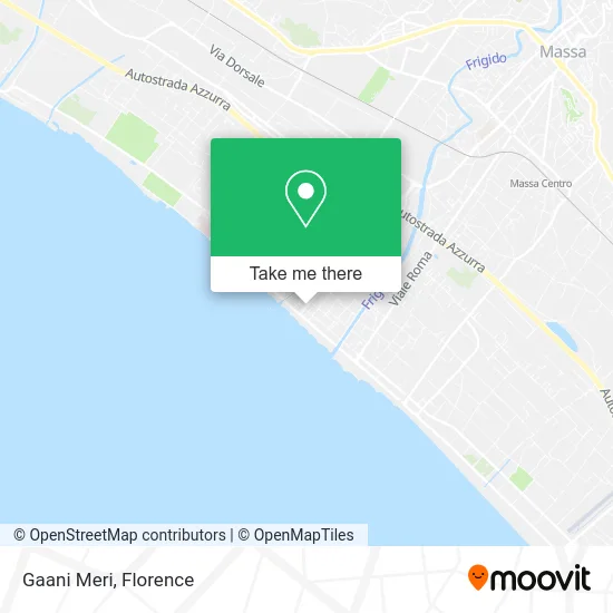
See Gaani Meri, Massa, on the map
Public Transit to Gaani Meri in Massa
Wondering how to get to Gaani Meri in Massa? Moovit helps you find the best way to get to Gaani Meri with step-by-step directions from the nearest public transit station.
Moovit provides free maps and live directions to help you navigate through your city. View schedules, routes, timetables, and find out how long does it take to get to Gaani Meri in real time.
Looking for the nearest stop or station to Gaani Meri? Check out this list of stops closest to your destination: San Leonardo Street/Aulla Street; San Leonardo/Lungobrugiano; Marina Di Massa Betti Square; Via Mattei/Via Pontremoli; Massa Center.
Bus: E1, L51, L60, L61, L63, L63, L62, L64, L67, L71, L76, L17.Train: R, R, R, R.
Want to see if there’s another route that gets you there at an earlier time? Moovit helps you find alternative routes or times. Get directions from and directions to Gaani Meri easily from the Moovit App or Website.
We make riding to Gaani Meri easy, which is why over 1.5 million users, including users in Massa, trust Moovit as the best app for public transit. You don’t need to download an individual bus app or train app, Moovit is your all-in-one transit app that helps you find the best bus time or train time available.
For information on prices of bus and train, costs and ride fares to Gaani Meri, please check the Moovit app.
Use the app to navigate to popular places including to the airport, hospital, stadium, grocery store, mall, coffee shop, school, college, and university.
Gaani Meri Address: Piazza Francesco Betti, 54100 Massa street in Massa
- Taxi,
- 26 Sea and Shop,
- Bargoni Sweet & Drink,
- Oriental Games,
- Aricò Carmela,
- Margaritas,
- Suele,
- M.E.S.E. Constructions Sas of Morbidi Giuseppe & C.,
- Tirreno,
- Sea Direction Betti Square,
- Nobile Pharmacy,
- Tirreno Beachfront Apartments,
- Twenty-Six Mare&Bottega,
- UniCredit ATM,
- Gabriella Satti,
- Notary Office of Cesare Gattoni and Alessandro Matteucci,
- Cafè del Mar,
- Flying Tiger,
- Unico Pinseria,
- Ohana Club
Places Near Gaani Meri (Massa)
- Cascine Park, Florence,
- Michelangelo Square, Florence,
- Michelangelo Square, Florence,
- Torregalli Hospital Scandicci *, Scandicci,
- Tobacco Manufacture, Florence,
- OOO, Florence,
- IKEA Florence, Sesto Fiorentino,
- Verdi Theater, Florence,
- Asmana, Campi Bisenzio,
- Artemio Franchi Municipal Stadium, Florence,
- Nelson Mandela Forum, Florence,
- Visarno Hippodrome, Florence,
- Santa Maria Nuova Hospital, Florence,
- I Gigli, Campi Bisenzio,
- Campi Bisenzio, Campi Bisenzio,
- Piero Palagi Hospital Facility-Florence, Florence,
- Field of Mars, Florence,
- Mandela Forum (Nelson Mandela Forum), Florence,
- Santa Maria Novella Station, Florence,
- Visarno Arena, Florence
How to get to popular places in Florence with public transit
Get around Massa by public transit!
Traveling around Massa has never been so easy. See step by step directions as you travel to any attraction, street or major public transit station. View bus and train schedules, arrival times, service alerts and detailed routes on a map, so you know exactly how to get to anywhere in Massa.
When traveling to any destination around Massa use Moovit's Live Directions with Get Off Notifications to know exactly where and how far to walk, how long to wait for your line, and how many stops are left. Moovit will alert you when it's time to get off — no need to constantly re-check whether yours is the next stop.
Wondering how to use public transit in Massa or how to pay for public transit in Massa? Moovit public transit app can help you navigate your way with public transit easily, and at minimum cost. It includes public transit fees, ticket prices, and costs. Looking for a map of Massa public transit lines? Moovit public transit app shows all public transit maps in Massa with all Bus, Train, Light Rail, Ferry and Funicular routes and stops on an interactive map.
Florence has 5 transit type(s), including: Bus, Train, Light Rail, Ferry and Funicular, operated by several transit agencies, including Florence Urban - Tuscan Bus Lines, GEST, Livorno and Province - Tuscan Bus Lines, Arezzo, Florence and Provinces - Tuscan Bus Lines, Prato and Province - Tuscan Bus Lines, Lucca and Province - Tuscan Bus Lines, Massa, Carrara and Province - Tuscan Bus Lines, Pisa and Province - Tuscan Bus Lines, Grosseto, Siena and Provinces - Tuscan Bus Lines, Arezzo, Siena and Provinces - Tuscan Bus Lines, Florence and Province - Tuscan Bus Lines, Pistoia and Province - Tuscan Bus Lines, Siena and Province - Tuscan Bus Lines, Arezzo and Province - Tuscan Bus Lines and Trenitalia