How to get to Itaú Unibanco by bus?
Click on the bus route to see step by step directions with maps, line arrival times and updated time schedules.
From Hospital Estadual Alberto Torres, São Gonçalo
45 minFrom Cadeia Publica Juiza Patricia Lourival Acioli, São Gonçalo
52 minFrom Cadeia Pública Tiago Teles, São Gonçalo
45 minFrom UFF - Universidade Federal Fluminense, Niterói
45 minFrom Bairro de Fátima, Niterói
39 minFrom São Francisco, Niterói
51 minFrom Hospital Niterói D'Or, Niterói
49 minFrom Policlínica Newton Alves Cardozo, Jardim Carioca
74 minFrom Charitas, Niterói
51 minFrom Rua Almirante Barroso, Centro
63 min
Bus stops near Itaú Unibanco in São Gonçalo
Bus lines to Itaú Unibanco in São Gonçalo
- 536, Niterói,VIEW
- 12, Jardim Catarina - Covanca (Via Santa Luzia),VIEW
- 13A, Santa Luzia - Venda da Cruz (Via Neves / Covanca),VIEW
- 13B, Santa Luzia - Neves,VIEW
- 31, Praia da Luz - Barreto,VIEW
- 400, Palmeiras - Niterói (Via Nova Cidade),VIEW
- 401, Luiz Caçador - Niterói (Via Porto Velho),VIEW
- 402, São Lourenço - Niterói (Via Porto Velho),VIEW
- 408, Alcântara - Niterói (Via Porto Velho),VIEW
- 409, Alcântara - Niterói (Via Trindade),VIEW
- 422M, Portão do Rosa - Niterói (Via Porto Velho),VIEW
- 424D, Alcântara - Campo Grande (Via Água Branca),VIEW
- 526M, Antonina - Niterói (Via Porto da Pedra),VIEW
- 403M, Niterói - Trindade ( Via Porto Velho ),VIEW
- 517M, Fazenda dos Mineiros - Niterói ( Via Porto Velho ),VIEW
- 13, Neves,VIEW
- 515M, Mutuá,VIEW
- 110, São Gonçalo X Passeio,VIEW
- 423, São Gonçalo X Vila Isabel Via Praça Sans Pena,VIEW
- 428, São Gonçalo X Vila Isabel Via Uerj,VIEW
What are the closest stations to Itaú Unibanco?
The closest stations to Itaú Unibanco are:
- Rua Visconde De Itaúna is 15 meters away, 1 min walk.
- Rua Comandante Ari Parreiras 2412 is 162 meters away, 3 min walk.
- Rua Francisco Portela 171 | Publix is 205 meters away, 3 min walk.
- Rua Comandante Ari Parreiras 2079 | Bradesco Paraíso is 307 meters away, 5 min walk.
- Rua Comandante Ari Parreiras 1844 is 347 meters away, 5 min walk.
Which bus lines stop near Itaú Unibanco?
These bus lines stop near Itaú Unibanco: 110, 401, 409, 424D, 536.
What’s the nearest bus station to Itaú Unibanco in São Gonçalo?
The nearest bus station to Itaú Unibanco in São Gonçalo is Rua Visconde De Itaúna. It’s a 1 min walk away.
What time is the first bus to Itaú Unibanco in São Gonçalo?
The 409 is the first bus that goes to Itaú Unibanco in São Gonçalo. It stops nearby at 3:01 AM.
What time is the last bus to Itaú Unibanco in São Gonçalo?
The 409 is the last bus that goes to Itaú Unibanco in São Gonçalo. It stops nearby at 3:02 AM.
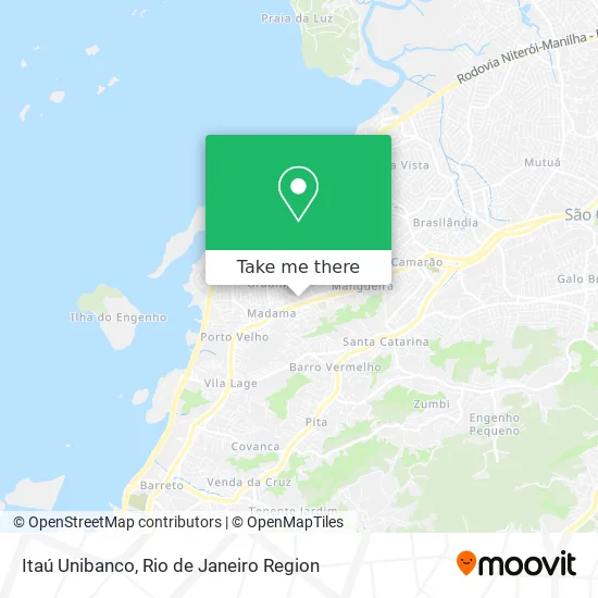
See Itaú Unibanco, São Gonçalo, on the map
Public Transit to Itaú Unibanco in São Gonçalo
Wondering how to get to Itaú Unibanco in São Gonçalo? Moovit helps you find the best way to get to Itaú Unibanco with step-by-step directions from the nearest public transit station.
Moovit provides free maps and live directions to help you navigate through your city. View schedules, routes, timetables, and find out how long does it take to get to Itaú Unibanco in real time.
Looking for the nearest stop or station to Itaú Unibanco? Check out this list of stops closest to your destination: Rua Visconde De Itaúna; Rua Comandante Ari Parreiras 2412; Rua Francisco Portela 171 | Publix; Rua Comandante Ari Parreiras 2079 | Bradesco Paraíso; Rua Comandante Ari Parreiras 1844.
Bus: 110, 401, 409, 424D, 536, 12, 13A, 13B, 31, 400, 13, 515M, 423, 428, 2110, 4110.
Want to see if there’s another route that gets you there at an earlier time? Moovit helps you find alternative routes or times. Get directions from and directions to Itaú Unibanco easily from the Moovit App or Website.
We make riding to Itaú Unibanco easy, which is why over 1.5 million users, including users in São Gonçalo, trust Moovit as the best app for public transit. You don’t need to download an individual bus app or train app, Moovit is your all-in-one transit app that helps you find the best bus time or train time available.
For information on prices of bus, costs and ride fares to Itaú Unibanco, please check the Moovit app.
Use the app to navigate to popular places including to the airport, hospital, stadium, grocery store, mall, coffee shop, school, college, and university.
Itaú Unibanco Address: Rua Visconde de Itaúna, 3145 Paraíso São Gonçalo-RJ 24431-005 street in São Gonçalo
- Itau - paraiso - agencia 7462,
- Hortifruti Paraíso,
- Rua Visconde de Itaúna Próximo ao 3145-3149,
- Gilmar da Silva Goncalves,
- Casa Myra,
- Espaço de Festa Papicho,
- Linha 567M - Avenida Central / Niterói,
- Vidraçaria e Serralheria Paraíso,
- Rua Fontes 300,
- Nardi,
- Cartorio do 2o Circunscrição do 4o Oficio,
- Banco Bradesco - Agência 6023-2,
- Rua Comandante Ari Parreiras 2179,
- Loja Maçonica Monte Ararat,
- Vigstar Escola Especializada na Formação de Profissionais de Segurança,
- Jb Informatica,
- Consultório Dentário Dra Fernanda de Deus,
- Wasol Administracao e Manutencao Em Condominios,
- Sindicato dos Vigilantes e Empregados Em Empresas de Seguran,
- Academia Stronger
Places Near Itaú Unibanco (São Gonçalo)
- Hospital Federal Do Andaraí, Andaraí,
- Hospital Municipal Ronaldo Gazolla, Acari,
- Rua Licínio Cardoso, São Francisco Xavier,
- Avenida Rio Branco, Centro,
- Praia do Arpoador, Ipanema,
- Hospital Federal Cardoso Fontes, Jacarepaguá,
- Shopping Nova América, Del Castilho,
- Museu Do Amanhã, Centro,
- Rio De Janeiro,
- Niterói, Niterói,
- Hospital Pedro Ernesto, Vila Isabel,
- Norte Shopping, Cachambi,
- Rodoviária Novo Rio (Rodoviária do Rio de Janeiro), Santo Cristo,
- Rua Ulysses Guimarães 16, Cidade Nova,
- Avenida Venezuela 134, Saúde,
- Feira Livre da Gloria, Glória,
- Shopping RioSul, Botafogo,
- Feirão De Malhas, Duque De Caxias,
- Shopping Rio Sul, Botafogo,
- Shopping Downtown, Barra Da Tijuca
How to get to popular places in Rio de Janeiro Region with public transit
Get around São Gonçalo by public transit!
Traveling around São Gonçalo has never been so easy. See step by step directions as you travel to any attraction, street or major public transit station. View bus and train schedules, arrival times, service alerts and detailed routes on a map, so you know exactly how to get to anywhere in São Gonçalo.
When traveling to any destination around São Gonçalo use Moovit's Live Directions with Get Off Notifications to know exactly where and how far to walk, how long to wait for your line, and how many stops are left. Moovit will alert you when it's time to get off — no need to constantly re-check whether yours is the next stop.
Wondering how to use public transit in São Gonçalo or how to pay for public transit in São Gonçalo? Moovit public transit app can help you navigate your way with public transit easily, and at minimum cost. It includes public transit fees, ticket prices, and costs. Looking for a map of São Gonçalo public transit lines? Moovit public transit app shows all public transit maps in São Gonçalo with all Bus, Train, Metro, Light Rail, Ferry, Cable Car, Gondola and Funicular routes and stops on an interactive map.
Rio de Janeiro Region has 8 transit type(s), including: Bus, Train, Metro, Light Rail, Ferry, Cable Car, Gondola and Funicular, operated by several transit agencies, including TrensRJ, Metrô Rio, VLT Carioca, Barcas Rio, BRT MOBI-Rio, Auto Viação Alpha, Auto Viação Tijuca, Gire Transportes, Transurb, Viação Nossa Senhora das Graças, Consórcio INTERSUL, Braso Lisboa (Municipal), Caprichosa Auto Ônibus, Auto Viação Três Amigos and Rodoviária Âncora Matias