How to get to J C Learning Center Inc by bus?
Click on the bus route to see step by step directions with maps, line arrival times and updated time schedules.
From Dcu Center, Worcester
104 minFrom Saint Vincent Hospital at Worcester Medical Center, Worcester
104 minFrom Worcester, MA, Worcester
102 minFrom South High Community School, Worcester
199 minFrom Foxwoods, Worcester
131 minFrom Palladium, Worcester
107 minFrom Polar Park, Worcester
104 minFrom Gardner, MA, Gardner
244 minFrom Registry Of Motor Vehicles (Rmv) Branch Office, Worcester
106 min
How to get to J C Learning Center Inc by train?
Click on the train route to see step by step directions with maps, line arrival times and updated time schedules.
Bus stops near J C Learning Center Inc in Boston
Train station near J C Learning Center Inc in Boston
- Holyoke Amtrak, 56 min walk,VIEW
Bus lines to J C Learning Center Inc in Boston
- B23, Holyoke Trans. Ctr. Via Hcc,VIEW
- P20, Holyoke Trans. Ctr. Via Holyoke Mall,VIEW
- P21, Union Station Via Meetinghouse/Meadow,VIEW
- P21E, Holyoke Trans Center Via I-391 Express,VIEW
- R22, Holyoke Via Grattan,VIEW
- R24, Holyoke Trans. Ctr.,VIEW
- T24, Beech St Via Main-Maple,VIEW
- R29, Mount Holyoke College,VIEW
- B48, Holyoke Trans. Ctr. Via Rt. 5,VIEW
- B49, Ware,VIEW
- G19, Holyoke Via Montcalm,VIEW
What are the closest stations to J C Learning Center Inc?
The closest stations to J C Learning Center Inc are:
- Maple / Suffolk is 79 yards away, 2 min walk.
- Main / Appleton (2) is 121 yards away, 2 min walk.
- Holyoke Transportation Center is 297 yards away, 4 min walk.
- Holyoke Amtrak is 4717 yards away, 56 min walk.
Which bus line stops near J C Learning Center Inc?
P21E (Holyoke Trans Center Via I-391 Express)
Which train line stops near J C Learning Center Inc?
VERMONTER (St Albans)
What’s the nearest bus station to J C Learning Center Inc in Boston?
The nearest bus stations to J C Learning Center Inc in Boston are Maple / Suffolk and Main / Appleton (2). The closest one is a 2 min walk away.
What time is the first train to J C Learning Center Inc in Boston?
The VALLEY FLYER is the first train that goes to J C Learning Center Inc in Boston. It stops nearby at 6:45 AM.
What time is the last train to J C Learning Center Inc in Boston?
The VALLEY FLYER is the last train that goes to J C Learning Center Inc in Boston. It stops nearby at 9:51 PM.
What time is the first bus to J C Learning Center Inc in Boston?
The P21 is the first bus that goes to J C Learning Center Inc in Boston. It stops nearby at 5:15 AM.
What time is the last bus to J C Learning Center Inc in Boston?
The P20 is the last bus that goes to J C Learning Center Inc in Boston. It stops nearby at 11:28 PM.
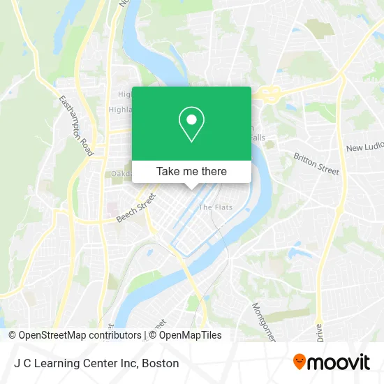
See J C Learning Center Inc, Boston, on the map
Public Transit to J C Learning Center Inc in Boston
Wondering how to get to J C Learning Center Inc in Boston? Moovit helps you find the best way to get to J C Learning Center Inc with step-by-step directions from the nearest public transit station.
Moovit provides free maps and live directions to help you navigate through your city. View schedules, routes, timetables, and find out how long does it take to get to J C Learning Center Inc in real time.
Looking for the nearest stop or station to J C Learning Center Inc? Check out this list of stops closest to your destination: Maple / Suffolk; Main / Appleton (2); Holyoke Transportation Center; Holyoke Amtrak.
Bus: P21E, B23, P20, P21, R22, R29, B48, B49, G19.Train: VERMONTER, VALLEY FLYER.
Want to see if there’s another route that gets you there at an earlier time? Moovit helps you find alternative routes or times. Get directions from and directions to J C Learning Center Inc easily from the Moovit App or Website.
We make riding to J C Learning Center Inc easy, which is why over 1.7 million users, including users in Boston, trust Moovit as the best app for public transit. You don’t need to download an individual bus app or train app, Moovit is your all-in-one transit app that helps you find the best bus time or train time available.
For information on prices of bus and train, costs and ride fares to J C Learning Center Inc, please check the Moovit app.
Use the app to navigate to popular places including to the airport, hospital, stadium, grocery store, mall, coffee shop, school, college, and university.
J C Learning Center Inc Address: 251 Appleton St street in Boston
- Salvation Army,
- Holyoke Corps,
- Betty Groceries & Restaurant,
- High Muzik,
- Staceys Dance Studio,
- Diamond Air Brush,
- Holyoke Canal Walk,
- Inked Out Tattoo Studio,
- Lechonera El Paseo in,
- Commonwealth of Massachusetts Environmental Management,
- Iglesia Rescatando las Ovejas Perdidas Inc.,
- T-Mobile,
- Iglesia Pentecostal la Senda Antigua,
- CHD CS Holyoke,
- El Paraiso Colombiano,
- Concilio Unión de Iglesias Cristianas Pentecostales de Jesucristo, inc.,
- Massachusetts Wing Chun Kung Fu Council,
- Emmanuel,
- The Church of Rescuing Sheeps,
- Betty Minimart
Places Near J C Learning Center Inc (Boston)
- Wang Theater, Boston,
- Massachusetts General Hospital, Boston,
- Cheers, Boston,
- Td Garden, Boston,
- Boston Medical Center, Boston,
- Quincy Market, Boston,
- North End, Boston,
- Seaport District, Boston,
- Faneuil Hall, Boston,
- Isabella Stewart Gardner Museum, Boston,
- Boston Convention & Exhibition Center, Boston,
- Museum Of Science, Boston,
- Boston Common, Boston,
- Leader Bank Pavilion (Leader Bank Pavillion), Boston,
- Wilbur Theatre, Boston,
- Mgm Music Hall, Boston,
- Prudential Center, Boston,
- Castle Island, Boston,
- House Of Blues, Boston,
- Boston Children's Hospital, Boston
How to get to popular places in Boston with public transit
Get around Boston by public transit!
Traveling around Boston has never been so easy. See step by step directions as you travel to any attraction, street or major public transit station. View bus and train schedules, arrival times, service alerts and detailed routes on a map, so you know exactly how to get to anywhere in Boston.
When traveling to any destination around Boston use Moovit's Live Directions with Get Off Notifications to know exactly where and how far to walk, how long to wait for your line, and how many stops are left. Moovit will alert you when it's time to get off — no need to constantly re-check whether yours is the next stop.
Wondering how to use public transit in Boston or how to pay for public transit in Boston? Moovit public transit app can help you navigate your way with public transit easily, and at minimum cost. It includes public transit fees, ticket prices, and costs. Looking for a map of Boston public transit lines? Moovit public transit app shows all public transit maps in Boston with all Bus, Train, Subway and Ferry routes and stops on an interactive map.
Boston has 4 transit type(s), including: Bus, Train, Subway and Ferry, operated by several transit agencies, including MBTA, Southeastern Regional Transit Authority, MetroWest Regional Transit Authority, Rhode Island Public Transit Authority, WRTA, Lowell Regional Transit Authority, Merrimack Valley Transit, Montachusett Regional Transit Authority, Cape Cod Regional Transit Authority, Brockton Area Transit Authority, Martha's Vineyard Transit Authority, the WAVE - Nantucket Regional Transit Authority, GATRA, Cape Ann Transportation Authority and Massport