Directions to Kivo Solutions (Boston) with public transportation
The following transit lines have routes that pass near Kivo Solutions
 Bus: 39, 16, 21, 30, 31.
- Train: NEEDHAM, FRANKLIN/FOXBORO, ORANGE LINE, PROVIDENCE/STOUGHTON.
- Subway: ORANGE LINE.
How to get to Kivo Solutions by bus?
Click on the bus route to see step by step directions with maps, line arrival times and updated time schedules.
From Boston Harbor Cruises, Boston
64 minFrom The Schrafft Center, Boston
87 minFrom Danehy Park, Cambridge
91 minFrom Bunker Hill, Boston
92 minFrom Assembly Row, Somerville
93 minFrom Club Quarters, Boston
53 minFrom Bunker Hill Monument, Boston
83 minFrom Bistro du Midi, Boston
43 minFrom Pax East, Boston
64 minFrom Kkkk, Boston
92 min
How to get to Kivo Solutions by train?
Click on the train route to see step by step directions with maps, line arrival times and updated time schedules.
How to get to Kivo Solutions by subway?
Click on the subway route to see step by step directions with maps, line arrival times and updated time schedules.
From Boston Harbor Cruises, Boston
31 minFrom The Schrafft Center, Boston
38 minFrom Danehy Park, Cambridge
56 minFrom Bunker Hill, Boston
45 minFrom Assembly Row, Somerville
48 minFrom Club Quarters, Boston
26 minFrom Bunker Hill Monument, Boston
41 minFrom Bistro du Midi, Boston
29 minFrom Pax East, Boston
40 minFrom Kkkk, Boston
45 min
Train station near Kivo Solutions in Boston
- Forest Hills, 1 min walk,VIEW
Bus stop near Kivo Solutions in Boston
- Forest Hills, 2 min walk,VIEW
Bus lines to Kivo Solutions in Boston
- 16, Andrew via South Bay Center - Forest Hills via South Bay Center,VIEW
- 21, Forest Hills - Ashmont,VIEW
- 30, Forest Hills - Mattapan,VIEW
- 31, Forest Hills - Mattapan,VIEW
- 32, Forest Hills - Wolcott Square,VIEW
- 33, Mattapan - River St & Milton St,VIEW
- 34, Forest Hills - Dedham Mall,VIEW
- 35, Forest Hills - Dedham Mall,VIEW
- 36, Forest Hills - VA Hospital,VIEW
- 37, Forest Hills - Baker & Vermont St,VIEW
- 38, Forest Hills - Wren St,VIEW
- 39, Back Bay - Forest Hills,VIEW
- 40, Forest Hills - Georgetowne,VIEW
- 42, Nubian - Forest Hills,VIEW
- 50, Forest Hills - Cleary Square,VIEW
- 51, Forest Hills - Reservoir,VIEW
- 34E, Forest Hills - Walpole Center via Washington St,VIEW
- NEEDHAM LINE SHUTTLE, Newton Highlands - Forest Hills,VIEW
- NEEDHAM LINE SHUTTLE, Needham Heights - Forest Hills,VIEW
- ORANGE LINE SHUTTLE, Forest Hills - Copley,VIEW
What are the closest stations to Kivo Solutions?
The closest stations to Kivo Solutions are:
- Forest Hills is 65 yards away, 1 min walk.
Which bus line stops near Kivo Solutions?
39 (Forest Hills)
Which train line stops near Kivo Solutions?
NEEDHAM (#625 | Needham Heights)
Which subway line stops near Kivo Solutions?
ORANGE LINE (Forest Hills)
What’s the nearest train station to Kivo Solutions in Boston?
The nearest train station to Kivo Solutions in Boston is Forest Hills. It’s a 1 min walk away.
What’s the nearest bus station to Kivo Solutions in Boston?
The nearest bus station to Kivo Solutions in Boston is Forest Hills. It’s a 2 min walk away.
What time is the first subway to Kivo Solutions in Boston?
The ORANGE LINE is the first subway that goes to Kivo Solutions in Boston. It stops nearby at 5:15 AM.
What time is the last subway to Kivo Solutions in Boston?
The ORANGE LINE is the last subway that goes to Kivo Solutions in Boston. It stops nearby at 1:58 AM.
What time is the first train to Kivo Solutions in Boston?
The NEEDHAM is the first train that goes to Kivo Solutions in Boston. It stops nearby at 7:30 AM.
What time is the last train to Kivo Solutions in Boston?
The PROVIDENCE/STOUGHTON is the last train that goes to Kivo Solutions in Boston. It stops nearby at 12:08 AM.
What time is the first bus to Kivo Solutions in Boston?
The 16 is the first bus that goes to Kivo Solutions in Boston. It stops nearby at 4:30 AM.
What time is the last bus to Kivo Solutions in Boston?
The 36 is the last bus that goes to Kivo Solutions in Boston. It stops nearby at 1:43 AM.
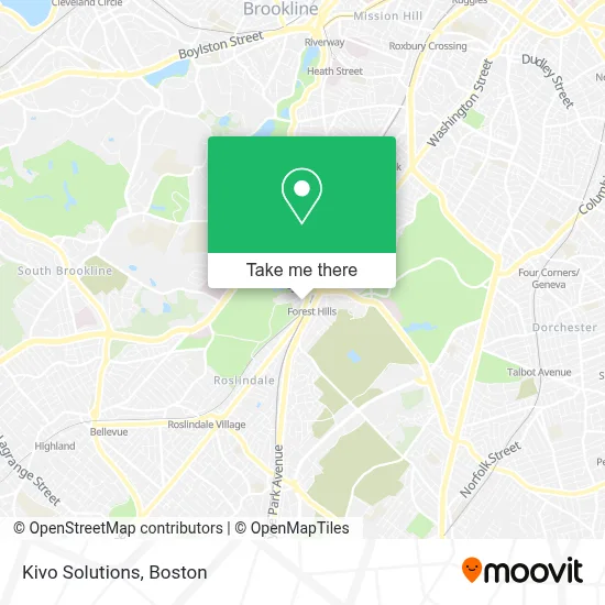
See Kivo Solutions, Boston, on the map
Public Transit to Kivo Solutions in Boston
Wondering how to get to Kivo Solutions in Boston? Moovit helps you find the best way to get to Kivo Solutions with step-by-step directions from the nearest public transit station.
Moovit provides free maps and live directions to help you navigate through your city. View schedules, routes, timetables, and find out how long does it take to get to Kivo Solutions in real time.
Looking for the nearest stop or station to Kivo Solutions? Check out this list of stops closest to your destination: Forest Hills.
Bus: 39, 16, 21, 30, 31, 32.Train: NEEDHAM, FRANKLIN/FOXBORO, ORANGE LINE, PROVIDENCE/STOUGHTON.Subway: ORANGE LINE.
Want to see if there’s another route that gets you there at an earlier time? Moovit helps you find alternative routes or times. Get directions from and directions to Kivo Solutions easily from the Moovit App or Website.
We make riding to Kivo Solutions easy, which is why over 1.7 million users, including users in Boston, trust Moovit as the best app for public transit. You don’t need to download an individual bus app or train app, Moovit is your all-in-one transit app that helps you find the best bus time or train time available.
For information on prices of subway, bus and train, costs and ride fares to Kivo Solutions, please check the Moovit app.
Use the app to navigate to popular places including to the airport, hospital, stadium, grocery store, mall, coffee shop, school, college, and university.
Kivo Solutions Address: 18 Asticou Rd street in Boston
- South St & Washington St,
- MBTA Forest Hills Station,
- Forest Hills Station MBTA,
- Forest Hills - Hyde Park Ave, Franklin Park, Zoo, Parking,
- Klassy Kuts Barber Shop,
- Memphis Locksmith,
- Apothecary Dispensary,
- Apothca,
- Dosa Factory,
- Forest Hills Station Lower Busway,
- Laz Parking (Public Parking),
- The Croft School,
- Forest Hi,
- West Roxbury-Boston Municipal Court,
- Keene Deanna Deanna Keene Law Offices Jamaica Plain,
- West Roxbury Courthouse,
- West Roxbury District Court,
- West Roxbury-Boston Municipal Court ,
- Doherty Lumber,
- Dunkin'
Places Near Kivo Solutions (Boston)
- Boston Children's Hospital, Boston,
- Castle Island, Boston,
- House Of Blues, Boston,
- North End, Boston,
- Seaport District, Boston,
- Faneuil Hall, Boston,
- Leader Bank Pavilion (Leader Bank Pavillion), Boston,
- Wang Theater, Boston,
- Boston Convention & Exhibition Center, Boston,
- Boston Common, Boston,
- Massachusetts General Hospital, Boston,
- Boston Medical Center, Boston,
- Prudential Center, Boston,
- Cheers, Boston,
- Td Garden, Boston,
- Mgm Music Hall, Boston,
- Quincy Market, Boston,
- Wilbur Theatre, Boston,
- Museum Of Science, Boston,
- Isabella Stewart Gardner Museum, Boston
How to get to popular places in Boston with public transit
Get around Boston by public transit!
Traveling around Boston has never been so easy. See step by step directions as you travel to any attraction, street or major public transit station. View bus and train schedules, arrival times, service alerts and detailed routes on a map, so you know exactly how to get to anywhere in Boston.
When traveling to any destination around Boston use Moovit's Live Directions with Get Off Notifications to know exactly where and how far to walk, how long to wait for your line, and how many stops are left. Moovit will alert you when it's time to get off — no need to constantly re-check whether yours is the next stop.
Wondering how to use public transit in Boston or how to pay for public transit in Boston? Moovit public transit app can help you navigate your way with public transit easily, and at minimum cost. It includes public transit fees, ticket prices, and costs. Looking for a map of Boston public transit lines? Moovit public transit app shows all public transit maps in Boston with all Bus, Train, Subway and Ferry routes and stops on an interactive map.
Boston has 4 transit type(s), including: Bus, Train, Subway and Ferry, operated by several transit agencies, including MBTA, Southeastern Regional Transit Authority, MetroWest Regional Transit Authority, Rhode Island Public Transit Authority, WRTA, Lowell Regional Transit Authority, Merrimack Valley Transit, Montachusett Regional Transit Authority, Cape Cod Regional Transit Authority, Brockton Area Transit Authority, Martha's Vineyard Transit Authority, the WAVE - Nantucket Regional Transit Authority, GATRA, Cape Ann Transportation Authority and Massport