How to get to Main Wok Chinese by bus?
Click on the bus route to see step by step directions with maps, line arrival times and updated time schedules.
From Palladium, Worcester
116 minFrom Registry Of Motor Vehicles (Rmv) Branch Office, Worcester
115 minFrom Foxwoods, Worcester
141 minFrom Polar Park, Worcester
113 minFrom South High Community School, Worcester
208 minFrom Worcester, MA, Worcester
111 minFrom Dcu Center, Worcester
113 minFrom Walmart Supercenter, Worcester
170 min
Bus stops near Main Wok Chinese in Boston
Bus lines to Main Wok Chinese in Boston
What are the closest stations to Main Wok Chinese?
The closest stations to Main Wok Chinese are:
- Page / Windemere is 592 yards away, 7 min walk.
- Page / Fresno is 676 yards away, 8 min walk.
- Roosevelt / Cottage is 1094 yards away, 13 min walk.
Which bus line stops near Main Wok Chinese?
G2 (E Springfield Via Carew-Mercy-Cottage)
What’s the nearest bus station to Main Wok Chinese in Boston?
The nearest bus station to Main Wok Chinese in Boston is Page / Windemere. It’s a 7 min walk away.
What time is the first bus to Main Wok Chinese in Boston?
The G2 is the first bus that goes to Main Wok Chinese in Boston. It stops nearby at 5:44 AM.
What time is the last bus to Main Wok Chinese in Boston?
The G2 is the last bus that goes to Main Wok Chinese in Boston. It stops nearby at 10:28 PM.
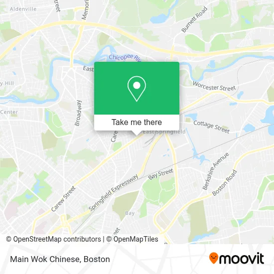
See Main Wok Chinese, Boston, on the map
Public Transit to Main Wok Chinese in Boston
Wondering how to get to Main Wok Chinese in Boston? Moovit helps you find the best way to get to Main Wok Chinese with step-by-step directions from the nearest public transit station.
Moovit provides free maps and live directions to help you navigate through your city. View schedules, routes, timetables, and find out how long does it take to get to Main Wok Chinese in real time.
Looking for the nearest stop or station to Main Wok Chinese? Check out this list of stops closest to your destination: Page / Windemere; Page / Fresno; Roosevelt / Cottage.
Bus: G2, T2, T3, T4, T21, X92.
Want to see if there’s another route that gets you there at an earlier time? Moovit helps you find alternative routes or times. Get directions from and directions to Main Wok Chinese easily from the Moovit App or Website.
We make riding to Main Wok Chinese easy, which is why over 1.7 million users, including users in Boston, trust Moovit as the best app for public transit. You don’t need to download an individual bus app or train app, Moovit is your all-in-one transit app that helps you find the best bus time or train time available.
For information on prices of bus, costs and ride fares to Main Wok Chinese, please check the Moovit app.
Use the app to navigate to popular places including to the airport, hospital, stadium, grocery store, mall, coffee shop, school, college, and university.
Main Wok Chinese Address: 590 Page Blvd street in Boston
- No Limits,
- Fettes Wine & Spirits,
- Soullaod Restaurant,
- Slosek Insurance,
- Kassy Mart Grocery,
- Iglesia Cristiana Pentecostés-SPFLD, Ma * Movimiento Misionero Mundial,
- Agap Love Fellowship,
- Big Sandwich,
- Sunnyside Up Restaurant,
- Allure Locksmith,
- Compliance Security,
- CARQUEST,
- Mountain Auto Parts,
- Genden Auto Parts,
- Necds,
- Sheet Metal Workers H & W & Annuity Fund,
- Wireless Solutions,
- 413 Multi Service,
- Virtue Salon of Excellence,
- Hot Spot
Places Near Main Wok Chinese (Boston)
- House Of Blues, Boston,
- Boston Children's Hospital, Boston,
- Leader Bank Pavilion (Leader Bank Pavillion), Boston,
- Prudential Center, Boston,
- North End, Boston,
- Boston Common, Boston,
- Quincy Market, Boston,
- Faneuil Hall, Boston,
- Isabella Stewart Gardner Museum, Boston,
- Wang Theater, Boston,
- Mgm Music Hall, Boston,
- Wilbur Theatre, Boston,
- Cheers, Boston,
- Castle Island, Boston,
- Museum Of Science, Boston,
- Boston Medical Center, Boston,
- Seaport District, Boston,
- Boston Convention & Exhibition Center, Boston,
- Massachusetts General Hospital, Boston,
- Td Garden, Boston
How to get to popular places in Boston with public transit
Get around Boston by public transit!
Traveling around Boston has never been so easy. See step by step directions as you travel to any attraction, street or major public transit station. View bus and train schedules, arrival times, service alerts and detailed routes on a map, so you know exactly how to get to anywhere in Boston.
When traveling to any destination around Boston use Moovit's Live Directions with Get Off Notifications to know exactly where and how far to walk, how long to wait for your line, and how many stops are left. Moovit will alert you when it's time to get off — no need to constantly re-check whether yours is the next stop.
Wondering how to use public transit in Boston or how to pay for public transit in Boston? Moovit public transit app can help you navigate your way with public transit easily, and at minimum cost. It includes public transit fees, ticket prices, and costs. Looking for a map of Boston public transit lines? Moovit public transit app shows all public transit maps in Boston with all Bus, Train, Subway and Ferry routes and stops on an interactive map.
Boston has 4 transit type(s), including: Bus, Train, Subway and Ferry, operated by several transit agencies, including MBTA, Southeastern Regional Transit Authority, MetroWest Regional Transit Authority, Rhode Island Public Transit Authority, WRTA, Lowell Regional Transit Authority, Merrimack Valley Transit, Montachusett Regional Transit Authority, Cape Cod Regional Transit Authority, Brockton Area Transit Authority, Martha's Vineyard Transit Authority, the WAVE - Nantucket Regional Transit Authority, GATRA, Cape Ann Transportation Authority and Massport