Directions to Megan Gallagher, Md (Boston) with public transportation
The following transit lines have routes that pass near Megan Gallagher, Md
 Bus: G1, P21, T21, T1, T2.
- Train: LAKE SHORE LIMITED, VERMONTER, AMTRAK HARTFORD LINE, NORTHEAST REGIONAL, VALLEY FLYER.
How to get to Megan Gallagher, Md by bus?
Click on the bus route to see step by step directions with maps, line arrival times and updated time schedules.
From Walmart Supercenter, Worcester
154 minFrom Polar Park, Worcester
96 minFrom Registry Of Motor Vehicles (Rmv) Branch Office, Worcester
99 minFrom South High Community School, Worcester
192 minFrom Dcu Center, Worcester
97 minFrom Worcester, MA, Worcester
95 minFrom Foxwoods, Worcester
124 minFrom Palladium, Worcester
100 min
How to get to Megan Gallagher, Md by train?
Click on the train route to see step by step directions with maps, line arrival times and updated time schedules.
Bus stops near Megan Gallagher, Md in Boston
Train station near Megan Gallagher, Md in Boston
- Springfield, 38 min walk,VIEW
Bus lines to Megan Gallagher, Md in Boston
What are the closest stations to Megan Gallagher, Md?
The closest stations to Megan Gallagher, Md are:
- Main/Noble is 101 yards away, 2 min walk.
- Chestnut / Baystate Medical Center is 177 yards away, 4 min walk.
- Main/Cumberland(Opposite) is 460 yards away, 6 min walk.
- Springfield is 3190 yards away, 38 min walk.
Which bus lines stop near Megan Gallagher, Md?
These bus lines stop near Megan Gallagher, Md: G1, P21.
Which train lines stop near Megan Gallagher, Md?
These train lines stop near Megan Gallagher, Md: LAKE SHORE LIMITED, VERMONTER.
What’s the nearest bus station to Megan Gallagher, Md in Boston?
The nearest bus station to Megan Gallagher, Md in Boston is Main/Noble. It’s a 2 min walk away.
What time is the first train to Megan Gallagher, Md in Boston?
The NORTHEAST REGIONAL is the first train that goes to Megan Gallagher, Md in Boston. It stops nearby at 4:10 AM.
What time is the last train to Megan Gallagher, Md in Boston?
The LAKE SHORE LIMITED is the last train that goes to Megan Gallagher, Md in Boston. It stops nearby at 6:04 PM.
What time is the first bus to Megan Gallagher, Md in Boston?
The P21 is the first bus that goes to Megan Gallagher, Md in Boston. It stops nearby at 5:05 AM.
What time is the last bus to Megan Gallagher, Md in Boston?
The G1 is the last bus that goes to Megan Gallagher, Md in Boston. It stops nearby at 9:56 PM.
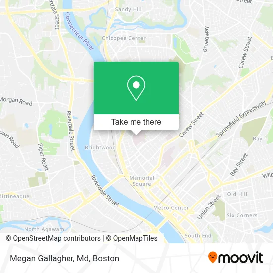
See Megan Gallagher, Md, Boston, on the map
Public Transit to Megan Gallagher, Md in Boston
Wondering how to get to Megan Gallagher, Md in Boston? Moovit helps you find the best way to get to Megan Gallagher, Md with step-by-step directions from the nearest public transit station.
Moovit provides free maps and live directions to help you navigate through your city. View schedules, routes, timetables, and find out how long does it take to get to Megan Gallagher, Md in real time.
Looking for the nearest stop or station to Megan Gallagher, Md? Check out this list of stops closest to your destination: Main/Noble; Chestnut / Baystate Medical Center; Main/Cumberland(Opposite); Springfield.
Bus: G1, P21, T21, T1, T2, T3, T5, T92.Train: LAKE SHORE LIMITED, VERMONTER, AMTRAK HARTFORD LINE, NORTHEAST REGIONAL, VALLEY FLYER.
Want to see if there’s another route that gets you there at an earlier time? Moovit helps you find alternative routes or times. Get directions from and directions to Megan Gallagher, Md easily from the Moovit App or Website.
We make riding to Megan Gallagher, Md easy, which is why over 1.7 million users, including users in Boston, trust Moovit as the best app for public transit. You don’t need to download an individual bus app or train app, Moovit is your all-in-one transit app that helps you find the best bus time or train time available.
For information on prices of bus and train, costs and ride fares to Megan Gallagher, Md, please check the Moovit app.
Use the app to navigate to popular places including to the airport, hospital, stadium, grocery store, mall, coffee shop, school, college, and university.
Megan Gallagher, Md Address: 759 Chestnut St street in Boston
- Health Sciences Library,
- Baystate General Surgery,
- Riffat Sabir, MD,
- James D Mueller, MD,
- Sudha Boochi Reddy, MD,
- Prasanth Prabhakaran, MD,
- Lewis Cohen, MD,
- Rifat Zaman,
- Kathy E Troczynski, CNP - Baystate Health,
- Saquib Inayatullah MD,
- Bethany L Lacasse, Pa,
- Baystate Trauma and Acute Care Surgery,
- Benjamin B Mattingly, MD,
- Thomas A Schwann, MD,
- Fereshetian Aram V Radiology Services,
- Erika W. Lachance, MD,
- Michael Canarie MD,
- Davis Family Heart and Vascular Center,
- Nadia A. Villarroel, MD,
- Reham S Shaaban, do
Places Near Megan Gallagher, Md (Boston)
- Faneuil Hall, Boston,
- Castle Island, Boston,
- Museum Of Science, Boston,
- Wilbur Theatre, Boston,
- Isabella Stewart Gardner Museum, Boston,
- Massachusetts General Hospital, Boston,
- North End, Boston,
- Seaport District, Boston,
- Leader Bank Pavilion (Leader Bank Pavillion), Boston,
- Boston Convention & Exhibition Center, Boston,
- Boston Common, Boston,
- Quincy Market, Boston,
- Prudential Center, Boston,
- Boston Medical Center, Boston,
- Mgm Music Hall, Boston,
- Cheers, Boston,
- Wang Theater, Boston,
- Td Garden, Boston,
- Boston Children's Hospital, Boston,
- House Of Blues, Boston
How to get to popular places in Boston with public transit
Get around Boston by public transit!
Traveling around Boston has never been so easy. See step by step directions as you travel to any attraction, street or major public transit station. View bus and train schedules, arrival times, service alerts and detailed routes on a map, so you know exactly how to get to anywhere in Boston.
When traveling to any destination around Boston use Moovit's Live Directions with Get Off Notifications to know exactly where and how far to walk, how long to wait for your line, and how many stops are left. Moovit will alert you when it's time to get off — no need to constantly re-check whether yours is the next stop.
Wondering how to use public transit in Boston or how to pay for public transit in Boston? Moovit public transit app can help you navigate your way with public transit easily, and at minimum cost. It includes public transit fees, ticket prices, and costs. Looking for a map of Boston public transit lines? Moovit public transit app shows all public transit maps in Boston with all Bus, Train, Subway and Ferry routes and stops on an interactive map.
Boston has 4 transit type(s), including: Bus, Train, Subway and Ferry, operated by several transit agencies, including MBTA, Southeastern Regional Transit Authority, MetroWest Regional Transit Authority, Rhode Island Public Transit Authority, WRTA, Lowell Regional Transit Authority, Merrimack Valley Transit, Montachusett Regional Transit Authority, Cape Cod Regional Transit Authority, Brockton Area Transit Authority, Martha's Vineyard Transit Authority, the WAVE - Nantucket Regional Transit Authority, GATRA, Cape Ann Transportation Authority and Massport