Directions to Mendez Landscape & Masonry (Boston) with public transportation
The following transit lines have routes that pass near Mendez Landscape & Masonry
 Bus: 501, 66, 70, 96, 64.
- Train: FITCHBURG, FRAMINGHAM/WORCESTER.
- Subway: RED LINE, GREEN LINE B.
How to get to Mendez Landscape & Masonry by bus?
Click on the bus route to see step by step directions with maps, line arrival times and updated time schedules.
From Rose Kennedy Greenway, Boston
42 minFrom Washington St, Boston
84 minFrom ICA, Boston
49 minFrom Revere, MA, Revere
88 minFrom Winchester, MA, Winchester
94 minFrom Snowport Winter Village, Boston
48 minFrom Medford Square, Medford
55 minFrom Suffolk Downs, Boston
90 minFrom AMC Theatres, Boston
61 minFrom Hampton Inn Boston Logan Airport, Revere
77 min
How to get to Mendez Landscape & Masonry by train?
Click on the train route to see step by step directions with maps, line arrival times and updated time schedules.
How to get to Mendez Landscape & Masonry by subway?
Click on the subway route to see step by step directions with maps, line arrival times and updated time schedules.
Bus stops near Mendez Landscape & Masonry in Boston
Subway stations near Mendez Landscape & Masonry in Boston
Bus lines to Mendez Landscape & Masonry in Boston
What are the closest stations to Mendez Landscape & Masonry?
The closest stations to Mendez Landscape & Masonry are:
- Cambridge St @ Mass Pike Exit is 47 yards away, 2 min walk.
- River St Opp Blackstone St is 349 yards away, 5 min walk.
- N Harvard St @ S Campus Dr is 425 yards away, 6 min walk.
- Cambridge St @ Seattle St is 581 yards away, 8 min walk.
- Packards Corner is 988 yards away, 12 min walk.
- Harvard Square is 1014 yards away, 12 min walk.
Which bus lines stop near Mendez Landscape & Masonry?
These bus lines stop near Mendez Landscape & Masonry: 501, 66, 70, 96.
Which train lines stop near Mendez Landscape & Masonry?
These train lines stop near Mendez Landscape & Masonry: FITCHBURG, FRAMINGHAM/WORCESTER.
Which subway line stops near Mendez Landscape & Masonry?
RED LINE (Alewife)
What’s the nearest subway station to Mendez Landscape & Masonry in Boston?
The nearest subway stations to Mendez Landscape & Masonry in Boston are Packards Corner and Harvard Square. The closest one is a 12 min walk away.
What’s the nearest bus station to Mendez Landscape & Masonry in Boston?
The nearest bus station to Mendez Landscape & Masonry in Boston is Cambridge St @ Mass Pike Exit. It’s a 2 min walk away.
What time is the first subway to Mendez Landscape & Masonry in Boston?
The GREEN LINE B is the first subway that goes to Mendez Landscape & Masonry in Boston. It stops nearby at 5:18 AM.
What time is the last subway to Mendez Landscape & Masonry in Boston?
The GREEN LINE B is the last subway that goes to Mendez Landscape & Masonry in Boston. It stops nearby at 2:22 AM.
What time is the first bus to Mendez Landscape & Masonry in Boston?
The 70 is the first bus that goes to Mendez Landscape & Masonry in Boston. It stops nearby at 4:28 AM.
What time is the last bus to Mendez Landscape & Masonry in Boston?
The 66 is the last bus that goes to Mendez Landscape & Masonry in Boston. It stops nearby at 2:31 AM.
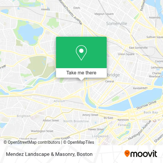
See Mendez Landscape & Masonry, Boston, on the map
Public Transit to Mendez Landscape & Masonry in Boston
Wondering how to get to Mendez Landscape & Masonry in Boston? Moovit helps you find the best way to get to Mendez Landscape & Masonry with step-by-step directions from the nearest public transit station.
Moovit provides free maps and live directions to help you navigate through your city. View schedules, routes, timetables, and find out how long does it take to get to Mendez Landscape & Masonry in real time.
Looking for the nearest stop or station to Mendez Landscape & Masonry? Check out this list of stops closest to your destination: Cambridge St @ Mass Pike Exit; River St Opp Blackstone St; N Harvard St @ S Campus Dr; Cambridge St @ Seattle St; Packards Corner; Harvard Square.
Bus: 501, 66, 70, 96, 64, 86.Train: FITCHBURG, FRAMINGHAM/WORCESTER.Subway: RED LINE, GREEN LINE B.
Want to see if there’s another route that gets you there at an earlier time? Moovit helps you find alternative routes or times. Get directions from and directions to Mendez Landscape & Masonry easily from the Moovit App or Website.
We make riding to Mendez Landscape & Masonry easy, which is why over 1.7 million users, including users in Boston, trust Moovit as the best app for public transit. You don’t need to download an individual bus app or train app, Moovit is your all-in-one transit app that helps you find the best bus time or train time available.
For information on prices of bus, subway and train, costs and ride fares to Mendez Landscape & Masonry, please check the Moovit app.
Use the app to navigate to popular places including to the airport, hospital, stadium, grocery store, mall, coffee shop, school, college, and university.
Mendez Landscape & Masonry Address: 92 Western Ave street in Boston
- Harvard Business School Taxi Stand,
- Spangler Center,
- Head of the Charles Regatta,
- Harvard Business School,
- Chao Center,
- Elitethirtynine,
- Bibliomotion,
- Harvard Innovation Lab (Harvard Ilab),
- Harvard Innovation Launch Lab,
- Spangler Food Court at Harvard Business School,
- Riverside Technology Center,
- Doubletree-Boston (Doubletree Suites-Boston Cambridge),
- DoubleTree Suites by Hilton Hotel Boston - Cambridge,
- Scullers Jazz Club,
- Charles River Park,
- SADL- Head of the Charles,
- Wachusett mountain,
- Harvard University Science And Engineering Complex (Sec),
- John Weeks Bridge (Weeks Memorial Bridge),
- Sub Zero Nitrogen Ice Cream
Places Near Mendez Landscape & Masonry (Boston)
- Museum Of Science, Boston,
- Massachusetts General Hospital, Boston,
- Td Garden, Boston,
- Cheers, Boston,
- House Of Blues, Boston,
- Leader Bank Pavilion (Leader Bank Pavillion), Boston,
- Isabella Stewart Gardner Museum, Boston,
- Boston Children's Hospital, Boston,
- North End, Boston,
- Wilbur Theatre, Boston,
- Seaport District, Boston,
- Boston Medical Center, Boston,
- Boston Common, Boston,
- Wang Theater, Boston,
- Castle Island, Boston,
- Mgm Music Hall, Boston,
- Boston Convention & Exhibition Center, Boston,
- Prudential Center, Boston,
- Faneuil Hall, Boston,
- Quincy Market, Boston
How to get to popular places in Boston with public transit
Get around Boston by public transit!
Traveling around Boston has never been so easy. See step by step directions as you travel to any attraction, street or major public transit station. View bus and train schedules, arrival times, service alerts and detailed routes on a map, so you know exactly how to get to anywhere in Boston.
When traveling to any destination around Boston use Moovit's Live Directions with Get Off Notifications to know exactly where and how far to walk, how long to wait for your line, and how many stops are left. Moovit will alert you when it's time to get off — no need to constantly re-check whether yours is the next stop.
Wondering how to use public transit in Boston or how to pay for public transit in Boston? Moovit public transit app can help you navigate your way with public transit easily, and at minimum cost. It includes public transit fees, ticket prices, and costs. Looking for a map of Boston public transit lines? Moovit public transit app shows all public transit maps in Boston with all Bus, Train, Subway and Ferry routes and stops on an interactive map.
Boston has 4 transit type(s), including: Bus, Train, Subway and Ferry, operated by several transit agencies, including MBTA, Southeastern Regional Transit Authority, MetroWest Regional Transit Authority, Rhode Island Public Transit Authority, WRTA, Lowell Regional Transit Authority, Merrimack Valley Transit, Montachusett Regional Transit Authority, Cape Cod Regional Transit Authority, Brockton Area Transit Authority, Martha's Vineyard Transit Authority, the WAVE - Nantucket Regional Transit Authority, GATRA, Cape Ann Transportation Authority and Massport