Directions to Mit Colab (Cambridge) with public transportation
The following transit lines have routes that pass near Mit Colab
 Bus: 1, 85, EZRIDE.
- Train: HAVERHILL, NEEDHAM.
- Subway: RED LINE, GREEN LINE D, GREEN LINE E, GREEN LINE B, GREEN LINE C.
How to get to Mit Colab by bus?
Click on the bus route to see step by step directions with maps, line arrival times and updated time schedules.
From Best Western Adams Inn Quincy - Boston, Quincy
94 minFrom Melrose, MA, Melrose
86 minFrom Ramada by Wyndham Boston, Boston
79 minFrom Forest Hills Station MBTA, Boston
50 minFrom Harpoon Brewery, Boston
52 minFrom Lower Mills, Boston
85 minFrom VFW Parkway, Boston
73 minFrom West Roxbury, Boston
75 minFrom Cruiseport Boston's Black Falcon Cruise Terminal, Boston
51 minFrom Downeast Cider, Boston
57 min
How to get to Mit Colab by train?
Click on the train route to see step by step directions with maps, line arrival times and updated time schedules.
How to get to Mit Colab by subway?
Click on the subway route to see step by step directions with maps, line arrival times and updated time schedules.
Bus stops near Mit Colab in Cambridge
Subway stations near Mit Colab in Cambridge
Bus lines to Mit Colab in Cambridge
- 1, Harvard,VIEW
- 85, Ruggles,VIEW
- EZRIDE, Inbound To North Station From Erie St,VIEW
- EZRIDE, Outbound North Station To Erie St Via Lechmere And Kendall,VIEW
- EZRIDE, Outbound To Erie St From North Station,VIEW
- 64, Kendall/MIT - Oak Square,VIEW
- 68, Kendall/MIT - Harvard,VIEW
- EZRIDE, Inbound To North Station Via Kendall And Lechmere,VIEW
- EZRIDE, Inbound Kendall To Lechmere,VIEW
What are the closest stations to Mit Colab?
The closest stations to Mit Colab are:
- 77 Massachusetts Ave is 142 yards away, 2 min walk.
- Vassar St @ Massachusetts Ave is 290 yards away, 4 min walk.
- Vassar St./Mass. Ave. is 314 yards away, 4 min walk.
- Broadway @ Hampshire St is 373 yards away, 5 min walk.
- Albany St./Osborn St. is 464 yards away, 6 min walk.
- Galileo Way @ Main St is 620 yards away, 8 min walk.
- Central is 1070 yards away, 13 min walk.
- Union Square is 1146 yards away, 14 min walk.
- Kenmore is 1612 yards away, 19 min walk.
Which bus lines stop near Mit Colab?
These bus lines stop near Mit Colab: 1, 85, EZRIDE.
Which train lines stop near Mit Colab?
These train lines stop near Mit Colab: HAVERHILL, NEEDHAM.
Which subway line stops near Mit Colab?
RED LINE (Alewife)
What’s the nearest subway station to Mit Colab in Cambridge?
The nearest subway station to Mit Colab in Cambridge is Central. It’s a 13 min walk away.
What’s the nearest bus station to Mit Colab in Cambridge?
The nearest bus station to Mit Colab in Cambridge is 77 Massachusetts Ave. It’s a 2 min walk away.
What time is the first subway to Mit Colab in Cambridge?
The GREEN LINE E is the first subway that goes to Mit Colab in Cambridge. It stops nearby at 4:50 AM.
What time is the last subway to Mit Colab in Cambridge?
The GREEN LINE D is the last subway that goes to Mit Colab in Cambridge. It stops nearby at 2:18 AM.
What time is the first bus to Mit Colab in Cambridge?
The 1 is the first bus that goes to Mit Colab in Cambridge. It stops nearby at 4:54 AM.
What time is the last bus to Mit Colab in Cambridge?
The 1 is the last bus that goes to Mit Colab in Cambridge. It stops nearby at 2:27 AM.
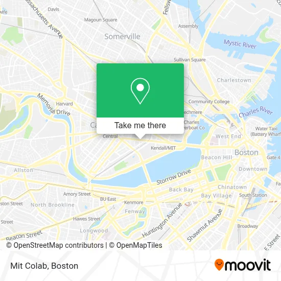
See Mit Colab, Cambridge, on the map
Public Transit to Mit Colab in Cambridge
Wondering how to get to Mit Colab in Cambridge? Moovit helps you find the best way to get to Mit Colab with step-by-step directions from the nearest public transit station.
Moovit provides free maps and live directions to help you navigate through your city. View schedules, routes, timetables, and find out how long does it take to get to Mit Colab in real time.
Looking for the nearest stop or station to Mit Colab? Check out this list of stops closest to your destination: 77 Massachusetts Ave; Vassar St @ Massachusetts Ave; Vassar St./Mass. Ave.; Broadway @ Hampshire St; Albany St./Osborn St.; Galileo Way @ Main St; Central; Union Square; Kenmore.
Bus: 1, 85, EZRIDE.Train: HAVERHILL, NEEDHAM.Subway: RED LINE, GREEN LINE D, GREEN LINE E, GREEN LINE B, GREEN LINE C.
Want to see if there’s another route that gets you there at an earlier time? Moovit helps you find alternative routes or times. Get directions from and directions to Mit Colab easily from the Moovit App or Website.
We make riding to Mit Colab easy, which is why over 1.7 million users, including users in Cambridge, trust Moovit as the best app for public transit. You don’t need to download an individual bus app or train app, Moovit is your all-in-one transit app that helps you find the best bus time or train time available.
For information on prices of bus, subway and train, costs and ride fares to Mit Colab, please check the Moovit app.
Use the app to navigate to popular places including to the airport, hospital, stadium, grocery store, mall, coffee shop, school, college, and university.
Mit Colab Address: Massachusetts Institute of Tech, 77 Massachusetts Ave street in Cambridge
- LabCentral,
- Ragon Institute,
- 300 Technology Square,
- K B Aruda Construction,
- Singleton Auditorium,
- Stata Center (Csail),
- Pisani Center,
- MIT R&D Pub,
- Hewlett Room 32-G882 (MIT Stata Center),
- The TARDIS,
- MIT Building 37 (McNair Building),
- 32-D463 (MIT Stata Center),
- Sean Collier Memorial,
- The Charles Stark Draper Laboratory, Inc,
- Whitehead Institute Cafeteria,
- MIT Institute for Soldier Nanotechnologies (Building NE47),
- Massachusetts Institute Of Technology (Mit),
- Windsor Inn (Windsor Hotel Cambridge),
- Port Landing,
- Nibr Novartis
Places Near Mit Colab (Cambridge)
- House Of Blues, Boston,
- Wilbur Theatre, Boston,
- Prudential Center, Boston,
- Museum Of Science, Boston,
- Castle Island, Boston,
- North End, Boston,
- Boston Children's Hospital, Boston,
- Faneuil Hall, Boston,
- Boston Medical Center, Boston,
- Cheers, Boston,
- Leader Bank Pavilion (Leader Bank Pavillion), Boston,
- Massachusetts General Hospital, Boston,
- Mgm Music Hall, Boston,
- Seaport District, Boston,
- Boston Common, Boston,
- Td Garden, Boston,
- Wang Theater, Boston,
- Boston Convention & Exhibition Center, Boston,
- Quincy Market, Boston,
- Isabella Stewart Gardner Museum, Boston
How to get to popular places in Boston with public transit
Get around Cambridge by public transit!
Traveling around Cambridge has never been so easy. See step by step directions as you travel to any attraction, street or major public transit station. View bus and train schedules, arrival times, service alerts and detailed routes on a map, so you know exactly how to get to anywhere in Cambridge.
When traveling to any destination around Cambridge use Moovit's Live Directions with Get Off Notifications to know exactly where and how far to walk, how long to wait for your line, and how many stops are left. Moovit will alert you when it's time to get off — no need to constantly re-check whether yours is the next stop.
Wondering how to use public transit in Cambridge or how to pay for public transit in Cambridge? Moovit public transit app can help you navigate your way with public transit easily, and at minimum cost. It includes public transit fees, ticket prices, and costs. Looking for a map of Cambridge public transit lines? Moovit public transit app shows all public transit maps in Cambridge with all Bus, Train, Subway and Ferry routes and stops on an interactive map.
Boston has 4 transit type(s), including: Bus, Train, Subway and Ferry, operated by several transit agencies, including MBTA, Southeastern Regional Transit Authority, MetroWest Regional Transit Authority, Rhode Island Public Transit Authority, WRTA, Lowell Regional Transit Authority, Merrimack Valley Transit, Montachusett Regional Transit Authority, Cape Cod Regional Transit Authority, Brockton Area Transit Authority, Martha's Vineyard Transit Authority, the WAVE - Nantucket Regional Transit Authority, GATRA, Cape Ann Transportation Authority and Massport