Directions to Mit Kavli Institute For Astrophysics (Cambridge) with public transportation
The following transit lines have routes that pass near Mit Kavli Institute For Astrophysics
 Bus: 1, 85, EZRIDE.
- Train: NEEDHAM.
- Subway: RED LINE, GREEN LINE B, GREEN LINE C, GREEN LINE D.
How to get to Mit Kavli Institute For Astrophysics by bus?
Click on the bus route to see step by step directions with maps, line arrival times and updated time schedules.
From Cruiseport Boston's Black Falcon Cruise Terminal, Boston
51 minFrom West Roxbury, Boston
69 minFrom Franklin Park, Boston
55 minFrom VFW Parkway, Boston
67 minFrom Malden Catholic High School, Malden
60 minFrom Conte Forum, Boston
62 minFrom Market Basket, Revere
90 minFrom West Roxbury, Boston
65 minFrom Embassy Suites-Boston, Boston
58 min
How to get to Mit Kavli Institute For Astrophysics by train?
Click on the train route to see step by step directions with maps, line arrival times and updated time schedules.
How to get to Mit Kavli Institute For Astrophysics by subway?
Click on the subway route to see step by step directions with maps, line arrival times and updated time schedules.
Bus stops near Mit Kavli Institute For Astrophysics in Cambridge
Subway stations near Mit Kavli Institute For Astrophysics in Cambridge
Bus lines to Mit Kavli Institute For Astrophysics in Cambridge
- 1, Harvard,VIEW
- EZRIDE, Outbound To Erie St From North Station,VIEW
- EZRIDE, Inbound To North Station Via Kendall And Lechmere,VIEW
- 85, Ruggles,VIEW
- EZRIDE, Inbound To North Station From Erie St,VIEW
- EZRIDE, Outbound North Station To Erie St Via Lechmere And Kendall,VIEW
- EZRIDE, Inbound Kendall To Lechmere,VIEW
- 64, Oak Square,VIEW
- 68, Harvard,VIEW
What are the closest stations to Mit Kavli Institute For Astrophysics?
The closest stations to Mit Kavli Institute For Astrophysics are:
- 77 Massachusetts Ave is 55 yards away, 1 min walk.
- Landsdowne/Mass Ave is 203 yards away, 3 min walk.
- Vassar St @ Massachusetts Ave is 311 yards away, 4 min walk.
- Albany St. /Edgerton House is 348 yards away, 5 min walk.
- Hynes Convention Center is 507 yards away, 7 min walk.
- Galileo Way @ Main St is 559 yards away, 7 min walk.
- Main St @ Galileo Way is 679 yards away, 9 min walk.
- Kendall/MIT is 867 yards away, 11 min walk.
Which bus lines stop near Mit Kavli Institute For Astrophysics?
These bus lines stop near Mit Kavli Institute For Astrophysics: 1, 85, EZRIDE.
Which train line stops near Mit Kavli Institute For Astrophysics?
NEEDHAM (#620 | South Station)
Which subway line stops near Mit Kavli Institute For Astrophysics?
RED LINE (Alewife)
What’s the nearest subway station to Mit Kavli Institute For Astrophysics in Cambridge?
The nearest subway station to Mit Kavli Institute For Astrophysics in Cambridge is Hynes Convention Center. It’s a 7 min walk away.
What’s the nearest bus station to Mit Kavli Institute For Astrophysics in Cambridge?
The nearest bus station to Mit Kavli Institute For Astrophysics in Cambridge is 77 Massachusetts Ave. It’s a 1 min walk away.
What time is the first subway to Mit Kavli Institute For Astrophysics in Cambridge?
The GREEN LINE D is the first subway that goes to Mit Kavli Institute For Astrophysics in Cambridge. It stops nearby at 5:00 AM.
What time is the last subway to Mit Kavli Institute For Astrophysics in Cambridge?
The GREEN LINE D is the last subway that goes to Mit Kavli Institute For Astrophysics in Cambridge. It stops nearby at 2:18 AM.
What time is the first bus to Mit Kavli Institute For Astrophysics in Cambridge?
The 1 is the first bus that goes to Mit Kavli Institute For Astrophysics in Cambridge. It stops nearby at 4:54 AM.
What time is the last bus to Mit Kavli Institute For Astrophysics in Cambridge?
The 1 is the last bus that goes to Mit Kavli Institute For Astrophysics in Cambridge. It stops nearby at 2:28 AM.
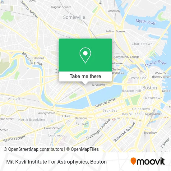
See Mit Kavli Institute For Astrophysics, Cambridge, on the map
Public Transit to Mit Kavli Institute For Astrophysics in Cambridge
Wondering how to get to Mit Kavli Institute For Astrophysics in Cambridge? Moovit helps you find the best way to get to Mit Kavli Institute For Astrophysics with step-by-step directions from the nearest public transit station.
Moovit provides free maps and live directions to help you navigate through your city. View schedules, routes, timetables, and find out how long does it take to get to Mit Kavli Institute For Astrophysics in real time.
Looking for the nearest stop or station to Mit Kavli Institute For Astrophysics? Check out this list of stops closest to your destination: 77 Massachusetts Ave; Landsdowne/Mass Ave; Vassar St @ Massachusetts Ave; Albany St. /Edgerton House; Hynes Convention Center; Galileo Way @ Main St; Main St @ Galileo Way; Kendall/MIT.
Bus: 1, 85, EZRIDE.Train: NEEDHAM.Subway: RED LINE, GREEN LINE B, GREEN LINE C, GREEN LINE D.
Want to see if there’s another route that gets you there at an earlier time? Moovit helps you find alternative routes or times. Get directions from and directions to Mit Kavli Institute For Astrophysics easily from the Moovit App or Website.
We make riding to Mit Kavli Institute For Astrophysics easy, which is why over 1.7 million users, including users in Cambridge, trust Moovit as the best app for public transit. You don’t need to download an individual bus app or train app, Moovit is your all-in-one transit app that helps you find the best bus time or train time available.
For information on prices of bus, subway and train, costs and ride fares to Mit Kavli Institute For Astrophysics, please check the Moovit app.
Use the app to navigate to popular places including to the airport, hospital, stadium, grocery store, mall, coffee shop, school, college, and university.
Location: Cambridge, Boston
- MIT Building 37 (McNair Building),
- MIT Aero/Astro Lab (33-116),
- Massachusetts Institute Of Technology (Mit),
- ATM,
- MIT Barker Engineering Library (10-500),
- MIT 10-250 (Huntington Hall),
- MIT,
- MIT Rotch Library of Architecture & Planning (7-238),
- K B Aruda Construction,
- MIT Lobdell Dining Hall (W20-208),
- M.I.T.,
- Mit Department of Materials Science and Engineering (Dmse),
- Mit Campus Map,
- MIT MBTA Bus Stop,
- Singleton Auditorium,
- MIT Tunnels,
- MIT Stratton Student Center (Building W20),
- Nibr Novartis,
- 32-D463 (MIT Stata Center),
- MIT R&D Pub
Places Near Mit Kavli Institute For Astrophysics (Cambridge)
- North End, Boston,
- Castle Island, Boston,
- Prudential Center, Boston,
- Wilbur Theatre, Boston,
- Faneuil Hall, Boston,
- Quincy Market, Boston,
- House Of Blues, Boston,
- Boston Common, Boston,
- Cheers, Boston,
- Td Garden, Boston,
- Seaport District, Boston,
- Isabella Stewart Gardner Museum, Boston,
- Boston Convention & Exhibition Center, Boston,
- Boston Medical Center, Boston,
- Leader Bank Pavilion (Leader Bank Pavillion), Boston,
- Massachusetts General Hospital, Boston,
- Boston Children's Hospital, Boston,
- Mgm Music Hall, Boston,
- Museum Of Science, Boston,
- Wang Theater, Boston
How to get to popular places in Boston with public transit
Get around Cambridge by public transit!
Traveling around Cambridge has never been so easy. See step by step directions as you travel to any attraction, street or major public transit station. View bus and train schedules, arrival times, service alerts and detailed routes on a map, so you know exactly how to get to anywhere in Cambridge.
When traveling to any destination around Cambridge use Moovit's Live Directions with Get Off Notifications to know exactly where and how far to walk, how long to wait for your line, and how many stops are left. Moovit will alert you when it's time to get off — no need to constantly re-check whether yours is the next stop.
Wondering how to use public transit in Cambridge or how to pay for public transit in Cambridge? Moovit public transit app can help you navigate your way with public transit easily, and at minimum cost. It includes public transit fees, ticket prices, and costs. Looking for a map of Cambridge public transit lines? Moovit public transit app shows all public transit maps in Cambridge with all Bus, Train, Subway and Ferry routes and stops on an interactive map.
Boston has 4 transit type(s), including: Bus, Train, Subway and Ferry, operated by several transit agencies, including MBTA, Southeastern Regional Transit Authority, MetroWest Regional Transit Authority, Rhode Island Public Transit Authority, WRTA, Lowell Regional Transit Authority, Merrimack Valley Transit, Montachusett Regional Transit Authority, Cape Cod Regional Transit Authority, Brockton Area Transit Authority, Martha's Vineyard Transit Authority, the WAVE - Nantucket Regional Transit Authority, GATRA, Cape Ann Transportation Authority and Massport