Directions to Modwash (Boston) with public transportation
The following transit lines have routes that pass near Modwash
 Bus: G2, G3, T2, T21, T3.
- Train: LAKE SHORE LIMITED, VERMONTER, AMTRAK HARTFORD LINE, NORTHEAST REGIONAL, VALLEY FLYER.
How to get to Modwash by bus?
Click on the bus route to see step by step directions with maps, line arrival times and updated time schedules.
From Worcester, MA, Worcester
108 minFrom Foxwoods, Worcester
137 minFrom Dcu Center, Worcester
110 minFrom Palladium, Worcester
113 minFrom Walmart Supercenter, Worcester
166 minFrom Polar Park, Worcester
109 minFrom South High Community School, Worcester
204 minFrom Registry Of Motor Vehicles (Rmv) Branch Office, Worcester
112 min
How to get to Modwash by train?
Click on the train route to see step by step directions with maps, line arrival times and updated time schedules.
Bus stops near Modwash in Boston
Train station near Modwash in Boston
- Springfield, 25 min walk,VIEW
Bus lines to Modwash in Boston
What are the closest stations to Modwash?
The closest stations to Modwash are:
- Carew / Armory is 37 yards away, 1 min walk.
- Armory And Carew(Tripper Timepoint) is 68 yards away, 1 min walk.
- Carew/Van Horn(Opposite) is 188 yards away, 3 min walk.
- Liberty / Carew is 451 yards away, 6 min walk.
- Springfield is 2095 yards away, 25 min walk.
Which bus lines stop near Modwash?
These bus lines stop near Modwash: G2, G3.
Which train lines stop near Modwash?
These train lines stop near Modwash: LAKE SHORE LIMITED, VERMONTER.
What’s the nearest train station to Modwash in Boston?
The nearest train station to Modwash in Boston is Springfield. It’s a 25 min walk away.
What’s the nearest bus station to Modwash in Boston?
The nearest bus stations to Modwash in Boston are Carew / Armory and Armory And Carew(Tripper Timepoint). The closest one is a 1 min walk away.
What time is the first train to Modwash in Boston?
The NORTHEAST REGIONAL is the first train that goes to Modwash in Boston. It stops nearby at 4:10 AM.
What time is the last train to Modwash in Boston?
The LAKE SHORE LIMITED is the last train that goes to Modwash in Boston. It stops nearby at 6:04 PM.
What time is the first bus to Modwash in Boston?
The G2 is the first bus that goes to Modwash in Boston. It stops nearby at 5:39 AM.
What time is the last bus to Modwash in Boston?
The G2 is the last bus that goes to Modwash in Boston. It stops nearby at 10:22 PM.
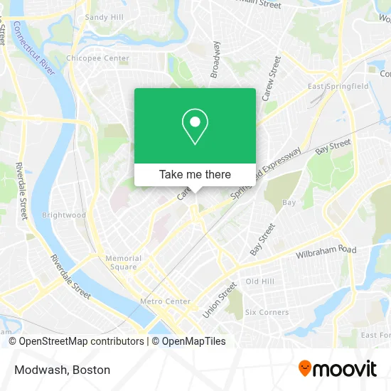
See Modwash, Boston, on the map
Public Transit to Modwash in Boston
Wondering how to get to Modwash in Boston? Moovit helps you find the best way to get to Modwash with step-by-step directions from the nearest public transit station.
Moovit provides free maps and live directions to help you navigate through your city. View schedules, routes, timetables, and find out how long does it take to get to Modwash in real time.
Looking for the nearest stop or station to Modwash? Check out this list of stops closest to your destination: Carew / Armory; Armory And Carew(Tripper Timepoint); Carew/Van Horn(Opposite); Liberty / Carew; Springfield.
Bus: G2, G3, T2, T21, T3, T4, X90.Train: LAKE SHORE LIMITED, VERMONTER, AMTRAK HARTFORD LINE, NORTHEAST REGIONAL, VALLEY FLYER.
Want to see if there’s another route that gets you there at an earlier time? Moovit helps you find alternative routes or times. Get directions from and directions to Modwash easily from the Moovit App or Website.
We make riding to Modwash easy, which is why over 1.7 million users, including users in Boston, trust Moovit as the best app for public transit. You don’t need to download an individual bus app or train app, Moovit is your all-in-one transit app that helps you find the best bus time or train time available.
For information on prices of bus and train, costs and ride fares to Modwash, please check the Moovit app.
Use the app to navigate to popular places including to the airport, hospital, stadium, grocery store, mall, coffee shop, school, college, and university.
Modwash Address: 710 Liberty St street in Boston
- Sampson Family Chapels,
- Sampson Funeral Home,
- ABC Glass Springfield,
- International Auto Sales,
- Hampden County Bar Association,
- Facchini Law Firm,
- DUNKIN',
- USPS Collection Box - Blue Box,
- A-1 Auto Service,
- Jordan Auto Sales,
- Rockitcoin,
- Coin Cloud Bitcoin ATM,
- Liberty Gas Station,
- WESTERN UNION,
- Jacqueline's Beauty Salon,
- Glamour Girls by Wendy,
- Raymond Dr Manniello DDS,
- Consumer Auto Parts,
- Fuentes de Salvacion,
- Allstate Insurance
Places Near Modwash (Boston)
- Seaport District, Boston,
- Boston Medical Center, Boston,
- Boston Children's Hospital, Boston,
- Quincy Market, Boston,
- Mgm Music Hall, Boston,
- Cheers, Boston,
- House Of Blues, Boston,
- Leader Bank Pavilion (Leader Bank Pavillion), Boston,
- Massachusetts General Hospital, Boston,
- Castle Island, Boston,
- Museum Of Science, Boston,
- Boston Common, Boston,
- Faneuil Hall, Boston,
- North End, Boston,
- Isabella Stewart Gardner Museum, Boston,
- Boston Convention & Exhibition Center, Boston,
- Wang Theater, Boston,
- Prudential Center, Boston,
- Td Garden, Boston,
- Wilbur Theatre, Boston
How to get to popular places in Boston with public transit
Get around Boston by public transit!
Traveling around Boston has never been so easy. See step by step directions as you travel to any attraction, street or major public transit station. View bus and train schedules, arrival times, service alerts and detailed routes on a map, so you know exactly how to get to anywhere in Boston.
When traveling to any destination around Boston use Moovit's Live Directions with Get Off Notifications to know exactly where and how far to walk, how long to wait for your line, and how many stops are left. Moovit will alert you when it's time to get off — no need to constantly re-check whether yours is the next stop.
Wondering how to use public transit in Boston or how to pay for public transit in Boston? Moovit public transit app can help you navigate your way with public transit easily, and at minimum cost. It includes public transit fees, ticket prices, and costs. Looking for a map of Boston public transit lines? Moovit public transit app shows all public transit maps in Boston with all Bus, Train, Subway and Ferry routes and stops on an interactive map.
Boston has 4 transit type(s), including: Bus, Train, Subway and Ferry, operated by several transit agencies, including MBTA, Southeastern Regional Transit Authority, MetroWest Regional Transit Authority, Rhode Island Public Transit Authority, WRTA, Lowell Regional Transit Authority, Merrimack Valley Transit, Montachusett Regional Transit Authority, Cape Cod Regional Transit Authority, Brockton Area Transit Authority, Martha's Vineyard Transit Authority, the WAVE - Nantucket Regional Transit Authority, GATRA, Cape Ann Transportation Authority and Massport