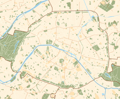
See Parc Des Expositions de la Porte de Versailles, Paris, on the map
Directions to Parc Des Expositions de la Porte de Versailles (Paris) with public transportation
The following transit lines have routes that pass near Parc Des Expositions de la Porte de Versailles
 Train:
 - Metro:
- Bus:
- Light Rail:
How to get to Parc Des Expositions de la Porte de Versailles by bus?
Click on the bus route to see step by step directions with maps, line arrival times and updated time schedules.
How to get to Parc Des Expositions de la Porte de Versailles by train?
Click on the train route to see step by step directions with maps, line arrival times and updated time schedules.
How to get to Parc Des Expositions de la Porte de Versailles by metro?
Click on the metro route to see step by step directions with maps, line arrival times and updated time schedules.
Metro stations near Parc Des Expositions de la Porte de Versailles in Paris
- Corentin-Celton,14 min walk,
- Malakoff-Plateau de Vanves,16 min walk,
Train stations near Parc Des Expositions de la Porte de Versailles in Paris
- Gare de Vanves - Malakoff,19 min walk,
What are the closest stations to Parc Des Expositions de la Porte de Versailles?
The closest stations to Parc Des Expositions de la Porte de Versailles are:
- Corentin-Celton is 1048 meters away, 14 min walk.
- Malakoff-Plateau de Vanves is 1148 meters away, 16 min walk.
- Gare de Vanves - Malakoff is 1426 meters away, 19 min walk.
Which train line stops near Parc Des Expositions de la Porte de Versailles?
N
Which metro lines stop near Parc Des Expositions de la Porte de Versailles?
These metro lines stop near Parc Des Expositions de la Porte de Versailles: 12, 13.
Which bus lines stop near Parc Des Expositions de la Porte de Versailles?
These bus lines stop near Parc Des Expositions de la Porte de Versailles: 126, 62, 80, 89.
Which light rail lines stop near Parc Des Expositions de la Porte de Versailles?
These light rail lines stop near Parc Des Expositions de la Porte de Versailles: T2, T3A.
What’s the nearest metro station to Parc Des Expositions de la Porte de Versailles in Paris?
The nearest metro station to Parc Des Expositions de la Porte de Versailles in Paris is Corentin-Celton. It’s a 14 min walk away.
What’s the nearest train station to Parc Des Expositions de la Porte de Versailles in Paris?
The nearest train station to Parc Des Expositions de la Porte de Versailles in Paris is Gare de Vanves - Malakoff. It’s a 19 min walk away.
See Parc Des Expositions de la Porte de Versailles, Paris, on the map
Public Transit to Parc Des Expositions de la Porte de Versailles in Paris
Wondering how to get to Parc Des Expositions de la Porte de Versailles in Paris, France? Moovit helps you find the best way to get to Parc Des Expositions de la Porte de Versailles with step-by-step directions from the nearest public transit station.
Moovit provides free maps and live directions to help you navigate through your city. View schedules, routes, timetables, and find out how long does it take to get to Parc Des Expositions de la Porte de Versailles in real time.
Looking for the nearest stop or station to Parc Des Expositions de la Porte de Versailles? Check out this list of stops closest to your destination: Corentin-Celton; Malakoff-Plateau de Vanves; Gare de Vanves - Malakoff.
Train:Metro:Bus:Light Rail:
Want to see if there’s another route that gets you there at an earlier time? Moovit helps you find alternative routes or times. Get directions from and directions to Parc Des Expositions de la Porte de Versailles easily from the Moovit App or Website.
We make riding to Parc Des Expositions de la Porte de Versailles easy, which is why over 1.5 million users, including users in Paris, trust Moovit as the best app for public transit. You don’t need to download an individual bus app or train app, Moovit is your all-in-one transit app that helps you find the best bus time or train time available.
For information on prices of bus, train, metro, light rail and RER, costs and ride fares to Parc Des Expositions de la Porte de Versailles, please check the Moovit app.
Use the app to navigate to popular places including to the airport, hospital, stadium, grocery store, mall, coffee shop, school, college, and university.
Parc Des Expositions de la Porte de Versailles Address: Boulevard Périphérique Intérieur street in Paris
Attractions near Parc Des Expositions de la Porte de Versailles
Foire de Paris,Paris Expo Porte de Versailles,Autonomic,E5,1 Place de la Porte de Versailles,ESC Congress 2019,McDonald's Paris Porte de Versailles,1 Place de la Porte de Versailles,Game Connection 2019,Super Wild Coffee,La Schtroumpf Experience,Samsung City,Salon de l'Agriculture,FWWC2019 IBC,le camion bol,Parc des expositions de la porte de Versailles,Terminal 7,Rue du 4 Septembre,Salon International de l'Agriculture 2018,Porte GHow to get to popular attractions in Paris with public transit
Le Bourget, Le Bourget,Centre Commercial Saint-Lazare Paris, Paris,Bois-Colombes, Bois-Colombes,Aéroville, Tremblay-En-France,Montgeron, Montgeron,Saint-Arnoult-en-Yvelines, Saint-Arnoult-En-Yvelines,Parc Des Princes G To K, Paris,Université Paris Ouest - Nanterre la Défense, Nanterre,Rungis, Rungis,Melun, Melun,Hôtel National Des Invalides – Musée de L'Armée, Paris,Moret-sur-Loing, Moret-Sur-Loing,Obiane (Orange Business Services), Palaiseau,Thales, Elancourt,Le Village d'Enghien, Enghien-Les-Bains,La Française des Jeux, Boulogne-Billancourt,Brioche Dorée, Mauregard,Le Cube, Issy-Les-Moulineaux,École Spéciale des Travaux Publics, du Bâtiment et de l'Industrie (ESTP Paris), Cachan,Chambourcy, ChambourcyGet around Paris by public transit!
Traveling around Paris has never been so easy. See step by step directions as you travel to any attraction, street or major public transit station. View bus and train schedules, arrival times, service alerts and detailed routes on a map, so you know exactly how to get to anywhere in Paris.
When traveling to any destination around Paris use Moovit's Live Directions with Get Off Notifications to know exactly where and how far to walk, how long to wait for your line, and how many stops are left. Moovit will alert you when it's time to get off — no need to constantly re-check whether yours is the next stop.
Wondering how to use public transit in Paris or how to pay for public transit in Paris? Moovit public transit app can help you navigate your way with public transit easily, and at minimum cost. It includes public transit fees, ticket prices, and costs. Looking for a map of Paris public transit lines? Moovit public transit app shows all public transit maps in Paris with all bus, train, metro, light rail or RER routes and stops on an interactive map.
Paris has 5 transit type(s), including: bus, train, metro, light rail or RER, operated by several transit agencies, including RATP, RER, RER Bus de remplacement, Train, Train Bus de remplacement, RATP, Tramway Bus de remplacement, TER, RATP, Tramway, ADP, ADP, RATP, Noctilien and Magical Shuttle