Directions to Pathway To Freedom Outreach Ministries (Boston) with public transportation
The following transit lines have routes that pass near Pathway To Freedom Outreach Ministries
 Bus: G2, T2, T21, T3, T4.
- Train: AMTRAK HARTFORD LINE, LAKE SHORE LIMITED, NORTHEAST REGIONAL, VALLEY FLYER, VERMONTER.
How to get to Pathway To Freedom Outreach Ministries by bus?
Click on the bus route to see step by step directions with maps, line arrival times and updated time schedules.
From Palladium, Worcester
117 minFrom Foxwoods, Worcester
142 minFrom South High Community School, Worcester
209 minFrom Registry Of Motor Vehicles (Rmv) Branch Office, Worcester
116 minFrom Worcester, MA, Worcester
112 minFrom Dcu Center, Worcester
114 minFrom Walmart Supercenter, Worcester
171 minFrom Polar Park, Worcester
114 min
Bus stops near Pathway To Freedom Outreach Ministries in Boston
Train station near Pathway To Freedom Outreach Ministries in Boston
- Springfield, 62 min walk,VIEW
Bus lines to Pathway To Freedom Outreach Ministries in Boston
What are the closest stations to Pathway To Freedom Outreach Ministries?
The closest stations to Pathway To Freedom Outreach Ministries are:
- Saint James Blvd / Saint James Ave is 95 yards away, 2 min walk.
- Saint James / St James is 122 yards away, 2 min walk.
- Springfield Rmv is 976 yards away, 12 min walk.
- Springfield is 5253 yards away, 62 min walk.
Which bus line stops near Pathway To Freedom Outreach Ministries?
G2 (E Springfield Via Carew-Cottage)
What’s the nearest bus station to Pathway To Freedom Outreach Ministries in Boston?
The nearest bus stations to Pathway To Freedom Outreach Ministries in Boston are Saint James Blvd / Saint James Ave and Saint James / St James. The closest one is a 2 min walk away.
What time is the first train to Pathway To Freedom Outreach Ministries in Boston?
The NORTHEAST REGIONAL is the first train that goes to Pathway To Freedom Outreach Ministries in Boston. It stops nearby at 4:10 AM.
What time is the last train to Pathway To Freedom Outreach Ministries in Boston?
The LAKE SHORE LIMITED is the last train that goes to Pathway To Freedom Outreach Ministries in Boston. It stops nearby at 6:04 PM.
What time is the first bus to Pathway To Freedom Outreach Ministries in Boston?
The G2 is the first bus that goes to Pathway To Freedom Outreach Ministries in Boston. It stops nearby at 5:42 AM.
What time is the last bus to Pathway To Freedom Outreach Ministries in Boston?
The G2 is the last bus that goes to Pathway To Freedom Outreach Ministries in Boston. It stops nearby at 10:27 PM.
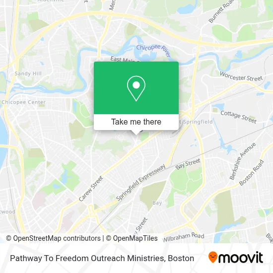
See Pathway To Freedom Outreach Ministries, Boston, on the map
Public Transit to Pathway To Freedom Outreach Ministries in Boston
Wondering how to get to Pathway To Freedom Outreach Ministries in Boston? Moovit helps you find the best way to get to Pathway To Freedom Outreach Ministries with step-by-step directions from the nearest public transit station.
Moovit provides free maps and live directions to help you navigate through your city. View schedules, routes, timetables, and find out how long does it take to get to Pathway To Freedom Outreach Ministries in real time.
Looking for the nearest stop or station to Pathway To Freedom Outreach Ministries? Check out this list of stops closest to your destination: Saint James Blvd / Saint James Ave; Saint James / St James; Springfield Rmv; Springfield.
Bus: G2, T2, T21, T3, T4, G3.Train: AMTRAK HARTFORD LINE, LAKE SHORE LIMITED, NORTHEAST REGIONAL, VALLEY FLYER, VERMONTER.
Want to see if there’s another route that gets you there at an earlier time? Moovit helps you find alternative routes or times. Get directions from and directions to Pathway To Freedom Outreach Ministries easily from the Moovit App or Website.
We make riding to Pathway To Freedom Outreach Ministries easy, which is why over 1.7 million users, including users in Boston, trust Moovit as the best app for public transit. You don’t need to download an individual bus app or train app, Moovit is your all-in-one transit app that helps you find the best bus time or train time available.
For information on prices of bus, costs and ride fares to Pathway To Freedom Outreach Ministries, please check the Moovit app.
Use the app to navigate to popular places including to the airport, hospital, stadium, grocery store, mall, coffee shop, school, college, and university.
Pathway To Freedom Outreach Ministries Address: 1430 Carew St street in Boston
- Lisa Mish - M&T Bank,
- Mary O. Pottenger School,
- Find Car Repair Shops Auto Repair,
- City of Springfield K 5,
- Fast Track Gas Station,
- Chick,
- Oddessey Dreams Club,
- Rue, Suhyun, DMD,
- Estrella Latina Restaurant,
- Angel Entertainment,
- Coinstar,
- Coinstar - Bitcoin ATM,
- Scott's Pup Tent,
- Dump,
- Backyard Fire at Shannon's,
- Western Union,
- Miss Bella Hispana Pageant,
- Arts Lawn Care,
- Berzenski Floor Sanding,
- Reds
Places Near Pathway To Freedom Outreach Ministries (Boston)
- Faneuil Hall, Boston,
- Boston Medical Center, Boston,
- Quincy Market, Boston,
- Boston Convention & Exhibition Center, Boston,
- Seaport District, Boston,
- North End, Boston,
- Prudential Center, Boston,
- Castle Island, Boston,
- Wang Theater, Boston,
- Mgm Music Hall, Boston,
- Boston Common, Boston,
- Cheers, Boston,
- Wilbur Theatre, Boston,
- Isabella Stewart Gardner Museum, Boston,
- House Of Blues, Boston,
- Massachusetts General Hospital, Boston,
- Boston Children's Hospital, Boston,
- Museum Of Science, Boston,
- Leader Bank Pavilion (Leader Bank Pavillion), Boston,
- Td Garden, Boston
How to get to popular places in Boston with public transit
Get around Boston by public transit!
Traveling around Boston has never been so easy. See step by step directions as you travel to any attraction, street or major public transit station. View bus and train schedules, arrival times, service alerts and detailed routes on a map, so you know exactly how to get to anywhere in Boston.
When traveling to any destination around Boston use Moovit's Live Directions with Get Off Notifications to know exactly where and how far to walk, how long to wait for your line, and how many stops are left. Moovit will alert you when it's time to get off — no need to constantly re-check whether yours is the next stop.
Wondering how to use public transit in Boston or how to pay for public transit in Boston? Moovit public transit app can help you navigate your way with public transit easily, and at minimum cost. It includes public transit fees, ticket prices, and costs. Looking for a map of Boston public transit lines? Moovit public transit app shows all public transit maps in Boston with all Bus, Train, Subway and Ferry routes and stops on an interactive map.
Boston has 4 transit type(s), including: Bus, Train, Subway and Ferry, operated by several transit agencies, including MBTA, Southeastern Regional Transit Authority, MetroWest Regional Transit Authority, Rhode Island Public Transit Authority, WRTA, Lowell Regional Transit Authority, Merrimack Valley Transit, Montachusett Regional Transit Authority, Cape Cod Regional Transit Authority, Brockton Area Transit Authority, Martha's Vineyard Transit Authority, the WAVE - Nantucket Regional Transit Authority, GATRA, Cape Ann Transportation Authority and Massport