Directions to Private Line Coach (Cambridge) with public transportation
The following transit lines have routes that pass near Private Line Coach
 Bus: 19, 47, 64, 70, EZRIDE.
- Train: FITCHBURG, FRAMINGHAM/WORCESTER.
- Subway: RED LINE, GREEN LINE B.
How to get to Private Line Coach by bus?
Click on the bus route to see step by step directions with maps, line arrival times and updated time schedules.
From South Boston Waterfront, Boston
45 minFrom Edic Pier, Boston
40 minFrom Chevalier Theatre (Chevalier Theater Show Line), Medford
61 minFrom Marina Bay, Quincy
154 minFrom L.L.Bean, Boston
46 minFrom Waltham, MA, Waltham
47 minFrom MBTA Suffolk Downs Station, Boston
88 minFrom Newton, MA, Newton
56 minFrom Boston Scientific, Quincy
161 minFrom Belle Isle Lobster & Seafood, Winthrop Town
98 min
How to get to Private Line Coach by train?
Click on the train route to see step by step directions with maps, line arrival times and updated time schedules.
How to get to Private Line Coach by subway?
Click on the subway route to see step by step directions with maps, line arrival times and updated time schedules.
Bus stops near Private Line Coach in Cambridge
Subway stations near Private Line Coach in Cambridge
What are the closest stations to Private Line Coach?
The closest stations to Private Line Coach are:
- Western Ave @ Howard St is 75 yards away, 1 min walk.
- Brookline St @ Putnam Ave is 83 yards away, 2 min walk.
- Babcock Street is 94 yards away, 2 min walk.
- Harvard Square is 1128 yards away, 14 min walk.
Which bus lines stop near Private Line Coach?
These bus lines stop near Private Line Coach: 19, 47, 64, 70, EZRIDE.
Which train lines stop near Private Line Coach?
These train lines stop near Private Line Coach: FITCHBURG, FRAMINGHAM/WORCESTER.
Which subway line stops near Private Line Coach?
RED LINE (Alewife)
What’s the nearest subway station to Private Line Coach in Cambridge?
The nearest subway station to Private Line Coach in Cambridge is Babcock Street. It’s a 2 min walk away.
What’s the nearest bus station to Private Line Coach in Cambridge?
The nearest bus station to Private Line Coach in Cambridge is Western Ave @ Howard St. It’s a 1 min walk away.
What time is the first subway to Private Line Coach in Cambridge?
The GREEN LINE B is the first subway that goes to Private Line Coach in Cambridge. It stops nearby at 5:18 AM.
What time is the last subway to Private Line Coach in Cambridge?
The GREEN LINE B is the last subway that goes to Private Line Coach in Cambridge. It stops nearby at 2:22 AM.
What time is the first bus to Private Line Coach in Cambridge?
The 70 is the first bus that goes to Private Line Coach in Cambridge. It stops nearby at 4:27 AM.
What time is the last bus to Private Line Coach in Cambridge?
The 70 is the last bus that goes to Private Line Coach in Cambridge. It stops nearby at 1:13 AM.
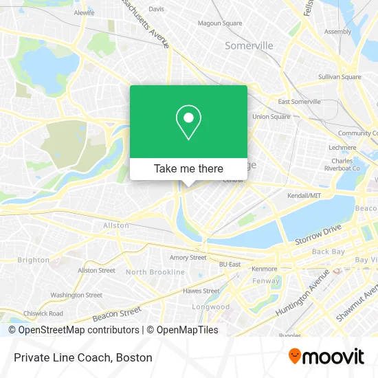
See Private Line Coach, Cambridge, on the map
Public Transit to Private Line Coach in Cambridge
Wondering how to get to Private Line Coach in Cambridge? Moovit helps you find the best way to get to Private Line Coach with step-by-step directions from the nearest public transit station.
Moovit provides free maps and live directions to help you navigate through your city. View schedules, routes, timetables, and find out how long does it take to get to Private Line Coach in real time.
Looking for the nearest stop or station to Private Line Coach? Check out this list of stops closest to your destination: Western Ave @ Howard St; Brookline St @ Putnam Ave; Babcock Street; Harvard Square.
Bus: 19, 47, 64, 70, EZRIDE.Train: FITCHBURG, FRAMINGHAM/WORCESTER.Subway: RED LINE, GREEN LINE B.
Want to see if there’s another route that gets you there at an earlier time? Moovit helps you find alternative routes or times. Get directions from and directions to Private Line Coach easily from the Moovit App or Website.
We make riding to Private Line Coach easy, which is why over 1.7 million users, including users in Cambridge, trust Moovit as the best app for public transit. You don’t need to download an individual bus app or train app, Moovit is your all-in-one transit app that helps you find the best bus time or train time available.
For information on prices of bus, subway and train, costs and ride fares to Private Line Coach, please check the Moovit app.
Use the app to navigate to popular places including to the airport, hospital, stadium, grocery store, mall, coffee shop, school, college, and university.
Private Line Coach Address: 1 Blackstone St street in Cambridge
- Walgreens,
- WESTERN UNION,
- Riverside Technology Center,
- Sub Zero Nitrogen Ice Cream,
- Head of the Charles Regatta,
- Pleasant Street Condominiums,
- The Brotel,
- Russell E Hoyt Field,
- Doubletree-Boston (Doubletree Suites-Boston Cambridge),
- SADL- Head of the Charles,
- Scullers Jazz Club,
- DoubleTree Suites by Hilton Hotel Boston - Cambridge,
- COURTYARD-Boston Cambridge (Cambridge Marriott),
- Cambridge Marriott,
- Wachusett mountain,
- 108,
- Stephen Funk Pearson,
- Cambridge Community Center (Cambridge Winter Farmers Market),
- Cambridge Community Center,
- Micro Center (Micro Elecronics)
Places Near Private Line Coach (Cambridge)
- Boston Convention & Exhibition Center, Boston,
- Mgm Music Hall, Boston,
- Quincy Market, Boston,
- North End, Boston,
- Boston Children's Hospital, Boston,
- Leader Bank Pavilion (Leader Bank Pavillion), Boston,
- Wang Theater, Boston,
- Seaport District, Boston,
- Prudential Center, Boston,
- House Of Blues, Boston,
- Cheers, Boston,
- Isabella Stewart Gardner Museum, Boston,
- Massachusetts General Hospital, Boston,
- Wilbur Theatre, Boston,
- Boston Common, Boston,
- Castle Island, Boston,
- Faneuil Hall, Boston,
- Td Garden, Boston,
- Museum Of Science, Boston,
- Boston Medical Center, Boston
How to get to popular places in Boston with public transit
Get around Cambridge by public transit!
Traveling around Cambridge has never been so easy. See step by step directions as you travel to any attraction, street or major public transit station. View bus and train schedules, arrival times, service alerts and detailed routes on a map, so you know exactly how to get to anywhere in Cambridge.
When traveling to any destination around Cambridge use Moovit's Live Directions with Get Off Notifications to know exactly where and how far to walk, how long to wait for your line, and how many stops are left. Moovit will alert you when it's time to get off — no need to constantly re-check whether yours is the next stop.
Wondering how to use public transit in Cambridge or how to pay for public transit in Cambridge? Moovit public transit app can help you navigate your way with public transit easily, and at minimum cost. It includes public transit fees, ticket prices, and costs. Looking for a map of Cambridge public transit lines? Moovit public transit app shows all public transit maps in Cambridge with all Bus, Train, Subway and Ferry routes and stops on an interactive map.
Boston has 4 transit type(s), including: Bus, Train, Subway and Ferry, operated by several transit agencies, including MBTA, Southeastern Regional Transit Authority, MetroWest Regional Transit Authority, Rhode Island Public Transit Authority, WRTA, Lowell Regional Transit Authority, Merrimack Valley Transit, Montachusett Regional Transit Authority, Cape Cod Regional Transit Authority, Brockton Area Transit Authority, Martha's Vineyard Transit Authority, the WAVE - Nantucket Regional Transit Authority, GATRA, Cape Ann Transportation Authority and Massport