Directions to Putnam Voc-Tech Hs (Boston) with public transportation
The following transit lines have routes that pass near Putnam Voc-Tech Hs
 Bus: B7, T1, T2, T3, T4.
- Train: AMTRAK HARTFORD LINE, LAKE SHORE LIMITED, NORTHEAST REGIONAL, VALLEY FLYER, VERMONTER.
How to get to Putnam Voc-Tech Hs by bus?
Click on the bus route to see step by step directions with maps, line arrival times and updated time schedules.
From Dcu Center, Worcester
111 minFrom Registry Of Motor Vehicles (Rmv) Branch Office, Worcester
113 minFrom Palladium, Worcester
114 minFrom Worcester, MA, Worcester
109 minFrom Foxwoods, Worcester
138 minFrom Polar Park, Worcester
110 minFrom Walmart Supercenter, Worcester
167 minFrom South High Community School, Worcester
205 min
Bus stops near Putnam Voc-Tech Hs in Boston
Train station near Putnam Voc-Tech Hs in Boston
- Springfield, 45 min walk,VIEW
Bus lines to Putnam Voc-Tech Hs in Boston
- B7, Colonial Estates Via Independence House,VIEW
- T1, Sumner To the X To Dickinson,VIEW
- T2, Belmont To the X,VIEW
- T3, Post Office,VIEW
- T4, Carew Street Roosevelt To State St,VIEW
- T21, Carew And Armory To Chestnut Glenwood Circle,VIEW
- T92, State Street Blunt Pk Rd To Bay Street,VIEW
- X92, Memorial Industrial Park Via Senior Center And Roosevelt,VIEW
- T5, State St Blunt Park Rd To Bay St,VIEW
What are the closest stations to Putnam Voc-Tech Hs?
The closest stations to Putnam Voc-Tech Hs are:
- Sci Tech High School is 425 yards away, 6 min walk.
- State / Benton is 491 yards away, 7 min walk.
- Springfield is 3774 yards away, 45 min walk.
Which bus line stops near Putnam Voc-Tech Hs?
B7 (Colonial Estates Via Independence House)
What’s the nearest bus station to Putnam Voc-Tech Hs in Boston?
The nearest bus station to Putnam Voc-Tech Hs in Boston is Sci Tech High School. It’s a 6 min walk away.
What time is the first train to Putnam Voc-Tech Hs in Boston?
The NORTHEAST REGIONAL is the first train that goes to Putnam Voc-Tech Hs in Boston. It stops nearby at 4:10 AM.
What time is the last train to Putnam Voc-Tech Hs in Boston?
The LAKE SHORE LIMITED is the last train that goes to Putnam Voc-Tech Hs in Boston. It stops nearby at 6:04 PM.
What time is the first bus to Putnam Voc-Tech Hs in Boston?
The B7 is the first bus that goes to Putnam Voc-Tech Hs in Boston. It stops nearby at 5:10 AM.
What time is the last bus to Putnam Voc-Tech Hs in Boston?
The B7 is the last bus that goes to Putnam Voc-Tech Hs in Boston. It stops nearby at 10:39 PM.
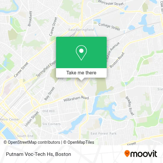
See Putnam Voc-Tech Hs, Boston, on the map
Public Transit to Putnam Voc-Tech Hs in Boston
Wondering how to get to Putnam Voc-Tech Hs in Boston? Moovit helps you find the best way to get to Putnam Voc-Tech Hs with step-by-step directions from the nearest public transit station.
Moovit provides free maps and live directions to help you navigate through your city. View schedules, routes, timetables, and find out how long does it take to get to Putnam Voc-Tech Hs in real time.
Looking for the nearest stop or station to Putnam Voc-Tech Hs? Check out this list of stops closest to your destination: Sci Tech High School; State / Benton; Springfield.
Bus: B7, T1, T2, T3, T4, T5.Train: AMTRAK HARTFORD LINE, LAKE SHORE LIMITED, NORTHEAST REGIONAL, VALLEY FLYER, VERMONTER.
Want to see if there’s another route that gets you there at an earlier time? Moovit helps you find alternative routes or times. Get directions from and directions to Putnam Voc-Tech Hs easily from the Moovit App or Website.
We make riding to Putnam Voc-Tech Hs easy, which is why over 1.7 million users, including users in Boston, trust Moovit as the best app for public transit. You don’t need to download an individual bus app or train app, Moovit is your all-in-one transit app that helps you find the best bus time or train time available.
For information on prices of bus, costs and ride fares to Putnam Voc-Tech Hs, please check the Moovit app.
Use the app to navigate to popular places including to the airport, hospital, stadium, grocery store, mall, coffee shop, school, college, and university.
Putnam Voc-Tech Hs Address: 1300 State St street in Boston
- Freedom Credit Union,
- Roger L. Putnam Vocational Technical Academy,
- Putnam Vocational Tech High School,
- Washer Wizards Home Appliance Repair Service,
- Hard at Play Professional DJ Services,
- Will's,
- Rapid Removal & Recycling,
- Talbert's Moving & Hauling,
- Shajessy,
- Abbey Roofing,
- Salon K.Lee,
- C Stewart Renovations and Home Improvement,
- Springfield High School Of Science & Technology,
- Springfield International Academy at Sci-Tech,
- Vibra Hospital Of Western Massachusetts,
- Vibra Hospital of Western Massachusetts-Central Campus,
- USPS Collection Box - Blue Box,
- ATM,
- High School of Science & Technology,
- Blunt Park
Places Near Putnam Voc-Tech Hs (Boston)
- Quincy Market, Boston,
- Museum Of Science, Boston,
- Cheers, Boston,
- North End, Boston,
- Castle Island, Boston,
- Seaport District, Boston,
- Wilbur Theatre, Boston,
- Td Garden, Boston,
- Mgm Music Hall, Boston,
- Isabella Stewart Gardner Museum, Boston,
- Boston Children's Hospital, Boston,
- Boston Medical Center, Boston,
- Wang Theater, Boston,
- House Of Blues, Boston,
- Prudential Center, Boston,
- Faneuil Hall, Boston,
- Leader Bank Pavilion (Leader Bank Pavillion), Boston,
- Boston Common, Boston,
- Massachusetts General Hospital, Boston,
- Boston Convention & Exhibition Center, Boston
How to get to popular places in Boston with public transit
Get around Boston by public transit!
Traveling around Boston has never been so easy. See step by step directions as you travel to any attraction, street or major public transit station. View bus and train schedules, arrival times, service alerts and detailed routes on a map, so you know exactly how to get to anywhere in Boston.
When traveling to any destination around Boston use Moovit's Live Directions with Get Off Notifications to know exactly where and how far to walk, how long to wait for your line, and how many stops are left. Moovit will alert you when it's time to get off — no need to constantly re-check whether yours is the next stop.
Wondering how to use public transit in Boston or how to pay for public transit in Boston? Moovit public transit app can help you navigate your way with public transit easily, and at minimum cost. It includes public transit fees, ticket prices, and costs. Looking for a map of Boston public transit lines? Moovit public transit app shows all public transit maps in Boston with all Bus, Train, Subway and Ferry routes and stops on an interactive map.
Boston has 4 transit type(s), including: Bus, Train, Subway and Ferry, operated by several transit agencies, including MBTA, Southeastern Regional Transit Authority, MetroWest Regional Transit Authority, Rhode Island Public Transit Authority, WRTA, Lowell Regional Transit Authority, Merrimack Valley Transit, Montachusett Regional Transit Authority, Cape Cod Regional Transit Authority, Brockton Area Transit Authority, Martha's Vineyard Transit Authority, the WAVE - Nantucket Regional Transit Authority, GATRA, Cape Ann Transportation Authority and Massport