Directions to S Shop (Boston) with public transportation
The following transit lines have routes that pass near S Shop
 Bus: B7, T1, T2, T4, T5.
- Train: AMTRAK HARTFORD LINE, LAKE SHORE LIMITED, NORTHEAST REGIONAL, VALLEY FLYER, VERMONTER.
How to get to S Shop by bus?
Click on the bus route to see step by step directions with maps, line arrival times and updated time schedules.
From Registry Of Motor Vehicles (Rmv) Branch Office, Worcester
115 minFrom Foxwoods, Worcester
140 minFrom Palladium, Worcester
116 minFrom Dcu Center, Worcester
113 minFrom Walmart Supercenter, Worcester
169 minFrom Polar Park, Worcester
112 minFrom Worcester, MA, Worcester
111 minFrom South High Community School, Worcester
207 min
Bus stops near S Shop in Boston
Train station near S Shop in Boston
- Springfield, 11 min walk,VIEW
Bus lines to S Shop in Boston
- B7, Colonial Estates Via Independence House,VIEW
- T1, Sumner To the X To Dickinson,VIEW
- T2, Belmont To the X,VIEW
- T4, Carew Street Roosevelt To State St,VIEW
- T5, State St Blunt Park Rd To Bay St,VIEW
- T21, Carew And Armory To Chestnut Glenwood Circle,VIEW
- T92, State Street Blunt Pk Rd To Bay Street,VIEW
- X92, Memorial Industrial Park Via Senior Center And Roosevelt,VIEW
- T3, Post Office,VIEW
- B17, 16 Acres Via Wilbraham Rd / Worthington St,VIEW
What are the closest stations to S Shop?
The closest stations to S Shop are:
- Blunt Park / State is 44 yards away, 1 min walk.
- Sci Tech High School is 370 yards away, 5 min walk.
- Wilbraham / Benton is 411 yards away, 5 min walk.
- Springfield is 906 yards away, 11 min walk.
Which bus line stops near S Shop?
B7 (Wilbraham Big Y Via Independence House)
What’s the nearest train station to S Shop in Boston?
The nearest train station to S Shop in Boston is Springfield. It’s a 11 min walk away.
What’s the nearest bus station to S Shop in Boston?
The nearest bus station to S Shop in Boston is Blunt Park / State. It’s a 1 min walk away.
What time is the first train to S Shop in Boston?
The NORTHEAST REGIONAL is the first train that goes to S Shop in Boston. It stops nearby at 4:10 AM.
What time is the last train to S Shop in Boston?
The LAKE SHORE LIMITED is the last train that goes to S Shop in Boston. It stops nearby at 6:04 PM.
What time is the first bus to S Shop in Boston?
The B7 is the first bus that goes to S Shop in Boston. It stops nearby at 5:10 AM.
What time is the last bus to S Shop in Boston?
The B7 is the last bus that goes to S Shop in Boston. It stops nearby at 10:38 PM.
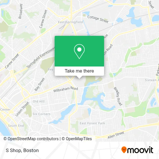
See S Shop, Boston, on the map
Public Transit to S Shop in Boston
Wondering how to get to S Shop in Boston? Moovit helps you find the best way to get to S Shop with step-by-step directions from the nearest public transit station.
Moovit provides free maps and live directions to help you navigate through your city. View schedules, routes, timetables, and find out how long does it take to get to S Shop in real time.
Looking for the nearest stop or station to S Shop? Check out this list of stops closest to your destination: Blunt Park / State; Sci Tech High School; Wilbraham / Benton; Springfield.
Bus: B7, T1, T2, T4, T5, T3, B17.Train: AMTRAK HARTFORD LINE, LAKE SHORE LIMITED, NORTHEAST REGIONAL, VALLEY FLYER, VERMONTER.
Want to see if there’s another route that gets you there at an earlier time? Moovit helps you find alternative routes or times. Get directions from and directions to S Shop easily from the Moovit App or Website.
We make riding to S Shop easy, which is why over 1.7 million users, including users in Boston, trust Moovit as the best app for public transit. You don’t need to download an individual bus app or train app, Moovit is your all-in-one transit app that helps you find the best bus time or train time available.
For information on prices of bus, costs and ride fares to S Shop, please check the Moovit app.
Use the app to navigate to popular places including to the airport, hospital, stadium, grocery store, mall, coffee shop, school, college, and university.
S Shop Address: ບໍລິຄຳໄຊ&ນະຄອນຫຼວງ street in Boston
- Salvation Army,
- Massmutual Caf Cafe,
- Massmutual Headquarters,
- Mass Mutual Corporate Library,
- Massmutual,
- Mass Mutual Heliport,
- Gamblers Anonymous,
- Message Center,
- Rapid Removal & Recycling,
- Talbert's Moving & Hauling,
- C Stewart Renovations and Home Improvement,
- Will's,
- Abbey Roofing,
- Shajessy,
- Salon K.Lee,
- High School of Science & Technology,
- Liquouri Auto,
- B & D Petroleum,
- Salon Brilliance,
- A Plus Baked Potato
Places Near S Shop (Boston)
- Boston Children's Hospital, Boston,
- House Of Blues, Boston,
- Faneuil Hall, Boston,
- North End, Boston,
- Isabella Stewart Gardner Museum, Boston,
- Boston Common, Boston,
- Massachusetts General Hospital, Boston,
- Quincy Market, Boston,
- Boston Convention & Exhibition Center, Boston,
- Boston Medical Center, Boston,
- Wilbur Theatre, Boston,
- Seaport District, Boston,
- Prudential Center, Boston,
- Castle Island, Boston,
- Wang Theater, Boston,
- Td Garden, Boston,
- Leader Bank Pavilion (Leader Bank Pavillion), Boston,
- Cheers, Boston,
- Mgm Music Hall, Boston,
- Museum Of Science, Boston
How to get to popular places in Boston with public transit
Get around Boston by public transit!
Traveling around Boston has never been so easy. See step by step directions as you travel to any attraction, street or major public transit station. View bus and train schedules, arrival times, service alerts and detailed routes on a map, so you know exactly how to get to anywhere in Boston.
When traveling to any destination around Boston use Moovit's Live Directions with Get Off Notifications to know exactly where and how far to walk, how long to wait for your line, and how many stops are left. Moovit will alert you when it's time to get off — no need to constantly re-check whether yours is the next stop.
Wondering how to use public transit in Boston or how to pay for public transit in Boston? Moovit public transit app can help you navigate your way with public transit easily, and at minimum cost. It includes public transit fees, ticket prices, and costs. Looking for a map of Boston public transit lines? Moovit public transit app shows all public transit maps in Boston with all Bus, Train, Subway and Ferry routes and stops on an interactive map.
Boston has 4 transit type(s), including: Bus, Train, Subway and Ferry, operated by several transit agencies, including MBTA, Southeastern Regional Transit Authority, MetroWest Regional Transit Authority, Rhode Island Public Transit Authority, WRTA, Lowell Regional Transit Authority, Merrimack Valley Transit, Montachusett Regional Transit Authority, Cape Cod Regional Transit Authority, Brockton Area Transit Authority, Martha's Vineyard Transit Authority, the WAVE - Nantucket Regional Transit Authority, GATRA, Cape Ann Transportation Authority and Massport