Directions to Scannell Field (Arlington) with public transportation
The following transit lines have routes that pass near Scannell Field
 Bus: 350, 77, 87.
- Train: FITCHBURG, LOWELL.
- Subway: RED LINE, GREEN LINE B, GREEN LINE C, GREEN LINE E.
How to get to Scannell Field by bus?
Click on the bus route to see step by step directions with maps, line arrival times and updated time schedules.
From Maverick Station, Boston
107 minFrom Abe & Louie's, Boston
51 minFrom Cathedral Of the Holy Cross, Boston
67 minFrom Tufts New England Medical Center, Boston
62 minFrom Intercontinental Boston Hotel Boston, Boston
78 minFrom Hyatt Regency Cambridge - Overlooking Boston, Cambridge
53 minFrom Uss Constitution, Boston
63 minFrom The Track at New Balance, Boston
47 minFrom Rosie's Place, Boston
55 minFrom Intercontinental-Boston (Intercontinental Hotel), Boston
78 min
How to get to Scannell Field by train?
Click on the train route to see step by step directions with maps, line arrival times and updated time schedules.
How to get to Scannell Field by subway?
Click on the subway route to see step by step directions with maps, line arrival times and updated time schedules.
From Maverick Station, Boston
64 minFrom Abe & Louie's, Boston
59 minFrom Cathedral Of the Holy Cross, Boston
68 minFrom Tufts New England Medical Center, Boston
53 minFrom Intercontinental Boston Hotel Boston, Boston
54 minFrom Hyatt Regency Cambridge - Overlooking Boston, Cambridge
60 minFrom Uss Constitution, Boston
77 minFrom The Track at New Balance, Boston
99 minFrom Rosie's Place, Boston
68 minFrom Intercontinental-Boston (Intercontinental Hotel), Boston
54 min
Bus stops near Scannell Field in Arlington
Subway stations near Scannell Field in Arlington
Train stations near Scannell Field in Arlington
Bus lines to Scannell Field in Arlington
What are the closest stations to Scannell Field?
The closest stations to Scannell Field are:
- Massachusetts Ave @ Broadway is 278 yards away, 4 min walk.
- Broadway @ Massachusetts Ave is 319 yards away, 4 min walk.
- Alewife is 1763 yards away, 21 min walk.
- Belmont is 4245 yards away, 50 min walk.
- Medford/Tufts Station is 4770 yards away, 56 min walk.
- West Medford is 5465 yards away, 65 min walk.
Which bus lines stop near Scannell Field?
These bus lines stop near Scannell Field: 350, 77.
Which train lines stop near Scannell Field?
These train lines stop near Scannell Field: FITCHBURG, LOWELL.
Which subway line stops near Scannell Field?
RED LINE (Alewife)
What’s the nearest subway station to Scannell Field in Arlington?
The nearest subway station to Scannell Field in Arlington is Alewife. It’s a 21 min walk away.
What’s the nearest bus station to Scannell Field in Arlington?
The nearest bus stations to Scannell Field in Arlington are Massachusetts Ave @ Broadway and Broadway @ Massachusetts Ave. The closest one is a 4 min walk away.
What time is the first subway to Scannell Field in Arlington?
The GREEN LINE E is the first subway that goes to Scannell Field in Arlington. It stops nearby at 4:57 AM.
What time is the last subway to Scannell Field in Arlington?
The GREEN LINE E is the last subway that goes to Scannell Field in Arlington. It stops nearby at 2:41 AM.
What time is the first train to Scannell Field in Arlington?
The LOWELL is the first train that goes to Scannell Field in Arlington. It stops nearby at 5:31 AM.
What time is the last train to Scannell Field in Arlington?
The LOWELL is the last train that goes to Scannell Field in Arlington. It stops nearby at 12:20 AM.
What time is the first bus to Scannell Field in Arlington?
The 77 is the first bus that goes to Scannell Field in Arlington. It stops nearby at 4:54 AM.
What time is the last bus to Scannell Field in Arlington?
The 87 is the last bus that goes to Scannell Field in Arlington. It stops nearby at 1:43 AM.
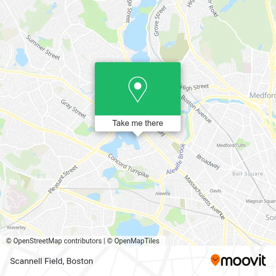
See Scannell Field, Arlington, on the map
Public Transit to Scannell Field in Arlington
Wondering how to get to Scannell Field in Arlington? Moovit helps you find the best way to get to Scannell Field with step-by-step directions from the nearest public transit station.
Moovit provides free maps and live directions to help you navigate through your city. View schedules, routes, timetables, and find out how long does it take to get to Scannell Field in real time.
Looking for the nearest stop or station to Scannell Field? Check out this list of stops closest to your destination: Massachusetts Ave @ Broadway; Broadway @ Massachusetts Ave; Alewife; Belmont; Medford/Tufts Station; West Medford.
Bus: 350, 77, 87.Train: FITCHBURG, LOWELL.Subway: RED LINE, GREEN LINE B, GREEN LINE C, GREEN LINE E.
Want to see if there’s another route that gets you there at an earlier time? Moovit helps you find alternative routes or times. Get directions from and directions to Scannell Field easily from the Moovit App or Website.
We make riding to Scannell Field easy, which is why over 1.7 million users, including users in Arlington, trust Moovit as the best app for public transit. You don’t need to download an individual bus app or train app, Moovit is your all-in-one transit app that helps you find the best bus time or train time available.
For information on prices of bus, subway and train, costs and ride fares to Scannell Field, please check the Moovit app.
Use the app to navigate to popular places including to the airport, hospital, stadium, grocery store, mall, coffee shop, school, college, and university.
Scannell Field Address: 90 Linwood St street in Arlington
- Friends of the Fox Thrift,
- Prose Restaurant,
- Brightview Arlington Addiction Treatment Center,
- Arlington Periodontal,
- Arlington Locks & Keys,
- Stephen Joseph Ma LMHC,
- Eco Massage,
- Journeywomen Psychotherapy,
- Larp Adventure Program,
- Lynette Ingram Cassel,
- Adrianne Jorge,
- Major Wellness Massage,
- Sandy Dixon Psychologist,
- Joyce Bloom, M.Ed., Lmhc at the Healing Center,
- Healing Connections,
- His Voice Aloud,
- Danny Miller Massage Therapist,
- DUNKIN',
- Arlington Aveto Parts,
- Tantric Intimacy
Places Near Scannell Field (Arlington)
- House Of Blues, Boston,
- Cheers, Boston,
- Wilbur Theatre, Boston,
- Wang Theater, Boston,
- Quincy Market, Boston,
- Boston Convention & Exhibition Center, Boston,
- Museum Of Science, Boston,
- Castle Island, Boston,
- Massachusetts General Hospital, Boston,
- Boston Medical Center, Boston,
- Faneuil Hall, Boston,
- Prudential Center, Boston,
- Seaport District, Boston,
- Leader Bank Pavilion (Leader Bank Pavillion), Boston,
- Boston Common, Boston,
- North End, Boston,
- Boston Children's Hospital, Boston,
- Isabella Stewart Gardner Museum, Boston,
- Mgm Music Hall, Boston,
- Td Garden, Boston
How to get to popular places in Boston with public transit
Get around Arlington by public transit!
Traveling around Arlington has never been so easy. See step by step directions as you travel to any attraction, street or major public transit station. View bus and train schedules, arrival times, service alerts and detailed routes on a map, so you know exactly how to get to anywhere in Arlington.
When traveling to any destination around Arlington use Moovit's Live Directions with Get Off Notifications to know exactly where and how far to walk, how long to wait for your line, and how many stops are left. Moovit will alert you when it's time to get off — no need to constantly re-check whether yours is the next stop.
Wondering how to use public transit in Arlington or how to pay for public transit in Arlington? Moovit public transit app can help you navigate your way with public transit easily, and at minimum cost. It includes public transit fees, ticket prices, and costs. Looking for a map of Arlington public transit lines? Moovit public transit app shows all public transit maps in Arlington with all Bus, Train, Subway and Ferry routes and stops on an interactive map.
Boston has 4 transit type(s), including: Bus, Train, Subway and Ferry, operated by several transit agencies, including MBTA, Southeastern Regional Transit Authority, MetroWest Regional Transit Authority, Rhode Island Public Transit Authority, WRTA, Lowell Regional Transit Authority, Merrimack Valley Transit, Montachusett Regional Transit Authority, Cape Cod Regional Transit Authority, Brockton Area Transit Authority, Martha's Vineyard Transit Authority, the WAVE - Nantucket Regional Transit Authority, GATRA, Cape Ann Transportation Authority and Massport