How to get to Scouting In Holyoke by bus?
Click on the bus route to see step by step directions with maps, line arrival times and updated time schedules.
From Registry Of Motor Vehicles (Rmv) Branch Office, Worcester
108 minFrom South High Community School, Worcester
200 minFrom Palladium, Worcester
109 minFrom Gardner, MA, Gardner
246 minFrom Saint Vincent Hospital at Worcester Medical Center, Worcester
105 minFrom Worcester, MA, Worcester
104 minFrom Foxwoods, Worcester
133 minFrom Polar Park, Worcester
105 minFrom Dcu Center, Worcester
106 min
How to get to Scouting In Holyoke by train?
Click on the train route to see step by step directions with maps, line arrival times and updated time schedules.
Bus stops near Scouting In Holyoke in Boston
Train station near Scouting In Holyoke in Boston
- Holyoke Amtrak, 2 min walk,VIEW
Bus lines to Scouting In Holyoke in Boston
What are the closest stations to Scouting In Holyoke?
The closest stations to Scouting In Holyoke are:
- Hampshire / Chestnut is 93 yards away, 2 min walk.
- Cabot / Chestnut is 100 yards away, 2 min walk.
- Holyoke Amtrak is 117 yards away, 2 min walk.
- Cabot / High is 136 yards away, 3 min walk.
- High / Cabot is 209 yards away, 4 min walk.
Which bus line stops near Scouting In Holyoke?
P21E (Holyoke Trans Center Via I-391 Express)
Which train line stops near Scouting In Holyoke?
VERMONTER (St Albans)
What’s the nearest train station to Scouting In Holyoke in Boston?
The nearest train station to Scouting In Holyoke in Boston is Holyoke Amtrak. It’s a 2 min walk away.
What’s the nearest bus station to Scouting In Holyoke in Boston?
The nearest bus stations to Scouting In Holyoke in Boston are Hampshire / Chestnut and Cabot / Chestnut. The closest one is a 2 min walk away.
What time is the first train to Scouting In Holyoke in Boston?
The VALLEY FLYER is the first train that goes to Scouting In Holyoke in Boston. It stops nearby at 6:45 AM.
What time is the last train to Scouting In Holyoke in Boston?
The VALLEY FLYER is the last train that goes to Scouting In Holyoke in Boston. It stops nearby at 9:51 PM.
What time is the first bus to Scouting In Holyoke in Boston?
The P21 is the first bus that goes to Scouting In Holyoke in Boston. It stops nearby at 5:16 AM.
What time is the last bus to Scouting In Holyoke in Boston?
The P20 is the last bus that goes to Scouting In Holyoke in Boston. It stops nearby at 11:26 PM.
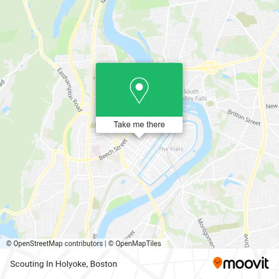
See Scouting In Holyoke, Boston, on the map
Public Transit to Scouting In Holyoke in Boston
Wondering how to get to Scouting In Holyoke in Boston? Moovit helps you find the best way to get to Scouting In Holyoke with step-by-step directions from the nearest public transit station.
Moovit provides free maps and live directions to help you navigate through your city. View schedules, routes, timetables, and find out how long does it take to get to Scouting In Holyoke in real time.
Looking for the nearest stop or station to Scouting In Holyoke? Check out this list of stops closest to your destination: Hampshire / Chestnut; Cabot / Chestnut; Holyoke Amtrak; Cabot / High; High / Cabot.
Bus: P21E, B23, R24, P21, R22, P20, T24.Train: VERMONTER, VALLEY FLYER.
Want to see if there’s another route that gets you there at an earlier time? Moovit helps you find alternative routes or times. Get directions from and directions to Scouting In Holyoke easily from the Moovit App or Website.
We make riding to Scouting In Holyoke easy, which is why over 1.7 million users, including users in Boston, trust Moovit as the best app for public transit. You don’t need to download an individual bus app or train app, Moovit is your all-in-one transit app that helps you find the best bus time or train time available.
For information on prices of bus and train, costs and ride fares to Scouting In Holyoke, please check the Moovit app.
Use the app to navigate to popular places including to the airport, hospital, stadium, grocery store, mall, coffee shop, school, college, and university.
Scouting In Holyoke Address: Masonic Temple, 235 Chestnut St street in Boston
- Mount Tom Lodge af&am,
- Holyoke Libary Park,
- ADT,
- ADT Alarm,
- Puerto Rican Cultural Project,
- U-Haul,
- H.B. Lawrence School,
- Artesana,
- Maplewood Hotel,
- Hello Holyoke,
- Hogan Technology,
- Inhome Remodeling,
- Iglesia Pentecostal Sol de Justicia Inc. Ipsj,
- Home Improvement, SMK,
- Gagnon Electric,
- Appleton & Maple,
- Walnut Street,
- Amazon Locker-Exhibit,
- CML Iglesias,
- Appleton Mart
Places Near Scouting In Holyoke (Boston)
- Castle Island, Boston,
- Wang Theater, Boston,
- Museum Of Science, Boston,
- Wilbur Theatre, Boston,
- Massachusetts General Hospital, Boston,
- Boston Medical Center, Boston,
- Cheers, Boston,
- Mgm Music Hall, Boston,
- Boston Children's Hospital, Boston,
- Td Garden, Boston,
- House Of Blues, Boston,
- Faneuil Hall, Boston,
- Leader Bank Pavilion (Leader Bank Pavillion), Boston,
- Boston Convention & Exhibition Center, Boston,
- Seaport District, Boston,
- Quincy Market, Boston,
- Prudential Center, Boston,
- North End, Boston,
- Isabella Stewart Gardner Museum, Boston,
- Boston Common, Boston
How to get to popular places in Boston with public transit
Get around Boston by public transit!
Traveling around Boston has never been so easy. See step by step directions as you travel to any attraction, street or major public transit station. View bus and train schedules, arrival times, service alerts and detailed routes on a map, so you know exactly how to get to anywhere in Boston.
When traveling to any destination around Boston use Moovit's Live Directions with Get Off Notifications to know exactly where and how far to walk, how long to wait for your line, and how many stops are left. Moovit will alert you when it's time to get off — no need to constantly re-check whether yours is the next stop.
Wondering how to use public transit in Boston or how to pay for public transit in Boston? Moovit public transit app can help you navigate your way with public transit easily, and at minimum cost. It includes public transit fees, ticket prices, and costs. Looking for a map of Boston public transit lines? Moovit public transit app shows all public transit maps in Boston with all Bus, Train, Subway and Ferry routes and stops on an interactive map.
Boston has 4 transit type(s), including: Bus, Train, Subway and Ferry, operated by several transit agencies, including MBTA, Southeastern Regional Transit Authority, MetroWest Regional Transit Authority, Rhode Island Public Transit Authority, WRTA, Lowell Regional Transit Authority, Merrimack Valley Transit, Montachusett Regional Transit Authority, Cape Cod Regional Transit Authority, Brockton Area Transit Authority, Martha's Vineyard Transit Authority, the WAVE - Nantucket Regional Transit Authority, GATRA, Cape Ann Transportation Authority and Massport