Directions to St. Pierre-Phaneuf Funeral Home (Boston) with public transportation
The following transit lines have routes that pass near St. Pierre-Phaneuf Funeral Home
 Bus: P21, G1, T1, T2, T3.
- Train: LAKE SHORE LIMITED, VERMONTER, AMTRAK HARTFORD LINE, NORTHEAST REGIONAL, VALLEY FLYER.
How to get to St. Pierre-Phaneuf Funeral Home by bus?
Click on the bus route to see step by step directions with maps, line arrival times and updated time schedules.
From Walmart Supercenter, Worcester
151 minFrom Polar Park, Worcester
94 minFrom South High Community School, Worcester
189 minFrom Registry Of Motor Vehicles (Rmv) Branch Office, Worcester
96 minFrom Worcester, MA, Worcester
92 minFrom Dcu Center, Worcester
95 minFrom Foxwoods, Worcester
122 minFrom Palladium, Worcester
98 min
How to get to St. Pierre-Phaneuf Funeral Home by train?
Click on the train route to see step by step directions with maps, line arrival times and updated time schedules.
Bus stops near St. Pierre-Phaneuf Funeral Home in Boston
Train station near St. Pierre-Phaneuf Funeral Home in Boston
- Springfield, 37 min walk,VIEW
Bus lines to St. Pierre-Phaneuf Funeral Home in Boston
What are the closest stations to St. Pierre-Phaneuf Funeral Home?
The closest stations to St. Pierre-Phaneuf Funeral Home are:
- Main / Huntington is 19 yards away, 1 min walk.
- Chestnut / Hebron is 295 yards away, 4 min walk.
- Springfield is 3149 yards away, 37 min walk.
Which bus line stops near St. Pierre-Phaneuf Funeral Home?
P21 (Holyoke Trans. Ctr. Via Meetinghouse/Meadow)
Which train lines stop near St. Pierre-Phaneuf Funeral Home?
These train lines stop near St. Pierre-Phaneuf Funeral Home: LAKE SHORE LIMITED, VERMONTER.
What’s the nearest bus station to St. Pierre-Phaneuf Funeral Home in Boston?
The nearest bus station to St. Pierre-Phaneuf Funeral Home in Boston is Main / Huntington. It’s a 1 min walk away.
What time is the first train to St. Pierre-Phaneuf Funeral Home in Boston?
The NORTHEAST REGIONAL is the first train that goes to St. Pierre-Phaneuf Funeral Home in Boston. It stops nearby at 4:10 AM.
What time is the last train to St. Pierre-Phaneuf Funeral Home in Boston?
The LAKE SHORE LIMITED is the last train that goes to St. Pierre-Phaneuf Funeral Home in Boston. It stops nearby at 6:04 PM.
What time is the first bus to St. Pierre-Phaneuf Funeral Home in Boston?
The P21 is the first bus that goes to St. Pierre-Phaneuf Funeral Home in Boston. It stops nearby at 5:04 AM.
What time is the last bus to St. Pierre-Phaneuf Funeral Home in Boston?
The G1 is the last bus that goes to St. Pierre-Phaneuf Funeral Home in Boston. It stops nearby at 9:57 PM.
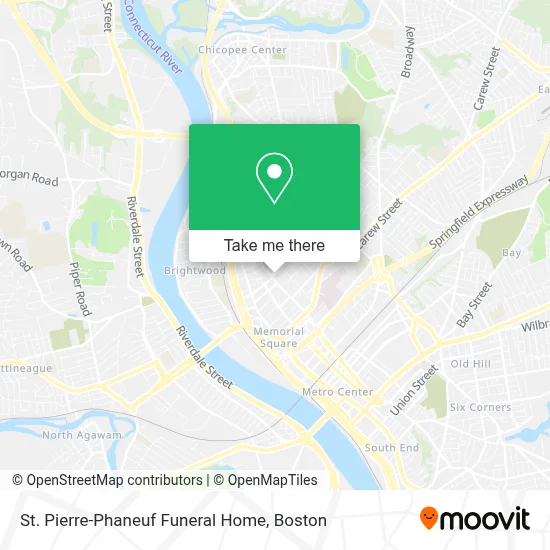
See St. Pierre-Phaneuf Funeral Home, Boston, on the map
Public Transit to St. Pierre-Phaneuf Funeral Home in Boston
Wondering how to get to St. Pierre-Phaneuf Funeral Home in Boston? Moovit helps you find the best way to get to St. Pierre-Phaneuf Funeral Home with step-by-step directions from the nearest public transit station.
Moovit provides free maps and live directions to help you navigate through your city. View schedules, routes, timetables, and find out how long does it take to get to St. Pierre-Phaneuf Funeral Home in real time.
Looking for the nearest stop or station to St. Pierre-Phaneuf Funeral Home? Check out this list of stops closest to your destination: Main / Huntington; Chestnut / Hebron; Springfield.
Bus: P21, G1, T1, T2, T3, T5, T21.Train: LAKE SHORE LIMITED, VERMONTER, AMTRAK HARTFORD LINE, NORTHEAST REGIONAL, VALLEY FLYER.
Want to see if there’s another route that gets you there at an earlier time? Moovit helps you find alternative routes or times. Get directions from and directions to St. Pierre-Phaneuf Funeral Home easily from the Moovit App or Website.
We make riding to St. Pierre-Phaneuf Funeral Home easy, which is why over 1.7 million users, including users in Boston, trust Moovit as the best app for public transit. You don’t need to download an individual bus app or train app, Moovit is your all-in-one transit app that helps you find the best bus time or train time available.
For information on prices of bus and train, costs and ride fares to St. Pierre-Phaneuf Funeral Home, please check the Moovit app.
Use the app to navigate to popular places including to the airport, hospital, stadium, grocery store, mall, coffee shop, school, college, and university.
St. Pierre-Phaneuf Funeral Home Address: 7 Chapin Ter street in Boston
- Radio Eighty Seven Point Nine FM,
- Jose E Llorens MD,
- Hernandez Airport Service,
- Edward Jones - Financial Advisor: Kevin Sylvester,
- Saint Thomas Aquinas Church,
- City of Springfield K 5,
- Springfield Middle School,
- D&A Used Tires,
- Restoring and Preserving History Daniels New Bethel Cogic,
- Reid Bookkeeping,
- Lincoln Street School Playground,
- Sharkface Entertainment,
- Fitzgerald Kevin,
- Adin T Putnam, MD,
- Dr. Pranay M Parikh MD,
- Howard Trietsch MD,
- Luanne A McCloskey, Pa,
- Jordin D Marousis, Pa,
- Azad A Jabiev, MD,
- Katie S Nason, MD
Places Near St. Pierre-Phaneuf Funeral Home (Boston)
- Wang Theater, Boston,
- North End, Boston,
- Wilbur Theatre, Boston,
- Isabella Stewart Gardner Museum, Boston,
- Seaport District, Boston,
- Td Garden, Boston,
- Boston Children's Hospital, Boston,
- Castle Island, Boston,
- Mgm Music Hall, Boston,
- Cheers, Boston,
- Museum Of Science, Boston,
- Faneuil Hall, Boston,
- Massachusetts General Hospital, Boston,
- House Of Blues, Boston,
- Quincy Market, Boston,
- Boston Medical Center, Boston,
- Boston Common, Boston,
- Prudential Center, Boston,
- Boston Convention & Exhibition Center, Boston,
- Leader Bank Pavilion (Leader Bank Pavillion), Boston
How to get to popular places in Boston with public transit
Get around Boston by public transit!
Traveling around Boston has never been so easy. See step by step directions as you travel to any attraction, street or major public transit station. View bus and train schedules, arrival times, service alerts and detailed routes on a map, so you know exactly how to get to anywhere in Boston.
When traveling to any destination around Boston use Moovit's Live Directions with Get Off Notifications to know exactly where and how far to walk, how long to wait for your line, and how many stops are left. Moovit will alert you when it's time to get off — no need to constantly re-check whether yours is the next stop.
Wondering how to use public transit in Boston or how to pay for public transit in Boston? Moovit public transit app can help you navigate your way with public transit easily, and at minimum cost. It includes public transit fees, ticket prices, and costs. Looking for a map of Boston public transit lines? Moovit public transit app shows all public transit maps in Boston with all Bus, Train, Subway and Ferry routes and stops on an interactive map.
Boston has 4 transit type(s), including: Bus, Train, Subway and Ferry, operated by several transit agencies, including MBTA, Southeastern Regional Transit Authority, MetroWest Regional Transit Authority, Rhode Island Public Transit Authority, WRTA, Lowell Regional Transit Authority, Merrimack Valley Transit, Montachusett Regional Transit Authority, Cape Cod Regional Transit Authority, Brockton Area Transit Authority, Martha's Vineyard Transit Authority, the WAVE - Nantucket Regional Transit Authority, GATRA, Cape Ann Transportation Authority and Massport