How to get to Sugar D.L.'s Baked Goods by bus?
Click on the bus route to see step by step directions with maps, line arrival times and updated time schedules.
From South High Community School, Worcester
234 minFrom Worcester, MA, Worcester
137 minFrom Polar Park, Worcester
139 minFrom Palladium, Worcester
142 minFrom Foxwoods, Worcester
167 minFrom Registry Of Motor Vehicles (Rmv) Branch Office, Worcester
141 minFrom Walmart Supercenter, Worcester
196 minFrom Dcu Center, Worcester
139 min
Bus stops near Sugar D.L.'s Baked Goods in Boston
Bus lines to Sugar D.L.'s Baked Goods in Boston
What are the closest stations to Sugar D.L.'s Baked Goods?
The closest stations to Sugar D.L.'s Baked Goods are:
- Big Y - Wilbraham is 262 yards away, 4 min walk.
- State / Hampden (Opposite) is 1166 yards away, 14 min walk.
Which bus lines stop near Sugar D.L.'s Baked Goods?
These bus lines stop near Sugar D.L.'s Baked Goods: B17, B7.
What’s the nearest bus station to Sugar D.L.'s Baked Goods in Boston?
The nearest bus station to Sugar D.L.'s Baked Goods in Boston is Big Y - Wilbraham. It’s a 4 min walk away.
What time is the first bus to Sugar D.L.'s Baked Goods in Boston?
The B7 is the first bus that goes to Sugar D.L.'s Baked Goods in Boston. It stops nearby at 5:15 AM.
What time is the last bus to Sugar D.L.'s Baked Goods in Boston?
The B7 is the last bus that goes to Sugar D.L.'s Baked Goods in Boston. It stops nearby at 10:59 PM.
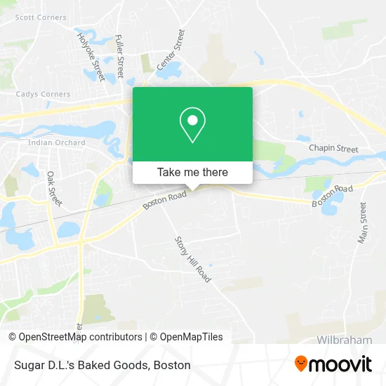
See Sugar D.L.'s Baked Goods, Boston, on the map
Public Transit to Sugar D.L.'s Baked Goods in Boston
Wondering how to get to Sugar D.L.'s Baked Goods in Boston? Moovit helps you find the best way to get to Sugar D.L.'s Baked Goods with step-by-step directions from the nearest public transit station.
Moovit provides free maps and live directions to help you navigate through your city. View schedules, routes, timetables, and find out how long does it take to get to Sugar D.L.'s Baked Goods in real time.
Looking for the nearest stop or station to Sugar D.L.'s Baked Goods? Check out this list of stops closest to your destination: Big Y - Wilbraham; State / Hampden (Opposite).
Bus: B17, B7, WS, B6.
Want to see if there’s another route that gets you there at an earlier time? Moovit helps you find alternative routes or times. Get directions from and directions to Sugar D.L.'s Baked Goods easily from the Moovit App or Website.
We make riding to Sugar D.L.'s Baked Goods easy, which is why over 1.7 million users, including users in Boston, trust Moovit as the best app for public transit. You don’t need to download an individual bus app or train app, Moovit is your all-in-one transit app that helps you find the best bus time or train time available.
For information on prices of bus, costs and ride fares to Sugar D.L.'s Baked Goods, please check the Moovit app.
Use the app to navigate to popular places including to the airport, hospital, stadium, grocery store, mall, coffee shop, school, college, and university.
Sugar D.L.'s Baked Goods Address: 2133 Boston Rd street in Boston
- Neuro Ophthalmology Eyecare PC,
- Inside-Out, Home & Garden,
- Garvey's,
- Pam Mitchell,
- Jenni Ortega Realty Group,
- Diane Updike Tarozzi,
- Wilbraham Hotel,
- Wilbraham Auto Sales,
- Domino's,
- Hardwood Hill,
- Perry-Abbott Regina Add To Favorites,
- Boston Rd,
- Home Depot,
- Berkshire Bank,
- Depot,
- 2001 Boston Rd Parking,
- STARBUCKS,
- The Home Depot,
- T Danielson John Od PHD,
- Chemi-Graphic
Places Near Sugar D.L.'s Baked Goods (Boston)
- Cheers, Boston,
- Museum Of Science, Boston,
- Wang Theater, Boston,
- Mgm Music Hall, Boston,
- Quincy Market, Boston,
- Faneuil Hall, Boston,
- Prudential Center, Boston,
- Isabella Stewart Gardner Museum, Boston,
- Leader Bank Pavilion (Leader Bank Pavillion), Boston,
- Boston Convention & Exhibition Center, Boston,
- North End, Boston,
- Seaport District, Boston,
- Boston Medical Center, Boston,
- Massachusetts General Hospital, Boston,
- Boston Common, Boston,
- Boston Children's Hospital, Boston,
- Castle Island, Boston,
- Wilbur Theatre, Boston,
- Td Garden, Boston,
- House Of Blues, Boston
How to get to popular places in Boston with public transit
Get around Boston by public transit!
Traveling around Boston has never been so easy. See step by step directions as you travel to any attraction, street or major public transit station. View bus and train schedules, arrival times, service alerts and detailed routes on a map, so you know exactly how to get to anywhere in Boston.
When traveling to any destination around Boston use Moovit's Live Directions with Get Off Notifications to know exactly where and how far to walk, how long to wait for your line, and how many stops are left. Moovit will alert you when it's time to get off — no need to constantly re-check whether yours is the next stop.
Wondering how to use public transit in Boston or how to pay for public transit in Boston? Moovit public transit app can help you navigate your way with public transit easily, and at minimum cost. It includes public transit fees, ticket prices, and costs. Looking for a map of Boston public transit lines? Moovit public transit app shows all public transit maps in Boston with all Bus, Train, Subway and Ferry routes and stops on an interactive map.
Boston has 4 transit type(s), including: Bus, Train, Subway and Ferry, operated by several transit agencies, including MBTA, Southeastern Regional Transit Authority, MetroWest Regional Transit Authority, Rhode Island Public Transit Authority, WRTA, Lowell Regional Transit Authority, Merrimack Valley Transit, Montachusett Regional Transit Authority, Cape Cod Regional Transit Authority, Brockton Area Transit Authority, Martha's Vineyard Transit Authority, the WAVE - Nantucket Regional Transit Authority, GATRA, Cape Ann Transportation Authority and Massport