Directions to Sweet Pea And Sage (Boston) with public transportation
The following transit lines have routes that pass near Sweet Pea And Sage
 Bus: 16, 39, 42, 35, 38.
- Train: NEEDHAM, FRANKLIN/FOXBORO, ORANGE LINE, PROVIDENCE/STOUGHTON.
- Subway: ORANGE LINE.
How to get to Sweet Pea And Sage by bus?
Click on the bus route to see step by step directions with maps, line arrival times and updated time schedules.
From Charlestown, Boston
79 minFrom Boston Harborwalk, Boston
58 minFrom South Bay Center, Boston
37 minFrom Bebop, Boston
35 minFrom Copley MBTA Station, Boston
32 minFrom Embassy Suites Boston At Logan, Boston
66 minFrom Santarpio's Pizza, Boston
66 minFrom Embassy Suites-Boston, Boston
66 minFrom Embassy Suites by Hilton Boston at Logan Airport, Boston
65 minFrom East Boston, Boston
71 min
How to get to Sweet Pea And Sage by train?
Click on the train route to see step by step directions with maps, line arrival times and updated time schedules.
How to get to Sweet Pea And Sage by subway?
Click on the subway route to see step by step directions with maps, line arrival times and updated time schedules.
From Embassy Suites Boston At Logan, Boston
43 minFrom Charlestown, Boston
44 minFrom Boston Harborwalk, Boston
33 minFrom Embassy Suites by Hilton Boston at Logan Airport, Boston
42 minFrom East Boston, Boston
43 minFrom South Bay Center, Boston
45 minFrom Santarpio's Pizza, Boston
41 minFrom Bebop, Boston
30 minFrom Embassy Suites-Boston, Boston
43 minFrom Copley MBTA Station, Boston
27 min
Bus stops near Sweet Pea And Sage in Boston
Train station near Sweet Pea And Sage in Boston
- Forest Hills, 13 min walk,VIEW
Bus lines to Sweet Pea And Sage in Boston
- 42, Nubian,VIEW
- 35, Avenue Louis Pasteur,VIEW
- 38, Forest Hills,VIEW
- 39, Haymarket Via Forest Hills,VIEW
- 16, Harbor Point Via South Bay Center,VIEW
- 21, Avenue Louis Pasteur Via Forest Hills,VIEW
- 31, Mattapan,VIEW
- 32, Cleary Square,VIEW
- 34, Dedham Mall,VIEW
- 36, Millennium Park,VIEW
- 30, Forest Hills - Mattapan,VIEW
- 33, Mattapan - River St & Milton St,VIEW
- 37, Forest Hills - Baker & Vermont St,VIEW
- 40, Forest Hills - Georgetowne,VIEW
- 50, Forest Hills - Cleary Square,VIEW
- 51, Forest Hills - Reservoir,VIEW
- 34E, Forest Hills - Walpole Center via Washington St,VIEW
- NEEDHAM LINE SHUTTLE, Newton Highlands - Forest Hills,VIEW
- NEEDHAM LINE SHUTTLE, Needham Heights - Forest Hills,VIEW
- ORANGE LINE SHUTTLE, Forest Hills - Copley,VIEW
What are the closest stations to Sweet Pea And Sage?
The closest stations to Sweet Pea And Sage are:
- Washington St @ Burnett St is 37 yards away, 1 min walk.
- Centre St @ Ballard St is 219 yards away, 3 min walk.
- Arborway Opp Courthouse is 570 yards away, 7 min walk.
- Forest Hills is 589 yards away, 8 min walk.
Which bus lines stop near Sweet Pea And Sage?
These bus lines stop near Sweet Pea And Sage: 16, 39.
Which train line stops near Sweet Pea And Sage?
NEEDHAM (#625 | Needham Heights)
Which subway line stops near Sweet Pea And Sage?
ORANGE LINE (Forest Hills)
What’s the nearest train station to Sweet Pea And Sage in Boston?
The nearest train station to Sweet Pea And Sage in Boston is Forest Hills. It’s a 13 min walk away.
What’s the nearest bus station to Sweet Pea And Sage in Boston?
The nearest bus station to Sweet Pea And Sage in Boston is Washington St @ Burnett St. It’s a 1 min walk away.
What time is the first subway to Sweet Pea And Sage in Boston?
The ORANGE LINE is the first subway that goes to Sweet Pea And Sage in Boston. It stops nearby at 5:15 AM.
What time is the last subway to Sweet Pea And Sage in Boston?
The ORANGE LINE is the last subway that goes to Sweet Pea And Sage in Boston. It stops nearby at 1:58 AM.
What time is the first train to Sweet Pea And Sage in Boston?
The NEEDHAM is the first train that goes to Sweet Pea And Sage in Boston. It stops nearby at 7:30 AM.
What time is the last train to Sweet Pea And Sage in Boston?
The PROVIDENCE/STOUGHTON is the last train that goes to Sweet Pea And Sage in Boston. It stops nearby at 12:08 AM.
What time is the first bus to Sweet Pea And Sage in Boston?
The 16 is the first bus that goes to Sweet Pea And Sage in Boston. It stops nearby at 4:30 AM.
What time is the last bus to Sweet Pea And Sage in Boston?
The 36 is the last bus that goes to Sweet Pea And Sage in Boston. It stops nearby at 1:43 AM.
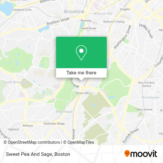
See Sweet Pea And Sage, Boston, on the map
Public Transit to Sweet Pea And Sage in Boston
Wondering how to get to Sweet Pea And Sage in Boston? Moovit helps you find the best way to get to Sweet Pea And Sage with step-by-step directions from the nearest public transit station.
Moovit provides free maps and live directions to help you navigate through your city. View schedules, routes, timetables, and find out how long does it take to get to Sweet Pea And Sage in real time.
Looking for the nearest stop or station to Sweet Pea And Sage? Check out this list of stops closest to your destination: Washington St @ Burnett St; Centre St @ Ballard St; Arborway Opp Courthouse; Forest Hills.
Bus: 16, 39, 42, 35, 38, 21, 31, 32, 34, 30, 33, 37, 40, 50.Train: NEEDHAM, FRANKLIN/FOXBORO, ORANGE LINE, PROVIDENCE/STOUGHTON.Subway: ORANGE LINE.
Want to see if there’s another route that gets you there at an earlier time? Moovit helps you find alternative routes or times. Get directions from and directions to Sweet Pea And Sage easily from the Moovit App or Website.
We make riding to Sweet Pea And Sage easy, which is why over 1.7 million users, including users in Boston, trust Moovit as the best app for public transit. You don’t need to download an individual bus app or train app, Moovit is your all-in-one transit app that helps you find the best bus time or train time available.
For information on prices of subway, bus and train, costs and ride fares to Sweet Pea And Sage, please check the Moovit app.
Use the app to navigate to popular places including to the airport, hospital, stadium, grocery store, mall, coffee shop, school, college, and university.
Sweet Pea And Sage Address: 166 South St street in Boston
- Hyde Park Telecommunications,
- Asap Lock & Key,
- South St & Washington St,
- Glenn's Gardening & Woodworking,
- Forest Hills Station MBTA,
- Forest Hills - Hyde Park Ave, Franklin Park, Zoo, Parking,
- MBTA Forest Hills Station,
- Forest Hills Station Lower Busway,
- Laz Parking (Public Parking),
- Dosa Factory,
- West Roxbury-Boston Municipal Court,
- Memphis Locksmith,
- Aviary,
- West Roxbury Courthouse,
- MBTA Arborway Bus Garage,
- West Roxbury-Boston Municipal Court ,
- West Roxbury District Court,
- Klassy Kuts Barber Shop,
- Arborway,
- Jp Car Wash
Places Near Sweet Pea And Sage (Boston)
- Boston Common, Boston,
- Boston Medical Center, Boston,
- Td Garden, Boston,
- Seaport District, Boston,
- Massachusetts General Hospital, Boston,
- Castle Island, Boston,
- Museum Of Science, Boston,
- Boston Children's Hospital, Boston,
- Wilbur Theatre, Boston,
- Quincy Market, Boston,
- Cheers, Boston,
- House Of Blues, Boston,
- Wang Theater, Boston,
- Leader Bank Pavilion (Leader Bank Pavillion), Boston,
- Mgm Music Hall, Boston,
- Prudential Center, Boston,
- Isabella Stewart Gardner Museum, Boston,
- North End, Boston,
- Faneuil Hall, Boston,
- Boston Convention & Exhibition Center, Boston
How to get to popular places in Boston with public transit
Get around Boston by public transit!
Traveling around Boston has never been so easy. See step by step directions as you travel to any attraction, street or major public transit station. View bus and train schedules, arrival times, service alerts and detailed routes on a map, so you know exactly how to get to anywhere in Boston.
When traveling to any destination around Boston use Moovit's Live Directions with Get Off Notifications to know exactly where and how far to walk, how long to wait for your line, and how many stops are left. Moovit will alert you when it's time to get off — no need to constantly re-check whether yours is the next stop.
Wondering how to use public transit in Boston or how to pay for public transit in Boston? Moovit public transit app can help you navigate your way with public transit easily, and at minimum cost. It includes public transit fees, ticket prices, and costs. Looking for a map of Boston public transit lines? Moovit public transit app shows all public transit maps in Boston with all Bus, Train, Subway and Ferry routes and stops on an interactive map.
Boston has 4 transit type(s), including: Bus, Train, Subway and Ferry, operated by several transit agencies, including MBTA, Southeastern Regional Transit Authority, MetroWest Regional Transit Authority, Rhode Island Public Transit Authority, WRTA, Lowell Regional Transit Authority, Merrimack Valley Transit, Montachusett Regional Transit Authority, Cape Cod Regional Transit Authority, Brockton Area Transit Authority, Martha's Vineyard Transit Authority, the WAVE - Nantucket Regional Transit Authority, GATRA, Cape Ann Transportation Authority and Massport