Directions to T & L's Antiques And Cleanouts (Boston) with public transportation
The following transit lines have routes that pass near T & L's Antiques And Cleanouts
 Bus: G2, T2, T21, T3, T4.
- Train: AMTRAK HARTFORD LINE, LAKE SHORE LIMITED, NORTHEAST REGIONAL, VALLEY FLYER, VERMONTER.
How to get to T & L's Antiques And Cleanouts by bus?
Click on the bus route to see step by step directions with maps, line arrival times and updated time schedules.
From South High Community School, Worcester
215 minFrom Dcu Center, Worcester
120 minFrom Worcester, MA, Worcester
118 minFrom Registry Of Motor Vehicles (Rmv) Branch Office, Worcester
122 minFrom Palladium, Worcester
123 minFrom Foxwoods, Worcester
148 minFrom Polar Park, Worcester
120 minFrom Walmart Supercenter, Worcester
177 min
Bus stops near T & L's Antiques And Cleanouts in Boston
Train station near T & L's Antiques And Cleanouts in Boston
- Springfield, 50 min walk,VIEW
Bus lines to T & L's Antiques And Cleanouts in Boston
What are the closest stations to T & L's Antiques And Cleanouts?
The closest stations to T & L's Antiques And Cleanouts are:
- Saint James Blvd / Saint James Ave is 389 yards away, 6 min walk.
- Saint James / St James is 419 yards away, 6 min walk.
- Bay / Baywood (1) is 585 yards away, 7 min walk.
- Springfield is 4187 yards away, 50 min walk.
Which bus line stops near T & L's Antiques And Cleanouts?
G2 (E Springfield Via Carew-Cottage)
What’s the nearest bus station to T & L's Antiques And Cleanouts in Boston?
The nearest bus stations to T & L's Antiques And Cleanouts in Boston are Saint James Blvd / Saint James Ave and Saint James / St James. The closest one is a 6 min walk away.
What time is the first train to T & L's Antiques And Cleanouts in Boston?
The NORTHEAST REGIONAL is the first train that goes to T & L's Antiques And Cleanouts in Boston. It stops nearby at 4:10 AM.
What time is the last train to T & L's Antiques And Cleanouts in Boston?
The LAKE SHORE LIMITED is the last train that goes to T & L's Antiques And Cleanouts in Boston. It stops nearby at 6:04 PM.
What time is the first bus to T & L's Antiques And Cleanouts in Boston?
The B6 is the first bus that goes to T & L's Antiques And Cleanouts in Boston. It stops nearby at 5:19 AM.
What time is the last bus to T & L's Antiques And Cleanouts in Boston?
The B6 is the last bus that goes to T & L's Antiques And Cleanouts in Boston. It stops nearby at 10:27 PM.
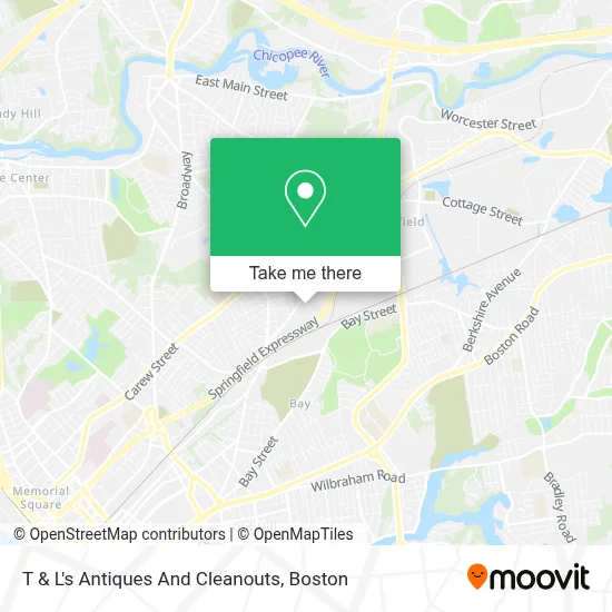
See T & L's Antiques And Cleanouts, Boston, on the map
Public Transit to T & L's Antiques And Cleanouts in Boston
Wondering how to get to T & L's Antiques And Cleanouts in Boston? Moovit helps you find the best way to get to T & L's Antiques And Cleanouts with step-by-step directions from the nearest public transit station.
Moovit provides free maps and live directions to help you navigate through your city. View schedules, routes, timetables, and find out how long does it take to get to T & L's Antiques And Cleanouts in real time.
Looking for the nearest stop or station to T & L's Antiques And Cleanouts? Check out this list of stops closest to your destination: Saint James Blvd / Saint James Ave; Saint James / St James; Bay / Baywood (1); Springfield.
Bus: G2, T2, T21, T3, T4, B6, T6.Train: AMTRAK HARTFORD LINE, LAKE SHORE LIMITED, NORTHEAST REGIONAL, VALLEY FLYER, VERMONTER.
Want to see if there’s another route that gets you there at an earlier time? Moovit helps you find alternative routes or times. Get directions from and directions to T & L's Antiques And Cleanouts easily from the Moovit App or Website.
We make riding to T & L's Antiques And Cleanouts easy, which is why over 1.7 million users, including users in Boston, trust Moovit as the best app for public transit. You don’t need to download an individual bus app or train app, Moovit is your all-in-one transit app that helps you find the best bus time or train time available.
For information on prices of bus, costs and ride fares to T & L's Antiques And Cleanouts, please check the Moovit app.
Use the app to navigate to popular places including to the airport, hospital, stadium, grocery store, mall, coffee shop, school, college, and university.
T & L's Antiques And Cleanouts Address: 259 Page Blvd street in Boston
- Crowley Barry W,
- Jadco,
- GML Construction,
- Springfield Indian Motorcycle Museum And Hall Of Fame,
- ADT 24 Hr Alarm & Home Security,
- Good Storage,
- Arcade on Wheels,
- Tech Roofing,
- East Springfield Oil Co,
- Eureka Lab Book,
- Marcil's Clock Shop,
- Estefania's Daycare,
- Charles C. Lewis Co.,
- Zaza Green,
- Supperior Carriers,
- Astro Chemicals,
- Interstate Batteries,
- Titeflex Corp (Hose),
- A FJ Auto Repair,
- Water Works Underground Lawn Sprinklers
Places Near T & L's Antiques And Cleanouts (Boston)
- Museum Of Science, Boston,
- North End, Boston,
- Cheers, Boston,
- House Of Blues, Boston,
- Seaport District, Boston,
- Massachusetts General Hospital, Boston,
- Quincy Market, Boston,
- Wang Theater, Boston,
- Boston Medical Center, Boston,
- Boston Children's Hospital, Boston,
- Td Garden, Boston,
- Castle Island, Boston,
- Boston Convention & Exhibition Center, Boston,
- Faneuil Hall, Boston,
- Mgm Music Hall, Boston,
- Leader Bank Pavilion (Leader Bank Pavillion), Boston,
- Isabella Stewart Gardner Museum, Boston,
- Boston Common, Boston,
- Wilbur Theatre, Boston,
- Prudential Center, Boston
How to get to popular places in Boston with public transit
Get around Boston by public transit!
Traveling around Boston has never been so easy. See step by step directions as you travel to any attraction, street or major public transit station. View bus and train schedules, arrival times, service alerts and detailed routes on a map, so you know exactly how to get to anywhere in Boston.
When traveling to any destination around Boston use Moovit's Live Directions with Get Off Notifications to know exactly where and how far to walk, how long to wait for your line, and how many stops are left. Moovit will alert you when it's time to get off — no need to constantly re-check whether yours is the next stop.
Wondering how to use public transit in Boston or how to pay for public transit in Boston? Moovit public transit app can help you navigate your way with public transit easily, and at minimum cost. It includes public transit fees, ticket prices, and costs. Looking for a map of Boston public transit lines? Moovit public transit app shows all public transit maps in Boston with all Bus, Train, Subway and Ferry routes and stops on an interactive map.
Boston has 4 transit type(s), including: Bus, Train, Subway and Ferry, operated by several transit agencies, including MBTA, Southeastern Regional Transit Authority, MetroWest Regional Transit Authority, Rhode Island Public Transit Authority, WRTA, Lowell Regional Transit Authority, Merrimack Valley Transit, Montachusett Regional Transit Authority, Cape Cod Regional Transit Authority, Brockton Area Transit Authority, Martha's Vineyard Transit Authority, the WAVE - Nantucket Regional Transit Authority, GATRA, Cape Ann Transportation Authority and Massport