How to get to The Inspiration Co. by bus?
Click on the bus route to see step by step directions with maps, line arrival times and updated time schedules.
From South High Community School, Worcester
200 minFrom Worcester, MA, Worcester
103 minFrom Polar Park, Worcester
104 minFrom Foxwoods, Worcester
132 minFrom Palladium, Worcester
108 minFrom Gardner, MA, Gardner
245 minFrom Registry Of Motor Vehicles (Rmv) Branch Office, Worcester
107 minFrom Dcu Center, Worcester
105 min
Bus stops near The Inspiration Co. in Boston
Bus lines to The Inspiration Co. in Boston
What are the closest stations to The Inspiration Co.?
The closest stations to The Inspiration Co. are:
- Holy Family / Devonshire is 265 yards away, 4 min walk.
- Lower Westfield / Whiting Farms is 305 yards away, 4 min walk.
- Holyoke Mall is 986 yards away, 12 min walk.
- Main / Jones Ferry (Across) is 1030 yards away, 13 min walk.
Which bus lines stop near The Inspiration Co.?
These bus lines stop near The Inspiration Co.: G73E, R24.
What’s the nearest bus station to The Inspiration Co. in Boston?
The nearest bus stations to The Inspiration Co. in Boston are Holy Family / Devonshire and Lower Westfield / Whiting Farms. The closest one is a 4 min walk away.
What time is the first bus to The Inspiration Co. in Boston?
The P20 is the first bus that goes to The Inspiration Co. in Boston. It stops nearby at 5:57 AM.
What time is the last bus to The Inspiration Co. in Boston?
The P20 is the last bus that goes to The Inspiration Co. in Boston. It stops nearby at 11:08 PM.
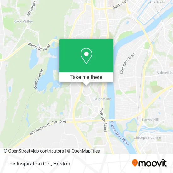
See The Inspiration Co., Boston, on the map
Public Transit to The Inspiration Co. in Boston
Wondering how to get to The Inspiration Co. in Boston? Moovit helps you find the best way to get to The Inspiration Co. with step-by-step directions from the nearest public transit station.
Moovit provides free maps and live directions to help you navigate through your city. View schedules, routes, timetables, and find out how long does it take to get to The Inspiration Co. in real time.
Looking for the nearest stop or station to The Inspiration Co.? Check out this list of stops closest to your destination: Holy Family / Devonshire; Lower Westfield / Whiting Farms; Holyoke Mall; Main / Jones Ferry (Across).
Bus: G73E, R24, P20, T20, R41, R29, T24.
Want to see if there’s another route that gets you there at an earlier time? Moovit helps you find alternative routes or times. Get directions from and directions to The Inspiration Co. easily from the Moovit App or Website.
We make riding to The Inspiration Co. easy, which is why over 1.7 million users, including users in Boston, trust Moovit as the best app for public transit. You don’t need to download an individual bus app or train app, Moovit is your all-in-one transit app that helps you find the best bus time or train time available.
For information on prices of bus, costs and ride fares to The Inspiration Co., please check the Moovit app.
Use the app to navigate to popular places including to the airport, hospital, stadium, grocery store, mall, coffee shop, school, college, and university.
The Inspiration Co. Address: 50 Holyoke St street in Boston
- Peet's Coffee,
- Monsoon Bistro,
- Select Comfort,
- Holyoke Mall at Ingleside,
- Charlotte Tilbury,
- Mastercuts,
- Auntie Anne's,
- WILLIAMS-SONOMA,
- Pixelab Experience,
- Custom T's,
- Midnight Odyssey Crystals,
- Go! Calendars, Toys & Games,
- Mi Amor,
- Kids Foot Locker,
- Mobeauty Supply Vending,
- Food Court Holyoke Mall,
- John Dougherty Harris Od - Optometrist,
- After Hours Formalwear,
- Lash Factory,
- Finish Line
Places Near The Inspiration Co. (Boston)
- Castle Island, Boston,
- Boston Convention & Exhibition Center, Boston,
- Seaport District, Boston,
- Prudential Center, Boston,
- Wilbur Theatre, Boston,
- Museum Of Science, Boston,
- Mgm Music Hall, Boston,
- Wang Theater, Boston,
- Faneuil Hall, Boston,
- Td Garden, Boston,
- Quincy Market, Boston,
- Massachusetts General Hospital, Boston,
- Boston Medical Center, Boston,
- North End, Boston,
- Leader Bank Pavilion (Leader Bank Pavillion), Boston,
- Cheers, Boston,
- Boston Children's Hospital, Boston,
- House Of Blues, Boston,
- Boston Common, Boston,
- Isabella Stewart Gardner Museum, Boston
How to get to popular places in Boston with public transit
Get around Boston by public transit!
Traveling around Boston has never been so easy. See step by step directions as you travel to any attraction, street or major public transit station. View bus and train schedules, arrival times, service alerts and detailed routes on a map, so you know exactly how to get to anywhere in Boston.
When traveling to any destination around Boston use Moovit's Live Directions with Get Off Notifications to know exactly where and how far to walk, how long to wait for your line, and how many stops are left. Moovit will alert you when it's time to get off — no need to constantly re-check whether yours is the next stop.
Wondering how to use public transit in Boston or how to pay for public transit in Boston? Moovit public transit app can help you navigate your way with public transit easily, and at minimum cost. It includes public transit fees, ticket prices, and costs. Looking for a map of Boston public transit lines? Moovit public transit app shows all public transit maps in Boston with all Bus, Train, Subway and Ferry routes and stops on an interactive map.
Boston has 4 transit type(s), including: Bus, Train, Subway and Ferry, operated by several transit agencies, including MBTA, Southeastern Regional Transit Authority, MetroWest Regional Transit Authority, Rhode Island Public Transit Authority, WRTA, Lowell Regional Transit Authority, Merrimack Valley Transit, Montachusett Regional Transit Authority, Cape Cod Regional Transit Authority, Brockton Area Transit Authority, Martha's Vineyard Transit Authority, the WAVE - Nantucket Regional Transit Authority, GATRA, Cape Ann Transportation Authority and Massport