Directions to Genospace (Cambridge) with public transportation
The following transit lines have routes that pass near Genospace
 Bus: 1, 19, 64, 91, BB.
- Train: FRAMINGHAM/WORCESTER, NEEDHAM.
- Subway: RED LINE, GREEN LINE B, GREEN LINE D, GREEN LINE E.
How to get to Genospace by bus?
Click on the bus route to see step by step directions with maps, line arrival times and updated time schedules.
From Four Points by Sheraton Boston Logan Airport, Revere
95 minFrom Spaulding Rehab, Boston
70 minFrom The Monument, Boston
51 minFrom West Roxbury, Boston
74 minFrom Codman Square, Boston
74 minFrom The Institute Of Contemporary Art, Boston
52 minFrom VFW Parkway, Boston
70 minFrom Marina Bay, Quincy
163 minFrom Winthrop, Winthrop Town
135 minFrom Terminal E- Logan International Airport, Boston
32 min
How to get to Genospace by train?
Click on the train route to see step by step directions with maps, line arrival times and updated time schedules.
How to get to Genospace by subway?
Click on the subway route to see step by step directions with maps, line arrival times and updated time schedules.
Bus stops near Genospace in Cambridge
Subway stations near Genospace in Cambridge
Bus lines to Genospace in Cambridge
- 64, Kendall/MIT - Oak Square,VIEW
- 83, Central Square - Rindge Ave,VIEW
- 91, Central Square - Sullivan,VIEW
- 1, Harvard,VIEW
- 47, Broadway,VIEW
- 70, Central Square,VIEW
- RED LINE SHUTTLE, Harvard - Kendall/MIT (Loop),VIEW
- RED LINE SHUTTLE, Harvard - JFK/UMass via Congress Street,VIEW
- RED LINE SHUTTLE, Alewife - Park Street,VIEW
- RED LINE SHUTTLE, Harvard - Broadway,VIEW
- RED LINE SHUTTLE, Harvard - JFK/UMass via State Street,VIEW
- RED LINE SHUTTLE, Harvard - South Station,VIEW
- RED LINE SHUTTLE, Alewife - Kendall/MIT,VIEW
- RED LINE SHUTTLE, Harvard - Park Street,VIEW
What are the closest stations to Genospace?
The closest stations to Genospace are:
- Prospect St @ Harvard St is 167 yards away, 3 min walk.
- Massachusetts Ave @ Inman St is 267 yards away, 4 min walk.
- Green St @ Magazine St is 270 yards away, 4 min walk.
- Massachusetts Ave @ Pearl St is 335 yards away, 5 min walk.
- Boston Univ. Central is 676 yards away, 9 min walk.
- Kendall/MIT is 1145 yards away, 14 min walk.
- Union Square is 2119 yards away, 25 min walk.
Which bus lines stop near Genospace?
These bus lines stop near Genospace: 1, 19, 64, 91, BB.
Which train lines stop near Genospace?
These train lines stop near Genospace: FRAMINGHAM/WORCESTER, NEEDHAM.
Which subway line stops near Genospace?
RED LINE (Alewife)
What’s the nearest subway station to Genospace in Cambridge?
The nearest subway station to Genospace in Cambridge is Boston Univ. Central. It’s a 9 min walk away.
What’s the nearest bus station to Genospace in Cambridge?
The nearest bus station to Genospace in Cambridge is Prospect St @ Harvard St. It’s a 3 min walk away.
What time is the first subway to Genospace in Cambridge?
The GREEN LINE E is the first subway that goes to Genospace in Cambridge. It stops nearby at 4:50 AM.
What time is the last subway to Genospace in Cambridge?
The GREEN LINE B is the last subway that goes to Genospace in Cambridge. It stops nearby at 2:15 AM.
What time is the first bus to Genospace in Cambridge?
The 70 is the first bus that goes to Genospace in Cambridge. It stops nearby at 4:26 AM.
What time is the last bus to Genospace in Cambridge?
The 1 is the last bus that goes to Genospace in Cambridge. It stops nearby at 2:31 AM.
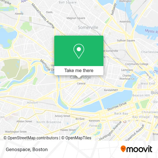
See Genospace, Cambridge, on the map
Public Transit to Genospace in Cambridge
Wondering how to get to Genospace in Cambridge? Moovit helps you find the best way to get to Genospace with step-by-step directions from the nearest public transit station.
Moovit provides free maps and live directions to help you navigate through your city. View schedules, routes, timetables, and find out how long does it take to get to Genospace in real time.
Looking for the nearest stop or station to Genospace? Check out this list of stops closest to your destination: Prospect St @ Harvard St; Massachusetts Ave @ Inman St; Green St @ Magazine St; Massachusetts Ave @ Pearl St; Boston Univ. Central; Kendall/MIT; Union Square.
Bus: 1, 19, 64, 91, BB, 83, 47, 70.Train: FRAMINGHAM/WORCESTER, NEEDHAM.Subway: RED LINE, GREEN LINE B, GREEN LINE D, GREEN LINE E.
Want to see if there’s another route that gets you there at an earlier time? Moovit helps you find alternative routes or times. Get directions from and directions to Genospace easily from the Moovit App or Website.
We make riding to Genospace easy, which is why over 1.7 million users, including users in Cambridge, trust Moovit as the best app for public transit. You don’t need to download an individual bus app or train app, Moovit is your all-in-one transit app that helps you find the best bus time or train time available.
For information on prices of bus, subway and train, costs and ride fares to Genospace, please check the Moovit app.
Use the app to navigate to popular places including to the airport, hospital, stadium, grocery store, mall, coffee shop, school, college, and university.
Genospace Address: 700 Massachusetts Ave street in Cambridge
- Lucky's Tattoo and Piercing,
- Sarah Notter,
- Aleppo Palace (Moody's Falafel Palace),
- Wul,
- MoneyGram,
- MBTA Bus Route 70a,
- Access: Drug User Health Program,
- Evergreen Garage Door Repair,
- Ace Hardware (Neighborhood Hardware Group),
- Friends Of Community Learning Center,
- Central Square,
- The Work Force Program,
- The Gilbane Group,
- Carl Barron Plaza,
- City Hall Historic District (Cambridge, Massachusetts),
- Galluccio & Watson,
- Central Square Florist,
- MBTA-Central Square,
- Veterans For Peace - Boston, Smedley D. Butler Brigade,
- Usps Central Square Cambridge
Places Near Genospace (Cambridge)
- Quincy Market, Boston,
- Museum Of Science, Boston,
- Cheers, Boston,
- North End, Boston,
- Castle Island, Boston,
- Seaport District, Boston,
- Wilbur Theatre, Boston,
- Td Garden, Boston,
- Mgm Music Hall, Boston,
- Isabella Stewart Gardner Museum, Boston,
- Boston Children's Hospital, Boston,
- Boston Medical Center, Boston,
- Wang Theater, Boston,
- House Of Blues, Boston,
- Prudential Center, Boston,
- Faneuil Hall, Boston,
- Leader Bank Pavilion (Leader Bank Pavillion), Boston,
- Boston Common, Boston,
- Massachusetts General Hospital, Boston,
- Boston Convention & Exhibition Center, Boston
How to get to popular places in Boston with public transit
Get around Cambridge by public transit!
Traveling around Cambridge has never been so easy. See step by step directions as you travel to any attraction, street or major public transit station. View bus and train schedules, arrival times, service alerts and detailed routes on a map, so you know exactly how to get to anywhere in Cambridge.
When traveling to any destination around Cambridge use Moovit's Live Directions with Get Off Notifications to know exactly where and how far to walk, how long to wait for your line, and how many stops are left. Moovit will alert you when it's time to get off — no need to constantly re-check whether yours is the next stop.
Wondering how to use public transit in Cambridge or how to pay for public transit in Cambridge? Moovit public transit app can help you navigate your way with public transit easily, and at minimum cost. It includes public transit fees, ticket prices, and costs. Looking for a map of Cambridge public transit lines? Moovit public transit app shows all public transit maps in Cambridge with all Bus, Train, Subway and Ferry routes and stops on an interactive map.
Boston has 4 transit type(s), including: Bus, Train, Subway and Ferry, operated by several transit agencies, including MBTA, Southeastern Regional Transit Authority, MetroWest Regional Transit Authority, Rhode Island Public Transit Authority, WRTA, Lowell Regional Transit Authority, Merrimack Valley Transit, Montachusett Regional Transit Authority, Cape Cod Regional Transit Authority, Brockton Area Transit Authority, Martha's Vineyard Transit Authority, the WAVE - Nantucket Regional Transit Authority, GATRA, Cape Ann Transportation Authority and Massport