Directions to Ianello Richard (Boston) with public transportation
The following transit lines have routes that pass near Ianello Richard
 Bus: B7, G1, G2, T1, T2.
- Train: LAKE SHORE LIMITED, VERMONTER, AMTRAK HARTFORD LINE, NORTHEAST REGIONAL, VALLEY FLYER.
How to get to Ianello Richard by bus?
Click on the bus route to see step by step directions with maps, line arrival times and updated time schedules.
From Polar Park, Worcester
96 minFrom Walmart Supercenter, Worcester
153 minFrom Dcu Center, Worcester
96 minFrom Foxwoods, Worcester
124 minFrom Registry Of Motor Vehicles (Rmv) Branch Office, Worcester
98 minFrom Palladium, Worcester
99 minFrom South High Community School, Worcester
191 minFrom Worcester, MA, Worcester
94 min
How to get to Ianello Richard by train?
Click on the train route to see step by step directions with maps, line arrival times and updated time schedules.
Bus stops near Ianello Richard in Boston
Train station near Ianello Richard in Boston
- Springfield, 30 min walk,VIEW
Bus lines to Ianello Richard in Boston
- B7, Colonial Estates Via Independence House,VIEW
- G1, The X Via Sumner Ave,VIEW
- G2, E Springfield Via Union Station-Mercy,VIEW
- T1, Sumner To the X To Dickinson,VIEW
- T2, Belmont To the X,VIEW
- T3, Post Office,VIEW
- T4, State Street Blunt Pk Rd To Bay St,VIEW
- T5, State St Blunt Park Rd To Bay St,VIEW
- T92, Orange To the X,VIEW
- X92, Memorial Industrial Park Via Senior Center And Roosevelt,VIEW
- T21, State Street Blunt Park Rd. To Bay Street,VIEW
- R10, Westfield State University,VIEW
- R14, Agawam Industrial Park,VIEW
- B6, Ludlow Big Y Via Bay/Berkshire/Pasco,VIEW
- G3, King/Westford,VIEW
- G5, Jewish Home To Massmutual Via Dickinson,VIEW
What are the closest stations to Ianello Richard?
The closest stations to Ianello Richard are:
- Main / Harrison is 71 yards away, 1 min walk.
- Court Square is 151 yards away, 2 min walk.
- Boland Way is 221 yards away, 3 min walk.
- Harrison Avenue (Out) is 429 yards away, 6 min walk.
- Springfield is 2468 yards away, 30 min walk.
Which bus lines stop near Ianello Richard?
These bus lines stop near Ianello Richard: B7, G1.
Which train lines stop near Ianello Richard?
These train lines stop near Ianello Richard: LAKE SHORE LIMITED, VERMONTER.
What’s the nearest train station to Ianello Richard in Boston?
The nearest train station to Ianello Richard in Boston is Springfield. It’s a 30 min walk away.
What’s the nearest bus station to Ianello Richard in Boston?
The nearest bus station to Ianello Richard in Boston is Main / Harrison. It’s a 1 min walk away.
What time is the first train to Ianello Richard in Boston?
The NORTHEAST REGIONAL is the first train that goes to Ianello Richard in Boston. It stops nearby at 4:10 AM.
What time is the last train to Ianello Richard in Boston?
The LAKE SHORE LIMITED is the last train that goes to Ianello Richard in Boston. It stops nearby at 6:04 PM.
What time is the first bus to Ianello Richard in Boston?
The R10 is the first bus that goes to Ianello Richard in Boston. It stops nearby at 5:01 AM.
What time is the last bus to Ianello Richard in Boston?
The B7 is the last bus that goes to Ianello Richard in Boston. It stops nearby at 10:40 PM.
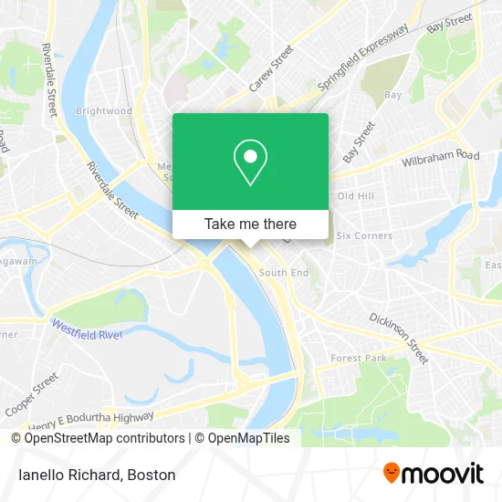
See Ianello Richard, Boston, on the map
Public Transit to Ianello Richard in Boston
Wondering how to get to Ianello Richard in Boston? Moovit helps you find the best way to get to Ianello Richard with step-by-step directions from the nearest public transit station.
Moovit provides free maps and live directions to help you navigate through your city. View schedules, routes, timetables, and find out how long does it take to get to Ianello Richard in real time.
Looking for the nearest stop or station to Ianello Richard? Check out this list of stops closest to your destination: Main / Harrison; Court Square; Boland Way; Harrison Avenue (Out); Springfield.
Bus: B7, G1, G2, T1, T2, T21, R10, R14, B6, G3, G5.Train: LAKE SHORE LIMITED, VERMONTER, AMTRAK HARTFORD LINE, NORTHEAST REGIONAL, VALLEY FLYER.
Want to see if there’s another route that gets you there at an earlier time? Moovit helps you find alternative routes or times. Get directions from and directions to Ianello Richard easily from the Moovit App or Website.
We make riding to Ianello Richard easy, which is why over 1.7 million users, including users in Boston, trust Moovit as the best app for public transit. You don’t need to download an individual bus app or train app, Moovit is your all-in-one transit app that helps you find the best bus time or train time available.
For information on prices of bus and train, costs and ride fares to Ianello Richard, please check the Moovit app.
Use the app to navigate to popular places including to the airport, hospital, stadium, grocery store, mall, coffee shop, school, college, and university.
Ianello Richard Address: 55 State St street in Boston
- Coffee Roaster Cafe,
- Law Office of Matthew S. Hutchinson, Esq.,
- Ryan E Alekman,
- Alekman & Ditusa,
- Claudette Jean Girard,
- USPS Collection Box - Blue Box,
- Cheryl J Dunn,
- Registry of Deeds,
- South End Market Patio,
- Moyah Smith - M&T Bank,
- Hampden County Probate And Family Court,
- United Electric Building,
- TNT Energy,
- Roderick L. Ireland Courthouse,
- City of Springfield,
- Macho Taco,
- Topgolf Swing Suite,
- Roasted Bean,
- Topgolf Swing Suite at MGM Springfield,
- Amherst Restaurants
Places Near Ianello Richard (Boston)
- Massachusetts General Hospital, Boston,
- Museum Of Science, Boston,
- Td Garden, Boston,
- Wilbur Theatre, Boston,
- Leader Bank Pavilion (Leader Bank Pavillion), Boston,
- North End, Boston,
- Boston Convention & Exhibition Center, Boston,
- Isabella Stewart Gardner Museum, Boston,
- Castle Island, Boston,
- Faneuil Hall, Boston,
- Boston Medical Center, Boston,
- Boston Children's Hospital, Boston,
- Mgm Music Hall, Boston,
- Cheers, Boston,
- House Of Blues, Boston,
- Wang Theater, Boston,
- Seaport District, Boston,
- Boston Common, Boston,
- Prudential Center, Boston,
- Quincy Market, Boston
How to get to popular places in Boston with public transit
Get around Boston by public transit!
Traveling around Boston has never been so easy. See step by step directions as you travel to any attraction, street or major public transit station. View bus and train schedules, arrival times, service alerts and detailed routes on a map, so you know exactly how to get to anywhere in Boston.
When traveling to any destination around Boston use Moovit's Live Directions with Get Off Notifications to know exactly where and how far to walk, how long to wait for your line, and how many stops are left. Moovit will alert you when it's time to get off — no need to constantly re-check whether yours is the next stop.
Wondering how to use public transit in Boston or how to pay for public transit in Boston? Moovit public transit app can help you navigate your way with public transit easily, and at minimum cost. It includes public transit fees, ticket prices, and costs. Looking for a map of Boston public transit lines? Moovit public transit app shows all public transit maps in Boston with all Bus, Train, Subway and Ferry routes and stops on an interactive map.
Boston has 4 transit type(s), including: Bus, Train, Subway and Ferry, operated by several transit agencies, including MBTA, Southeastern Regional Transit Authority, MetroWest Regional Transit Authority, Rhode Island Public Transit Authority, WRTA, Lowell Regional Transit Authority, Merrimack Valley Transit, Montachusett Regional Transit Authority, Cape Cod Regional Transit Authority, Brockton Area Transit Authority, Martha's Vineyard Transit Authority, the WAVE - Nantucket Regional Transit Authority, GATRA, Cape Ann Transportation Authority and Massport