Directions to Itabus (Niterói) with public transportation
The following transit lines have routes that pass near Itabus
 Bus: 1775D (EXECUTIVO), 1941D, 2755D (EXECUTIVO), 570D, 740D.
- Ferry: PRAÇA ARARIBÓIA - PRAÇA XV.
How to get to Itabus by bus?
Click on the bus route to see step by step directions with maps, line arrival times and updated time schedules.
From São Gonçalo Shopping, São Gonçalo
34 minFrom Avenida Pasteur, Botafogo
54 minFrom Avenida Treze de Maio 13, Centro
37 minFrom Posto 2, Copacabana
49 minFrom Rio Comprido, Rio Comprido
39 minFrom MetrôRio-Glória (Estação Glória), Glória
39 minFrom Rodoviária Novo Rio Av. Francisco Bicalho, No 01, Santo Cristo
29 minFrom Vila Mimosa, Praça Da Bandeira
34 minFrom Rua Sorocaba 464, Botafogo
45 min
How to get to Itabus by ferry?
Click on the ferry route to see step by step directions with maps, line arrival times and updated time schedules.
Bus stops near Itabus in Niterói
Ferry station near Itabus in Niterói
- Praça Araribóia ⛴, 35 min walk,VIEW
Bus lines to Itabus in Niterói
- 61, Icaraí,VIEW
- 113D, Niterói (Rápido),VIEW
- 1910D (EXECUTIVO), Piratininga,VIEW
- 2905D (EXECUTIVO), Charitas,VIEW
- 03, Centro X Bairro de Fátima,VIEW
- 22, Bonfim X Amaral Peixoto,VIEW
- 31, Ponta da Areia,VIEW
- 60, Ilha Conceição X Icaraí,VIEW
- 28, Largo do Cravinho - Centro (Via Fonseca - Circular),VIEW
- 29, Largo do Cravinho - Centro (Via Avenida do Contorno - Circular),VIEW
- 30, Martins Torres - Centro / Terminal (Via Santa Rosa),VIEW
- 42SL, Barreto - Centro (Via São Lourenço),VIEW
- OC1, OCEÂNICA 1,VIEW
- OC2, OCEÂNICA 2,VIEW
- OC3A, OCEÂNICA 3A,VIEW
- 34A, LARGO DA BATALHA X CENTRO,VIEW
- 35, BALDEADOR X CENTRO,VIEW
- 36, SAPÊ X CENTRO,VIEW
- 37, PARQUE DA COLINA X CENTRO,VIEW
- 38A, ITAIPU X CENTRO (VIA ENG DO MATO),VIEW
What are the closest stations to Itabus?
The closest stations to Itabus are:
- Rua Sao Joao, 165 / Catedral De São João - Niterói is 228 meters away, 4 min walk.
- Avenida Ernani Do Amaral Peixoto 435 is 253 meters away, 4 min walk.
- Praça Araribóia ⛴ is 2669 meters away, 35 min walk.
Which bus lines stop near Itabus?
These bus lines stop near Itabus: 1775D (EXECUTIVO), 1941D, 2755D (EXECUTIVO), 570D, 740D, 755D.
Which ferry line stops near Itabus?
PRAÇA ARARIBÓIA - PRAÇA XV (Praça Araribóia)
What’s the nearest bus station to Itabus in Niterói?
The nearest bus stations to Itabus in Niterói are Rua Sao Joao, 165 / Catedral De São João - Niterói and Avenida Ernani Do Amaral Peixoto 435. The closest one is a 4 min walk away.
What time is the first bus to Itabus in Niterói?
The OC3A is the first bus that goes to Itabus in Niterói. It stops nearby at 3:00 AM.
What time is the last bus to Itabus in Niterói?
The 45 is the last bus that goes to Itabus in Niterói. It stops nearby at 3:06 AM.
What time is the first ferry to Itabus in Niterói?
The PRAÇA ARARIBÓIA - PRAÇA XV is the first ferry that goes to Itabus in Niterói. It stops nearby at 5:40 AM.
What time is the last ferry to Itabus in Niterói?
The PRAÇA ARARIBÓIA - PRAÇA XV is the last ferry that goes to Itabus in Niterói. It stops nearby at 11:50 PM.
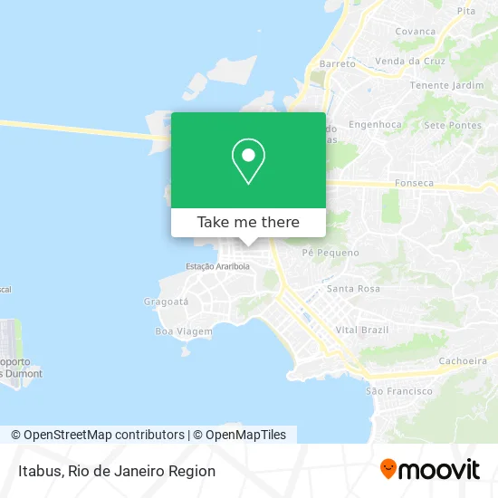
See Itabus, Niterói, on the map
Public Transit to Itabus in Niterói
Wondering how to get to Itabus in Niterói? Moovit helps you find the best way to get to Itabus with step-by-step directions from the nearest public transit station.
Moovit provides free maps and live directions to help you navigate through your city. View schedules, routes, timetables, and find out how long does it take to get to Itabus in real time.
Looking for the nearest stop or station to Itabus? Check out this list of stops closest to your destination: Rua Sao Joao; Avenida Ernani Do Amaral Peixoto 435; Praça Araribóia ⛴.
Bus: 1775D (EXECUTIVO), 1941D, 2755D (EXECUTIVO), 570D, 740D, 755D, 61, 113D, 1910D (EXECUTIVO), 2905D (EXECUTIVO), 03, 22, 31, 60, 28.Ferry: PRAÇA ARARIBÓIA - PRAÇA XV.
Want to see if there’s another route that gets you there at an earlier time? Moovit helps you find alternative routes or times. Get directions from and directions to Itabus easily from the Moovit App or Website.
We make riding to Itabus easy, which is why over 1.5 million users, including users in Niterói, trust Moovit as the best app for public transit. You don’t need to download an individual bus app or train app, Moovit is your all-in-one transit app that helps you find the best bus time or train time available.
For information on prices of bus and ferry, costs and ride fares to Itabus, please check the Moovit app.
Use the app to navigate to popular places including to the airport, hospital, stadium, grocery store, mall, coffee shop, school, college, and university.
Itabus Address: R. Visc. de Sepetiba, 935 street in Niterói
- Rua Visconde de Sepetiba 935,
- Tower 2000 Turismo Ltda,
- Cadu Assessoria Financeira Gestão Representação e Serviços,
- Forma Medical Comercio de Produtos Hospitalares Ltda,
- Banco Bonsucesso S.A.,
- Ponto Pilates,
- Pharmactive Farmácia de Manipulação,
- Almirante Tefe,Centro,
- Fundação Municipal de Saúde de Niterói,
- Rua Professor Valdemir Alves Machado,
- Rua Coronel Gomes Machado,
- Rua Visconde de Sepetiba / Rua São Pedro,
- corhu,
- EMUSA,
- Cartório Correia 12 Ofício,
- Proger Niterói,
- Parque Municipal Eduardo Travassos (Parque das Águas),
- News GPS,
- Secretaria Municipal De Urbanismo E Mobilidade,
- Consulado Honorário Portugal
Places Near Itabus (Niterói)
- Feira Livre da Gloria, Glória,
- Rio De Janeiro,
- Hospital Federal Cardoso Fontes, Jacarepaguá,
- Hospital Pedro Ernesto, Vila Isabel,
- Shopping Nova América, Del Castilho,
- Avenida Venezuela 134, Saúde,
- Norte Shopping, Cachambi,
- Praia do Arpoador, Ipanema,
- Rodoviária Novo Rio (Rodoviária do Rio de Janeiro), Santo Cristo,
- Avenida Rio Branco, Centro,
- Rua Ulysses Guimarães 16, Cidade Nova,
- Hospital Municipal Ronaldo Gazolla, Acari,
- Feirão De Malhas, Duque De Caxias,
- Shopping Rio Sul, Botafogo,
- Shopping RioSul, Botafogo,
- Rua Licínio Cardoso, São Francisco Xavier,
- Niterói, Niterói,
- Shopping Downtown, Barra Da Tijuca,
- Hospital Federal Do Andaraí, Andaraí,
- Museu Do Amanhã, Centro
How to get to popular places in Rio de Janeiro Region with public transit
Get around Niterói by public transit!
Traveling around Niterói has never been so easy. See step by step directions as you travel to any attraction, street or major public transit station. View bus and train schedules, arrival times, service alerts and detailed routes on a map, so you know exactly how to get to anywhere in Niterói.
When traveling to any destination around Niterói use Moovit's Live Directions with Get Off Notifications to know exactly where and how far to walk, how long to wait for your line, and how many stops are left. Moovit will alert you when it's time to get off — no need to constantly re-check whether yours is the next stop.
Wondering how to use public transit in Niterói or how to pay for public transit in Niterói? Moovit public transit app can help you navigate your way with public transit easily, and at minimum cost. It includes public transit fees, ticket prices, and costs. Looking for a map of Niterói public transit lines? Moovit public transit app shows all public transit maps in Niterói with all Bus, Train, Metro, Light Rail, Ferry, Cable Car, Gondola and Funicular routes and stops on an interactive map.
Rio de Janeiro Region has 8 transit type(s), including: Bus, Train, Metro, Light Rail, Ferry, Cable Car, Gondola and Funicular, operated by several transit agencies, including TrensRJ, Metrô Rio, VLT Carioca, Barcas Rio, BRT MOBI-Rio, Auto Viação Alpha, Auto Viação Tijuca, Gire Transportes, Transurb, Viação Nossa Senhora das Graças, Consórcio INTERSUL, Braso Lisboa (Municipal), Caprichosa Auto Ônibus, Auto Viação Três Amigos and Rodoviária Âncora Matias