Directions to Johnstone Supply Springfield (Boston) with public transportation
The following transit lines have routes that pass near Johnstone Supply Springfield
 Bus: B4, P20, T2, T4, T21.
- Train: LAKE SHORE LIMITED, VERMONTER, AMTRAK HARTFORD LINE, NORTHEAST REGIONAL, VALLEY FLYER.
How to get to Johnstone Supply Springfield by bus?
Click on the bus route to see step by step directions with maps, line arrival times and updated time schedules.
From South High Community School, Worcester
204 minFrom Dcu Center, Worcester
109 minFrom Foxwoods, Worcester
136 minFrom Registry Of Motor Vehicles (Rmv) Branch Office, Worcester
111 minFrom Worcester, MA, Worcester
107 minFrom Walmart Supercenter, Worcester
166 minFrom Polar Park, Worcester
109 minFrom Palladium, Worcester
112 min
How to get to Johnstone Supply Springfield by train?
Click on the train route to see step by step directions with maps, line arrival times and updated time schedules.
Bus stops near Johnstone Supply Springfield in Boston
Train station near Johnstone Supply Springfield in Boston
- Springfield, 37 min walk,VIEW
Bus lines to Johnstone Supply Springfield in Boston
- B4, Union Station,VIEW
- T2, Plainfield Via Carew St,VIEW
- T4, Carew Street Roosevelt To State St,VIEW
- T21, Plainfield Via Carew,VIEW
- G1, Chicopee Big Y,VIEW
- G2, Union Station,VIEW
- P20, Holyoke Trans. Ctr. Via Holyoke Mall,VIEW
- T1, State Street Bunt Pk Rd,VIEW
- T3, Liberty/Carew Roosevelt To State St,VIEW
- T5, Belmont To the X,VIEW
- T92, Orange To White St.,VIEW
What are the closest stations to Johnstone Supply Springfield?
The closest stations to Johnstone Supply Springfield are:
- Plainfield / Lowell (Opposite) is 23 yards away, 1 min walk.
- Main/St. George (2) is 261 yards away, 4 min walk.
- Springfield is 3103 yards away, 37 min walk.
Which bus lines stop near Johnstone Supply Springfield?
These bus lines stop near Johnstone Supply Springfield: B4, P20.
Which train lines stop near Johnstone Supply Springfield?
These train lines stop near Johnstone Supply Springfield: LAKE SHORE LIMITED, VERMONTER.
What’s the nearest bus station to Johnstone Supply Springfield in Boston?
The nearest bus station to Johnstone Supply Springfield in Boston is Plainfield / Lowell (Opposite). It’s a 1 min walk away.
What time is the first train to Johnstone Supply Springfield in Boston?
The NORTHEAST REGIONAL is the first train that goes to Johnstone Supply Springfield in Boston. It stops nearby at 4:10 AM.
What time is the last train to Johnstone Supply Springfield in Boston?
The LAKE SHORE LIMITED is the last train that goes to Johnstone Supply Springfield in Boston. It stops nearby at 6:04 PM.
What time is the first bus to Johnstone Supply Springfield in Boston?
The P20 is the first bus that goes to Johnstone Supply Springfield in Boston. It stops nearby at 5:31 AM.
What time is the last bus to Johnstone Supply Springfield in Boston?
The P20 is the last bus that goes to Johnstone Supply Springfield in Boston. It stops nearby at 11:15 PM.
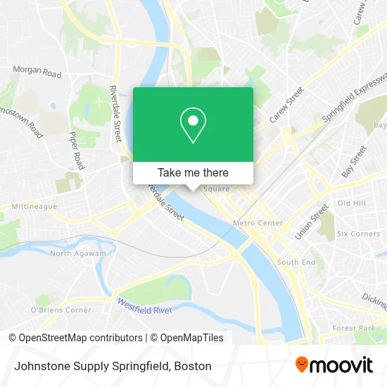
See Johnstone Supply Springfield, Boston, on the map
Public Transit to Johnstone Supply Springfield in Boston
Wondering how to get to Johnstone Supply Springfield in Boston? Moovit helps you find the best way to get to Johnstone Supply Springfield with step-by-step directions from the nearest public transit station.
Moovit provides free maps and live directions to help you navigate through your city. View schedules, routes, timetables, and find out how long does it take to get to Johnstone Supply Springfield in real time.
Looking for the nearest stop or station to Johnstone Supply Springfield? Check out this list of stops closest to your destination: Plainfield / Lowell (Opposite); Main/St. George (2); Springfield.
Bus: B4, P20, T2, T4, T21, G1, G2, T1, T3.Train: LAKE SHORE LIMITED, VERMONTER, AMTRAK HARTFORD LINE, NORTHEAST REGIONAL, VALLEY FLYER.
Want to see if there’s another route that gets you there at an earlier time? Moovit helps you find alternative routes or times. Get directions from and directions to Johnstone Supply Springfield easily from the Moovit App or Website.
We make riding to Johnstone Supply Springfield easy, which is why over 1.7 million users, including users in Boston, trust Moovit as the best app for public transit. You don’t need to download an individual bus app or train app, Moovit is your all-in-one transit app that helps you find the best bus time or train time available.
For information on prices of bus and train, costs and ride fares to Johnstone Supply Springfield, please check the Moovit app.
Use the app to navigate to popular places including to the airport, hospital, stadium, grocery store, mall, coffee shop, school, college, and university.
Johnstone Supply Springfield Address: 105 Avocado St street in Boston
- Sitterly Movers,
- Dave Soda & Pet City,
- Cash & Carry Grocer,
- Johnstone Supply - SPR,
- Hampton Foods,
- Meat Outlet,
- A Simos Whol Produce,
- North Riverfront Park,
- Wmas-Fm (Springfield),
- Amazon Locker-Cookies,
- Saint Peter And Saint Paul Russian Church,
- STARBUCKS,
- Oculoplastics,
- E & R System Technik,
- Mount Calvary Baptist Church,
- Borinquen Apartments,
- Amiras Boutique,
- La Placita,
- Arce's Tax Service,
- R and S Family Fashions
Places Near Johnstone Supply Springfield (Boston)
- Boston Convention & Exhibition Center, Boston,
- Wilbur Theatre, Boston,
- Mgm Music Hall, Boston,
- Quincy Market, Boston,
- North End, Boston,
- Leader Bank Pavilion (Leader Bank Pavillion), Boston,
- Cheers, Boston,
- Boston Children's Hospital, Boston,
- House Of Blues, Boston,
- Isabella Stewart Gardner Museum, Boston,
- Faneuil Hall, Boston,
- Castle Island, Boston,
- Seaport District, Boston,
- Td Garden, Boston,
- Wang Theater, Boston,
- Boston Common, Boston,
- Museum Of Science, Boston,
- Prudential Center, Boston,
- Massachusetts General Hospital, Boston,
- Boston Medical Center, Boston
How to get to popular places in Boston with public transit
Get around Boston by public transit!
Traveling around Boston has never been so easy. See step by step directions as you travel to any attraction, street or major public transit station. View bus and train schedules, arrival times, service alerts and detailed routes on a map, so you know exactly how to get to anywhere in Boston.
When traveling to any destination around Boston use Moovit's Live Directions with Get Off Notifications to know exactly where and how far to walk, how long to wait for your line, and how many stops are left. Moovit will alert you when it's time to get off — no need to constantly re-check whether yours is the next stop.
Wondering how to use public transit in Boston or how to pay for public transit in Boston? Moovit public transit app can help you navigate your way with public transit easily, and at minimum cost. It includes public transit fees, ticket prices, and costs. Looking for a map of Boston public transit lines? Moovit public transit app shows all public transit maps in Boston with all Bus, Train, Subway and Ferry routes and stops on an interactive map.
Boston has 4 transit type(s), including: Bus, Train, Subway and Ferry, operated by several transit agencies, including MBTA, Southeastern Regional Transit Authority, MetroWest Regional Transit Authority, Rhode Island Public Transit Authority, WRTA, Lowell Regional Transit Authority, Merrimack Valley Transit, Montachusett Regional Transit Authority, Cape Cod Regional Transit Authority, Brockton Area Transit Authority, Martha's Vineyard Transit Authority, the WAVE - Nantucket Regional Transit Authority, GATRA, Cape Ann Transportation Authority and Massport