Directions to Las Kangris Restaurant & Bar (Boston) with public transportation
The following transit lines have routes that pass near Las Kangris Restaurant & Bar
 Bus: G5, PETER PAN, R14, B6, B7.
- Train: LAKE SHORE LIMITED, VERMONTER, AMTRAK HARTFORD LINE, NORTHEAST REGIONAL, VALLEY FLYER.
How to get to Las Kangris Restaurant & Bar by bus?
Click on the bus route to see step by step directions with maps, line arrival times and updated time schedules.
From South High Community School, Worcester
182 minFrom Polar Park, Worcester
87 minFrom Walmart Supercenter, Worcester
144 minFrom Palladium, Worcester
91 minFrom Registry Of Motor Vehicles (Rmv) Branch Office, Worcester
89 minFrom Dcu Center, Worcester
88 minFrom Worcester, MA, Worcester
85 minFrom Foxwoods, Worcester
115 min
How to get to Las Kangris Restaurant & Bar by train?
Click on the train route to see step by step directions with maps, line arrival times and updated time schedules.
Bus stops near Las Kangris Restaurant & Bar in Boston
Train station near Las Kangris Restaurant & Bar in Boston
- Springfield, 49 min walk,VIEW
Bus lines to Las Kangris Restaurant & Bar in Boston
- B6, Ludlow via Bay St,VIEW
- B7, Wilbraham Big Y-State St-Boston Rd,VIEW
- B17, Wilbraham Big Y-Worthington St-Wilbraham Rd,VIEW
- G1, Chicopee / Sumner-Allen-Canon Circle,VIEW
- G2, Carew-East Springfield / Belmont-Dwight Rd,VIEW
- G3, Spfld Plaza via Liberty / King-Westford,VIEW
- G5, Dickinson-Jewish Home-Longmeadow,VIEW
- R10, Westfield/West Springfield via Route 20,VIEW
- R14, Feeding Hills-Springfield,VIEW
- T1, Tripper 1 Helper Service,VIEW
- T2, Tripper 2 Helper Service,VIEW
- T3, Tripper 3 Helper Service,VIEW
- T4, Tripper 4 Helper Service,VIEW
- T5, Tripper 5 Helper Service,VIEW
- T6, Tripper 6 Helper Service,VIEW
- T92, Tripper 92 Helper Service,VIEW
- X90, Inner Crosstown,VIEW
- X92, Mid City Crosstown,VIEW
- T21, Plainfield Via Carew,VIEW
What are the closest stations to Las Kangris Restaurant & Bar?
The closest stations to Las Kangris Restaurant & Bar are:
- Main / Worthington is 148 yards away, 3 min walk.
- State And Main(Tripper Timepoint) is 290 yards away, 4 min walk.
- Springfield is 4155 yards away, 49 min walk.
Which bus lines stop near Las Kangris Restaurant & Bar?
These bus lines stop near Las Kangris Restaurant & Bar: G5, PETER PAN, R14.
Which train lines stop near Las Kangris Restaurant & Bar?
These train lines stop near Las Kangris Restaurant & Bar: LAKE SHORE LIMITED, VERMONTER.
What’s the nearest bus station to Las Kangris Restaurant & Bar in Boston?
The nearest bus station to Las Kangris Restaurant & Bar in Boston is Main / Worthington. It’s a 3 min walk away.
What time is the first train to Las Kangris Restaurant & Bar in Boston?
The NORTHEAST REGIONAL is the first train that goes to Las Kangris Restaurant & Bar in Boston. It stops nearby at 4:10 AM.
What time is the last train to Las Kangris Restaurant & Bar in Boston?
The LAKE SHORE LIMITED is the last train that goes to Las Kangris Restaurant & Bar in Boston. It stops nearby at 6:04 PM.
What time is the first bus to Las Kangris Restaurant & Bar in Boston?
The R10 is the first bus that goes to Las Kangris Restaurant & Bar in Boston. It stops nearby at 5:01 AM.
What time is the last bus to Las Kangris Restaurant & Bar in Boston?
The R10 is the last bus that goes to Las Kangris Restaurant & Bar in Boston. It stops nearby at 11:21 PM.
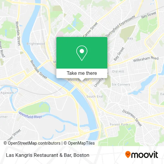
See Las Kangris Restaurant & Bar, Boston, on the map
Public Transit to Las Kangris Restaurant & Bar in Boston
Wondering how to get to Las Kangris Restaurant & Bar in Boston? Moovit helps you find the best way to get to Las Kangris Restaurant & Bar with step-by-step directions from the nearest public transit station.
Moovit provides free maps and live directions to help you navigate through your city. View schedules, routes, timetables, and find out how long does it take to get to Las Kangris Restaurant & Bar in real time.
Looking for the nearest stop or station to Las Kangris Restaurant & Bar? Check out this list of stops closest to your destination: Main / Worthington; State And Main(Tripper Timepoint); Springfield.
Bus: G5, PETER PAN, R14, B6, B7, B17, G1, G2, T21.Train: LAKE SHORE LIMITED, VERMONTER, AMTRAK HARTFORD LINE, NORTHEAST REGIONAL, VALLEY FLYER.
Want to see if there’s another route that gets you there at an earlier time? Moovit helps you find alternative routes or times. Get directions from and directions to Las Kangris Restaurant & Bar easily from the Moovit App or Website.
We make riding to Las Kangris Restaurant & Bar easy, which is why over 1.7 million users, including users in Boston, trust Moovit as the best app for public transit. You don’t need to download an individual bus app or train app, Moovit is your all-in-one transit app that helps you find the best bus time or train time available.
For information on prices of bus and train, costs and ride fares to Las Kangris Restaurant & Bar, please check the Moovit app.
Use the app to navigate to popular places including to the airport, hospital, stadium, grocery store, mall, coffee shop, school, college, and university.
Las Kangris Restaurant & Bar Address: 1373 Main St street in Boston
- Springfield Macarons,
- Digital Forensics,
- Black Alan J,
- McGuire Thomas F,
- Birdicus Gigantium,
- Harrison Place,
- Fuze,
- Susan A Mielnikowski Attorney,
- Thomson Reuters,
- Elegant Affairs-Glass Room,
- Juan M Rivera, Esq Attorney at Law,
- Neville & Kerr,
- Job Corps,
- Dawn D McDonald,
- Law Offices of Michelle Cruz,
- Daniel A. Pava,
- Mason, Mark D,
- Law Office of Joseph M Pacella,
- Shrair David A,
- Davis John W
Places Near Las Kangris Restaurant & Bar (Boston)
- Seaport District, Boston,
- Isabella Stewart Gardner Museum, Boston,
- Boston Common, Boston,
- Massachusetts General Hospital, Boston,
- Wilbur Theatre, Boston,
- Mgm Music Hall, Boston,
- Boston Children's Hospital, Boston,
- Cheers, Boston,
- Boston Convention & Exhibition Center, Boston,
- Quincy Market, Boston,
- Castle Island, Boston,
- Leader Bank Pavilion (Leader Bank Pavillion), Boston,
- Museum Of Science, Boston,
- Faneuil Hall, Boston,
- House Of Blues, Boston,
- Td Garden, Boston,
- Prudential Center, Boston,
- Wang Theater, Boston,
- Boston Medical Center, Boston,
- North End, Boston
How to get to popular places in Boston with public transit
Get around Boston by public transit!
Traveling around Boston has never been so easy. See step by step directions as you travel to any attraction, street or major public transit station. View bus and train schedules, arrival times, service alerts and detailed routes on a map, so you know exactly how to get to anywhere in Boston.
When traveling to any destination around Boston use Moovit's Live Directions with Get Off Notifications to know exactly where and how far to walk, how long to wait for your line, and how many stops are left. Moovit will alert you when it's time to get off — no need to constantly re-check whether yours is the next stop.
Wondering how to use public transit in Boston or how to pay for public transit in Boston? Moovit public transit app can help you navigate your way with public transit easily, and at minimum cost. It includes public transit fees, ticket prices, and costs. Looking for a map of Boston public transit lines? Moovit public transit app shows all public transit maps in Boston with all Bus, Train, Subway and Ferry routes and stops on an interactive map.
Boston has 4 transit type(s), including: Bus, Train, Subway and Ferry, operated by several transit agencies, including MBTA, Southeastern Regional Transit Authority, MetroWest Regional Transit Authority, Rhode Island Public Transit Authority, WRTA, Lowell Regional Transit Authority, Merrimack Valley Transit, Montachusett Regional Transit Authority, Cape Cod Regional Transit Authority, Brockton Area Transit Authority, Martha's Vineyard Transit Authority, the WAVE - Nantucket Regional Transit Authority, GATRA, Cape Ann Transportation Authority and Massport