Directions to Luminoso Technologies, Inc. (Cambridge) with public transportation
The following transit lines have routes that pass near Luminoso Technologies, Inc.
 Bus: 1, 19, 47, 64, 91.
- Train: FRAMINGHAM/WORCESTER, NEEDHAM, PROVIDENCE/STOUGHTON.
- Subway: RED LINE, GREEN LINE D, GREEN LINE E, GREEN LINE B.
How to get to Luminoso Technologies, Inc. by bus?
Click on the bus route to see step by step directions with maps, line arrival times and updated time schedules.
From Market Basket, Revere
93 minFrom ICA, Boston
52 minFrom The Mall At Chestnut Hill, Newton
74 minFrom Home2 Suites-Boston South Bay (Home2 Stes by Hilton Boston S Bay), Boston
45 minFrom Marina Bay, Quincy
163 minFrom Four Points by Sheraton Boston Logan Airport, Revere
94 minFrom Boston College (BC), Boston
53 minFrom Alumni Stadium, Boston
53 minFrom VFW Parkway, Boston
70 minFrom West Roxbury, Boston
74 min
How to get to Luminoso Technologies, Inc. by train?
Click on the train route to see step by step directions with maps, line arrival times and updated time schedules.
How to get to Luminoso Technologies, Inc. by subway?
Click on the subway route to see step by step directions with maps, line arrival times and updated time schedules.
Bus stops near Luminoso Technologies, Inc. in Cambridge
Subway stations near Luminoso Technologies, Inc. in Cambridge
Bus lines to Luminoso Technologies, Inc. in Cambridge
- 1, Harvard,VIEW
- RED LINE SHUTTLE, Kendall/MIT (Loop Shuttle),VIEW
- RED LINE SHUTTLE, Harvard (Shuttle),VIEW
- RED LINE SHUTTLE, Jfk/Umass (Shuttle),VIEW
- RED LINE SHUTTLE, Park Street (Shuttle),VIEW
- RED LINE SHUTTLE, Alewife (Shuttle),VIEW
- RED LINE SHUTTLE, Alewife (Local Shuttle),VIEW
- 70, Central Square,VIEW
- 47, Broadway,VIEW
- 64, Kendall/MIT - Oak Square,VIEW
- 83, Central Square - Rindge Ave,VIEW
- 91, Central Square - Sullivan,VIEW
What are the closest stations to Luminoso Technologies, Inc.?
The closest stations to Luminoso Technologies, Inc. are:
- Massachusetts Ave @ Prospect St is 27 yards away, 1 min walk.
- Central is 42 yards away, 1 min walk.
- Central - Massachusetts Ave Opp Pearl St is 126 yards away, 2 min walk.
- Massachusetts Ave @ Pearl St is 133 yards away, 2 min walk.
- Green St @ Magazine St is 143 yards away, 2 min walk.
- Prospect St @ Bishop Allen Dr is 177 yards away, 3 min walk.
- Union Square is 1711 yards away, 21 min walk.
- Boston Univ. Central is 2568 yards away, 31 min walk.
Which bus lines stop near Luminoso Technologies, Inc.?
These bus lines stop near Luminoso Technologies, Inc.: 1, 19, 47, 64, 91.
Which train lines stop near Luminoso Technologies, Inc.?
These train lines stop near Luminoso Technologies, Inc.: FRAMINGHAM/WORCESTER, NEEDHAM, PROVIDENCE/STOUGHTON.
Which subway line stops near Luminoso Technologies, Inc.?
RED LINE (Alewife)
What’s the nearest subway station to Luminoso Technologies, Inc. in Cambridge?
The nearest subway station to Luminoso Technologies, Inc. in Cambridge is Central. It’s a 1 min walk away.
What’s the nearest bus station to Luminoso Technologies, Inc. in Cambridge?
The nearest bus station to Luminoso Technologies, Inc. in Cambridge is Massachusetts Ave @ Prospect St. It’s a 1 min walk away.
What time is the first subway to Luminoso Technologies, Inc. in Cambridge?
The GREEN LINE E is the first subway that goes to Luminoso Technologies, Inc. in Cambridge. It stops nearby at 4:50 AM.
What time is the last subway to Luminoso Technologies, Inc. in Cambridge?
The GREEN LINE B is the last subway that goes to Luminoso Technologies, Inc. in Cambridge. It stops nearby at 2:15 AM.
What time is the first bus to Luminoso Technologies, Inc. in Cambridge?
The 70 is the first bus that goes to Luminoso Technologies, Inc. in Cambridge. It stops nearby at 4:26 AM.
What time is the last bus to Luminoso Technologies, Inc. in Cambridge?
The 1 is the last bus that goes to Luminoso Technologies, Inc. in Cambridge. It stops nearby at 2:31 AM.
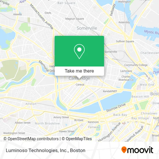
See Luminoso Technologies, Inc., Cambridge, on the map
Public Transit to Luminoso Technologies, Inc. in Cambridge
Wondering how to get to Luminoso Technologies, Inc. in Cambridge? Moovit helps you find the best way to get to Luminoso Technologies, Inc. with step-by-step directions from the nearest public transit station.
Moovit provides free maps and live directions to help you navigate through your city. View schedules, routes, timetables, and find out how long does it take to get to Luminoso Technologies, Inc. in real time.
Looking for the nearest stop or station to Luminoso Technologies, Inc.? Check out this list of stops closest to your destination: Massachusetts Ave @ Prospect St; Central; Central - Massachusetts Ave Opp Pearl St; Massachusetts Ave @ Pearl St; Green St @ Magazine St; Prospect St @ Bishop Allen Dr; Union Square; Boston Univ. Central.
Bus: 1, 19, 47, 64, 91, RED LINE SHUTTLE, RED LINE SHUTTLE, RED LINE SHUTTLE, RED LINE SHUTTLE, RED LINE SHUTTLE, RED LINE SHUTTLE, RED LINE SHUTTLE, RED LINE SHUTTLE, 70.Train: FRAMINGHAM/WORCESTER, NEEDHAM, PROVIDENCE/STOUGHTON.Subway: RED LINE, GREEN LINE D, GREEN LINE E, GREEN LINE B.
Want to see if there’s another route that gets you there at an earlier time? Moovit helps you find alternative routes or times. Get directions from and directions to Luminoso Technologies, Inc. easily from the Moovit App or Website.
We make riding to Luminoso Technologies, Inc. easy, which is why over 1.7 million users, including users in Cambridge, trust Moovit as the best app for public transit. You don’t need to download an individual bus app or train app, Moovit is your all-in-one transit app that helps you find the best bus time or train time available.
For information on prices of bus, subway and train, costs and ride fares to Luminoso Technologies, Inc., please check the Moovit app.
Use the app to navigate to popular places including to the airport, hospital, stadium, grocery store, mall, coffee shop, school, college, and university.
Luminoso Technologies, Inc. Address: 25 Dorchester Ave street in Cambridge
- Wul,
- Sarah Notter,
- Central Square Florist,
- Central Square,
- Lucky's Tattoo and Piercing,
- Carl Barron Plaza,
- MBTA-Central Square,
- MBTA Bus Route 70a,
- MoneyGram,
- Blick Art Materials (Utrecht Art Supplies),
- CVS/pharmacy,
- Ace Hardware (Neighborhood Hardware Group),
- Aleppo Palace (Moody's Falafel Palace),
- Cambridge Savings Bank (Cambridge Sav Bank Banking Ctrs),
- Amazon Hub Locker (Central Square),
- The Gilbane Group,
- H Mart,
- MBTA Bus Stop (Mass Ave @ Pearl St),
- H Mart (HMart),
- City Hall Historic District (Cambridge, Massachusetts)
Places Near Luminoso Technologies, Inc. (Cambridge)
- Boston Convention & Exhibition Center, Boston,
- Wilbur Theatre, Boston,
- House Of Blues, Boston,
- North End, Boston,
- Isabella Stewart Gardner Museum, Boston,
- Mgm Music Hall, Boston,
- Boston Medical Center, Boston,
- Castle Island, Boston,
- Td Garden, Boston,
- Quincy Market, Boston,
- Leader Bank Pavilion (Leader Bank Pavillion), Boston,
- Museum Of Science, Boston,
- Prudential Center, Boston,
- Boston Children's Hospital, Boston,
- Faneuil Hall, Boston,
- Massachusetts General Hospital, Boston,
- Wang Theater, Boston,
- Seaport District, Boston,
- Boston Common, Boston,
- Cheers, Boston
How to get to popular places in Boston with public transit
Get around Cambridge by public transit!
Traveling around Cambridge has never been so easy. See step by step directions as you travel to any attraction, street or major public transit station. View bus and train schedules, arrival times, service alerts and detailed routes on a map, so you know exactly how to get to anywhere in Cambridge.
When traveling to any destination around Cambridge use Moovit's Live Directions with Get Off Notifications to know exactly where and how far to walk, how long to wait for your line, and how many stops are left. Moovit will alert you when it's time to get off — no need to constantly re-check whether yours is the next stop.
Wondering how to use public transit in Cambridge or how to pay for public transit in Cambridge? Moovit public transit app can help you navigate your way with public transit easily, and at minimum cost. It includes public transit fees, ticket prices, and costs. Looking for a map of Cambridge public transit lines? Moovit public transit app shows all public transit maps in Cambridge with all Bus, Train, Subway and Ferry routes and stops on an interactive map.
Boston has 4 transit type(s), including: Bus, Train, Subway and Ferry, operated by several transit agencies, including MBTA, Southeastern Regional Transit Authority, MetroWest Regional Transit Authority, Rhode Island Public Transit Authority, WRTA, Lowell Regional Transit Authority, Merrimack Valley Transit, Montachusett Regional Transit Authority, Cape Cod Regional Transit Authority, Brockton Area Transit Authority, Martha's Vineyard Transit Authority, the WAVE - Nantucket Regional Transit Authority, GATRA, Cape Ann Transportation Authority and Massport