Directions to Mcginn Law, Pc (Cambridge) with public transportation
The following transit lines have routes that pass near Mcginn Law, Pc
 Bus: 1, 64, 68, 91, 83.
- Train: FITCHBURG, FRAMINGHAM/WORCESTER.
- Subway: RED LINE, GREEN LINE B, GREEN LINE D, GREEN LINE E.
How to get to Mcginn Law, Pc by bus?
Click on the bus route to see step by step directions with maps, line arrival times and updated time schedules.
From World Trade Center MBTA Station - Silver Line, Boston
53 minFrom Lemuel Shattuck Hospital, Boston
72 minFrom Melrose, MA, Melrose
98 minFrom Boston Latin Academy, Boston
49 minFrom 7F Everett Street, Revere
90 minFrom Winchester, MA, Winchester
86 minFrom Laugh Boston, Boston
53 minFrom Comfort Inn & Suites Logan International Airport, Revere
93 minFrom VFW Parkway, Boston
69 minFrom Santarpio's Pizza, Boston
64 min
How to get to Mcginn Law, Pc by train?
Click on the train route to see step by step directions with maps, line arrival times and updated time schedules.
How to get to Mcginn Law, Pc by subway?
Click on the subway route to see step by step directions with maps, line arrival times and updated time schedules.
From World Trade Center MBTA Station - Silver Line, Boston
37 minFrom Lemuel Shattuck Hospital, Boston
52 minFrom Boston Latin Academy, Boston
55 minFrom 7F Everett Street, Revere
52 minFrom Laugh Boston, Boston
34 minFrom Comfort Inn & Suites Logan International Airport, Revere
55 minFrom Santarpio's Pizza, Boston
40 min
Bus stops near Mcginn Law, Pc in Cambridge
Subway stations near Mcginn Law, Pc in Cambridge
Bus lines to Mcginn Law, Pc in Cambridge
What are the closest stations to Mcginn Law, Pc?
The closest stations to Mcginn Law, Pc are:
- Massachusetts Ave @ Dana St is 148 yards away, 2 min walk.
- Broadway @ Lee St is 242 yards away, 3 min walk.
- Broadway @ Antrim St is 316 yards away, 4 min walk.
- Prospect St @ Bishop Allen Dr is 525 yards away, 7 min walk.
- Amory Street is 652 yards away, 8 min walk.
- Western Ave @ Howard St is 816 yards away, 10 min walk.
- Green St @ Magazine St is 1130 yards away, 14 min walk.
- Central is 1191 yards away, 15 min walk.
- Union Square is 1762 yards away, 21 min walk.
Which bus lines stop near Mcginn Law, Pc?
These bus lines stop near Mcginn Law, Pc: 1, 64, 68, 91.
Which train lines stop near Mcginn Law, Pc?
These train lines stop near Mcginn Law, Pc: FITCHBURG, FRAMINGHAM/WORCESTER.
Which subway line stops near Mcginn Law, Pc?
RED LINE (Alewife)
What’s the nearest subway station to Mcginn Law, Pc in Cambridge?
The nearest subway station to Mcginn Law, Pc in Cambridge is Amory Street. It’s a 8 min walk away.
What’s the nearest bus station to Mcginn Law, Pc in Cambridge?
The nearest bus station to Mcginn Law, Pc in Cambridge is Massachusetts Ave @ Dana St. It’s a 2 min walk away.
What time is the first subway to Mcginn Law, Pc in Cambridge?
The GREEN LINE E is the first subway that goes to Mcginn Law, Pc in Cambridge. It stops nearby at 4:50 AM.
What time is the last subway to Mcginn Law, Pc in Cambridge?
The GREEN LINE B is the last subway that goes to Mcginn Law, Pc in Cambridge. It stops nearby at 2:18 AM.
What time is the first bus to Mcginn Law, Pc in Cambridge?
The 70 is the first bus that goes to Mcginn Law, Pc in Cambridge. It stops nearby at 4:26 AM.
What time is the last bus to Mcginn Law, Pc in Cambridge?
The 1 is the last bus that goes to Mcginn Law, Pc in Cambridge. It stops nearby at 2:32 AM.
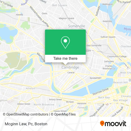
See Mcginn Law, Pc, Cambridge, on the map
Public Transit to Mcginn Law, Pc in Cambridge
Wondering how to get to Mcginn Law, Pc in Cambridge? Moovit helps you find the best way to get to Mcginn Law, Pc with step-by-step directions from the nearest public transit station.
Moovit provides free maps and live directions to help you navigate through your city. View schedules, routes, timetables, and find out how long does it take to get to Mcginn Law, Pc in real time.
Looking for the nearest stop or station to Mcginn Law, Pc? Check out this list of stops closest to your destination: Massachusetts Ave @ Dana St; Broadway @ Lee St; Broadway @ Antrim St; Prospect St @ Bishop Allen Dr; Amory Street; Western Ave @ Howard St; Green St @ Magazine St; Central; Union Square.
Bus: 1, 64, 68, 91, 83.Train: FITCHBURG, FRAMINGHAM/WORCESTER.Subway: RED LINE, GREEN LINE B, GREEN LINE D, GREEN LINE E.
Want to see if there’s another route that gets you there at an earlier time? Moovit helps you find alternative routes or times. Get directions from and directions to Mcginn Law, Pc easily from the Moovit App or Website.
We make riding to Mcginn Law, Pc easy, which is why over 1.7 million users, including users in Cambridge, trust Moovit as the best app for public transit. You don’t need to download an individual bus app or train app, Moovit is your all-in-one transit app that helps you find the best bus time or train time available.
For information on prices of bus, subway and train, costs and ride fares to Mcginn Law, Pc, please check the Moovit app.
Use the app to navigate to popular places including to the airport, hospital, stadium, grocery store, mall, coffee shop, school, college, and university.
Mcginn Law, Pc Address: 872 Mass Ave Ste 1-6 street in Cambridge
- Progressive Insurance,
- Lee St & Mass Ave,
- Anisha Guria-Re/Max Destiny,
- Cambridge YMCA,
- Cambridge, Massachusetts,
- Massachusetts Ave @ Bigelow St (Bus Stop),
- Dumpling House,
- Ace Hardware (Neighborhood Hardware Group),
- Project Prakash (Gay Men S Domestic Violen Project),
- Sangthip Therapeutic Thai Massage,
- Moishe HOUSE,
- VSM Services Inc,
- Lucky's Tattoo and Piercing,
- Sarah Notter,
- Aleppo Palace (Moody's Falafel Palace),
- Wul,
- MoneyGram,
- MBTA Bus Route 70a,
- Central Square,
- Cambridge Community Center
Places Near Mcginn Law, Pc (Cambridge)
- Wilbur Theatre, Boston,
- Prudential Center, Boston,
- Boston Common, Boston,
- Isabella Stewart Gardner Museum, Boston,
- Faneuil Hall, Boston,
- Museum Of Science, Boston,
- North End, Boston,
- House Of Blues, Boston,
- Wang Theater, Boston,
- Cheers, Boston,
- Boston Convention & Exhibition Center, Boston,
- Massachusetts General Hospital, Boston,
- Leader Bank Pavilion (Leader Bank Pavillion), Boston,
- Castle Island, Boston,
- Seaport District, Boston,
- Quincy Market, Boston,
- Boston Medical Center, Boston,
- Td Garden, Boston,
- Boston Children's Hospital, Boston,
- Mgm Music Hall, Boston
How to get to popular places in Boston with public transit
Get around Cambridge by public transit!
Traveling around Cambridge has never been so easy. See step by step directions as you travel to any attraction, street or major public transit station. View bus and train schedules, arrival times, service alerts and detailed routes on a map, so you know exactly how to get to anywhere in Cambridge.
When traveling to any destination around Cambridge use Moovit's Live Directions with Get Off Notifications to know exactly where and how far to walk, how long to wait for your line, and how many stops are left. Moovit will alert you when it's time to get off — no need to constantly re-check whether yours is the next stop.
Wondering how to use public transit in Cambridge or how to pay for public transit in Cambridge? Moovit public transit app can help you navigate your way with public transit easily, and at minimum cost. It includes public transit fees, ticket prices, and costs. Looking for a map of Cambridge public transit lines? Moovit public transit app shows all public transit maps in Cambridge with all Bus, Train, Subway and Ferry routes and stops on an interactive map.
Boston has 4 transit type(s), including: Bus, Train, Subway and Ferry, operated by several transit agencies, including MBTA, Southeastern Regional Transit Authority, MetroWest Regional Transit Authority, Rhode Island Public Transit Authority, WRTA, Lowell Regional Transit Authority, Merrimack Valley Transit, Montachusett Regional Transit Authority, Cape Cod Regional Transit Authority, Brockton Area Transit Authority, Martha's Vineyard Transit Authority, the WAVE - Nantucket Regional Transit Authority, GATRA, Cape Ann Transportation Authority and Massport