Directions to Mckinney Building (Boston) with public transportation
The following transit lines have routes that pass near Mckinney Building
 Bus: G1, X92, B6, B7, G3.
- Train: LAKE SHORE LIMITED, VERMONTER, AMTRAK HARTFORD LINE, NORTHEAST REGIONAL, VALLEY FLYER.
How to get to Mckinney Building by bus?
Click on the bus route to see step by step directions with maps, line arrival times and updated time schedules.
From Dcu Center, Worcester
93 minFrom Foxwoods, Worcester
120 minFrom Walmart Supercenter, Worcester
149 minFrom South High Community School, Worcester
187 minFrom Registry Of Motor Vehicles (Rmv) Branch Office, Worcester
94 minFrom Palladium, Worcester
96 minFrom Worcester, MA, Worcester
90 minFrom Polar Park, Worcester
92 min
How to get to Mckinney Building by train?
Click on the train route to see step by step directions with maps, line arrival times and updated time schedules.
Bus stops near Mckinney Building in Boston
Train station near Mckinney Building in Boston
- Springfield, 10 min walk,VIEW
Bus lines to Mckinney Building in Boston
- B6, Ludlow Big Y Via Bay/Berkshire,VIEW
- B7, Colonial Estates Via Independence House,VIEW
- G3, Springfield Plaza To Rmv Via Union Station,VIEW
- T1, Sumner To the X To Dickinson,VIEW
- T2, Belmont To the X,VIEW
- T4, State Street Blunt Pk Rd To Bay St,VIEW
- T5, State St Blunt Park Rd To Bay St,VIEW
- T21, Plainfield Via Carew,VIEW
- T92, State Street Blunt Pk Rd To Bay Street,VIEW
- T3, Tripper 3 Helper Service,VIEW
- T6, Tripper 6 Helper Service,VIEW
- X90, Inner Crosstown,VIEW
- G1, The X Via Sumner Ave,VIEW
- G2, E Springfield Via Union Station-Mercy,VIEW
- X92, Memorial Industrial Park Via Senior Center And Roosevelt,VIEW
- G5, Jewish Home To Massmutual Via Dickinson,VIEW
What are the closest stations to Mckinney Building?
The closest stations to Mckinney Building are:
- Springfield Library is 335 yards away, 5 min walk.
- State / Chestnut is 379 yards away, 5 min walk.
- Court Square is 384 yards away, 6 min walk.
- Dwight / Bruce Landon Way is 518 yards away, 7 min walk.
- Springfield is 705 yards away, 10 min walk.
Which bus lines stop near Mckinney Building?
These bus lines stop near Mckinney Building: G1, X92.
Which train lines stop near Mckinney Building?
These train lines stop near Mckinney Building: LAKE SHORE LIMITED, VERMONTER.
What’s the nearest train station to Mckinney Building in Boston?
The nearest train station to Mckinney Building in Boston is Springfield. It’s a 10 min walk away.
What’s the nearest bus station to Mckinney Building in Boston?
The nearest bus stations to Mckinney Building in Boston are Springfield Library and State / Chestnut. The closest one is a 5 min walk away.
What time is the first train to Mckinney Building in Boston?
The NORTHEAST REGIONAL is the first train that goes to Mckinney Building in Boston. It stops nearby at 4:10 AM.
What time is the last train to Mckinney Building in Boston?
The LAKE SHORE LIMITED is the last train that goes to Mckinney Building in Boston. It stops nearby at 6:04 PM.
What time is the first bus to Mckinney Building in Boston?
The B7 is the first bus that goes to Mckinney Building in Boston. It stops nearby at 5:02 AM.
What time is the last bus to Mckinney Building in Boston?
The B7 is the last bus that goes to Mckinney Building in Boston. It stops nearby at 10:39 PM.
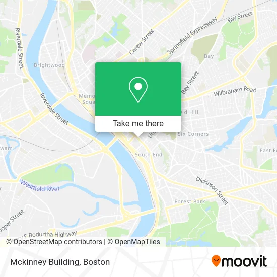
See Mckinney Building, Boston, on the map
Public Transit to Mckinney Building in Boston
Wondering how to get to Mckinney Building in Boston? Moovit helps you find the best way to get to Mckinney Building with step-by-step directions from the nearest public transit station.
Moovit provides free maps and live directions to help you navigate through your city. View schedules, routes, timetables, and find out how long does it take to get to Mckinney Building in real time.
Looking for the nearest stop or station to Mckinney Building? Check out this list of stops closest to your destination: Springfield Library; State / Chestnut; Court Square; Dwight / Bruce Landon Way; Springfield.
Bus: G1, X92, B6, B7, G3, T1, T2, T3, T6, X90, G2, G5.Train: LAKE SHORE LIMITED, VERMONTER, AMTRAK HARTFORD LINE, NORTHEAST REGIONAL, VALLEY FLYER.
Want to see if there’s another route that gets you there at an earlier time? Moovit helps you find alternative routes or times. Get directions from and directions to Mckinney Building easily from the Moovit App or Website.
We make riding to Mckinney Building easy, which is why over 1.7 million users, including users in Boston, trust Moovit as the best app for public transit. You don’t need to download an individual bus app or train app, Moovit is your all-in-one transit app that helps you find the best bus time or train time available.
For information on prices of bus and train, costs and ride fares to Mckinney Building, please check the Moovit app.
Use the app to navigate to popular places including to the airport, hospital, stadium, grocery store, mall, coffee shop, school, college, and university.
Location: Boston
- J J Package Store,
- McKinney and Burbach Tavern,
- Hcoc,
- Union Chandler Hotel,
- Colonial Station Branch Post Office,
- Colonial Block,
- Mgm Springfield Hotel,
- Guenther And Handel's Block,
- Comm of Mass/Parole Board,
- Western Massachusetts Correctional Alcohol Center,
- Aids Foundation of W Mass,
- Jackson Hewitt Tax Service,
- Cal Mare,
- Knox Bar,
- Commonwealth Bar And Lounge,
- Hampden Furniture Showcase,
- Springfield Safe Deposit And Trust Company,
- Armory Square,
- Community Music School Of Springfield,
- Leonardo Da Vinci Park
Places Near Mckinney Building (Boston)
- Faneuil Hall, Boston,
- Quincy Market, Boston,
- House Of Blues, Boston,
- Td Garden, Boston,
- Boston Convention & Exhibition Center, Boston,
- North End, Boston,
- Boston Children's Hospital, Boston,
- Prudential Center, Boston,
- Boston Medical Center, Boston,
- Cheers, Boston,
- Castle Island, Boston,
- Leader Bank Pavilion (Leader Bank Pavillion), Boston,
- Wang Theater, Boston,
- Seaport District, Boston,
- Massachusetts General Hospital, Boston,
- Boston Common, Boston,
- Isabella Stewart Gardner Museum, Boston,
- Mgm Music Hall, Boston,
- Museum Of Science, Boston,
- Wilbur Theatre, Boston
How to get to popular places in Boston with public transit
Get around Boston by public transit!
Traveling around Boston has never been so easy. See step by step directions as you travel to any attraction, street or major public transit station. View bus and train schedules, arrival times, service alerts and detailed routes on a map, so you know exactly how to get to anywhere in Boston.
When traveling to any destination around Boston use Moovit's Live Directions with Get Off Notifications to know exactly where and how far to walk, how long to wait for your line, and how many stops are left. Moovit will alert you when it's time to get off — no need to constantly re-check whether yours is the next stop.
Wondering how to use public transit in Boston or how to pay for public transit in Boston? Moovit public transit app can help you navigate your way with public transit easily, and at minimum cost. It includes public transit fees, ticket prices, and costs. Looking for a map of Boston public transit lines? Moovit public transit app shows all public transit maps in Boston with all Bus, Train, Subway and Ferry routes and stops on an interactive map.
Boston has 4 transit type(s), including: Bus, Train, Subway and Ferry, operated by several transit agencies, including MBTA, Southeastern Regional Transit Authority, MetroWest Regional Transit Authority, Rhode Island Public Transit Authority, WRTA, Lowell Regional Transit Authority, Merrimack Valley Transit, Montachusett Regional Transit Authority, Cape Cod Regional Transit Authority, Brockton Area Transit Authority, Martha's Vineyard Transit Authority, the WAVE - Nantucket Regional Transit Authority, GATRA, Cape Ann Transportation Authority and Massport