Directions to Mendez Tree Service (Boston) with public transportation
The following transit lines have routes that pass near Mendez Tree Service
 Bus: B6, B7, G5, G1, G2.
- Train: LAKE SHORE LIMITED, VERMONTER, AMTRAK HARTFORD LINE, NORTHEAST REGIONAL, VALLEY FLYER.
How to get to Mendez Tree Service by bus?
Click on the bus route to see step by step directions with maps, line arrival times and updated time schedules.
From Dcu Center, Worcester
92 minFrom Worcester, MA, Worcester
90 minFrom Foxwoods, Worcester
120 minFrom Palladium, Worcester
95 minFrom Walmart Supercenter, Worcester
149 minFrom Polar Park, Worcester
92 minFrom South High Community School, Worcester
187 minFrom Registry Of Motor Vehicles (Rmv) Branch Office, Worcester
94 min
How to get to Mendez Tree Service by train?
Click on the train route to see step by step directions with maps, line arrival times and updated time schedules.
Bus stops near Mendez Tree Service in Boston
Train station near Mendez Tree Service in Boston
- Springfield, 46 min walk,VIEW
Bus lines to Mendez Tree Service in Boston
- G5, Union Station Via Jewish Home,VIEW
- T92, State Street Blunt Pk Rd To Bay Street,VIEW
- T1, Sumner To the X To Dickinson,VIEW
- B7, Colonial Estates Via Independence House,VIEW
- G1, The X Via Sumner Ave,VIEW
- G2, E Springfield Via Union Station-Mercy,VIEW
- T2, Belmont To the X,VIEW
- T4, State Street Blunt Pk Rd To Bay St,VIEW
- T5, State St Blunt Park Rd To Bay St,VIEW
- T21, Plainfield Via Carew,VIEW
- X92, Memorial Industrial Park Via Senior Center And Roosevelt,VIEW
- B6, Ludlow via Bay St,VIEW
- G3, Spfld Plaza via Liberty / King-Westford,VIEW
- T3, Tripper 3 Helper Service,VIEW
- T6, Tripper 6 Helper Service,VIEW
- X90, Inner Crosstown,VIEW
What are the closest stations to Mendez Tree Service?
The closest stations to Mendez Tree Service are:
- Maple / Stockbridge is 72 yards away, 2 min walk.
- State And Dwight(Tripper Timepoint) is 92 yards away, 2 min walk.
- Court Square is 94 yards away, 2 min walk.
- State / Chestnut is 100 yards away, 2 min walk.
- Springfield is 3883 yards away, 46 min walk.
Which bus lines stop near Mendez Tree Service?
These bus lines stop near Mendez Tree Service: B6, B7, G5.
Which train lines stop near Mendez Tree Service?
These train lines stop near Mendez Tree Service: LAKE SHORE LIMITED, VERMONTER.
What’s the nearest bus station to Mendez Tree Service in Boston?
The nearest bus stations to Mendez Tree Service in Boston are Maple / Stockbridge, State And Dwight(Tripper Timepoint), Court Square and State / Chestnut. The closest one is a 2 min walk away.
What time is the first train to Mendez Tree Service in Boston?
The NORTHEAST REGIONAL is the first train that goes to Mendez Tree Service in Boston. It stops nearby at 4:10 AM.
What time is the last train to Mendez Tree Service in Boston?
The LAKE SHORE LIMITED is the last train that goes to Mendez Tree Service in Boston. It stops nearby at 6:04 PM.
What time is the first bus to Mendez Tree Service in Boston?
The B7 is the first bus that goes to Mendez Tree Service in Boston. It stops nearby at 5:02 AM.
What time is the last bus to Mendez Tree Service in Boston?
The B7 is the last bus that goes to Mendez Tree Service in Boston. It stops nearby at 10:39 PM.
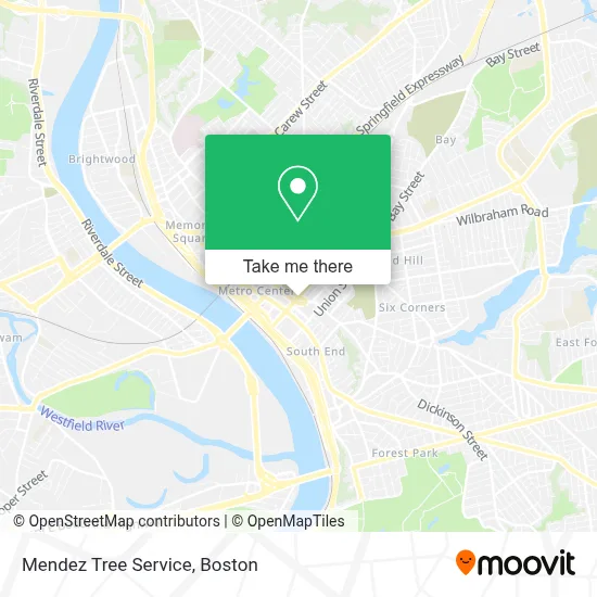
See Mendez Tree Service, Boston, on the map
Public Transit to Mendez Tree Service in Boston
Wondering how to get to Mendez Tree Service in Boston? Moovit helps you find the best way to get to Mendez Tree Service with step-by-step directions from the nearest public transit station.
Moovit provides free maps and live directions to help you navigate through your city. View schedules, routes, timetables, and find out how long does it take to get to Mendez Tree Service in real time.
Looking for the nearest stop or station to Mendez Tree Service? Check out this list of stops closest to your destination: Maple / Stockbridge; State And Dwight(Tripper Timepoint); Court Square; State / Chestnut; Springfield.
Bus: B6, B7, G5, G1, G2, T2, T4, T92, T1, G3, T3, T6, X90.Train: LAKE SHORE LIMITED, VERMONTER, AMTRAK HARTFORD LINE, NORTHEAST REGIONAL, VALLEY FLYER.
Want to see if there’s another route that gets you there at an earlier time? Moovit helps you find alternative routes or times. Get directions from and directions to Mendez Tree Service easily from the Moovit App or Website.
We make riding to Mendez Tree Service easy, which is why over 1.7 million users, including users in Boston, trust Moovit as the best app for public transit. You don’t need to download an individual bus app or train app, Moovit is your all-in-one transit app that helps you find the best bus time or train time available.
For information on prices of bus and train, costs and ride fares to Mendez Tree Service, please check the Moovit app.
Use the app to navigate to popular places including to the airport, hospital, stadium, grocery store, mall, coffee shop, school, college, and university.
Mendez Tree Service Address: Services Association, 1350 Main St street in Boston
- Skyview Downtown,
- Merrick Park,
- Springfield Police Metro Unit Substation,
- The Puritan,
- Holiday Inn Express,
- Skyview Downtown Garage,
- Christ Church Cathedral,
- Horton Court,
- Dr. Seuss And the Cat In the Hat,
- The Storyteller,
- George Walter Vincent Smith Art Museum,
- Massmutual Center Ice Rink,
- South Congregational Church,
- Dr. Seuss National Memorial Sculpture Garden,
- Community Music School Of Springfield,
- Michele & Donald D'Amour Museum Of Fine Arts,
- Springfield Safe Deposit And Trust Company,
- Heating Plant,
- Stockbridge Court Apartments,
- Yertle Garden
Places Near Mendez Tree Service (Boston)
- Isabella Stewart Gardner Museum, Boston,
- Seaport District, Boston,
- Prudential Center, Boston,
- Massachusetts General Hospital, Boston,
- Mgm Music Hall, Boston,
- House Of Blues, Boston,
- Boston Convention & Exhibition Center, Boston,
- Boston Children's Hospital, Boston,
- Museum Of Science, Boston,
- Cheers, Boston,
- Castle Island, Boston,
- Boston Medical Center, Boston,
- North End, Boston,
- Td Garden, Boston,
- Wilbur Theatre, Boston,
- Quincy Market, Boston,
- Faneuil Hall, Boston,
- Boston Common, Boston,
- Wang Theater, Boston,
- Leader Bank Pavilion (Leader Bank Pavillion), Boston
How to get to popular places in Boston with public transit
Get around Boston by public transit!
Traveling around Boston has never been so easy. See step by step directions as you travel to any attraction, street or major public transit station. View bus and train schedules, arrival times, service alerts and detailed routes on a map, so you know exactly how to get to anywhere in Boston.
When traveling to any destination around Boston use Moovit's Live Directions with Get Off Notifications to know exactly where and how far to walk, how long to wait for your line, and how many stops are left. Moovit will alert you when it's time to get off — no need to constantly re-check whether yours is the next stop.
Wondering how to use public transit in Boston or how to pay for public transit in Boston? Moovit public transit app can help you navigate your way with public transit easily, and at minimum cost. It includes public transit fees, ticket prices, and costs. Looking for a map of Boston public transit lines? Moovit public transit app shows all public transit maps in Boston with all Bus, Train, Subway and Ferry routes and stops on an interactive map.
Boston has 4 transit type(s), including: Bus, Train, Subway and Ferry, operated by several transit agencies, including MBTA, Southeastern Regional Transit Authority, MetroWest Regional Transit Authority, Rhode Island Public Transit Authority, WRTA, Lowell Regional Transit Authority, Merrimack Valley Transit, Montachusett Regional Transit Authority, Cape Cod Regional Transit Authority, Brockton Area Transit Authority, Martha's Vineyard Transit Authority, the WAVE - Nantucket Regional Transit Authority, GATRA, Cape Ann Transportation Authority and Massport