Directions to Municipal Lot 5 (Cambridge) with public transportation
The following transit lines have routes that pass near Municipal Lot 5
 Bus: 1, 19, 47, 64, 70.
- Train: FRAMINGHAM/WORCESTER, NEEDHAM.
- Subway: RED LINE, GREEN LINE D, GREEN LINE E, GREEN LINE B.
How to get to Municipal Lot 5 by bus?
Click on the bus route to see step by step directions with maps, line arrival times and updated time schedules.
From South Bay Center, Boston
46 minFrom Bentley University, Waltham
77 minFrom Comfort Inn & Suites Logan International Airport, Revere
83 minFrom Four Points by Sheraton Boston Logan Airport, Revere
95 minFrom Marina Bay, Quincy
160 minFrom Regent Theatre, Arlington
49 minFrom Arnold Arboretum, Boston
63 minFrom VFW Parkway, Boston
72 minFrom West Roxbury, Boston
75 minFrom Target, Boston
44 min
How to get to Municipal Lot 5 by train?
Click on the train route to see step by step directions with maps, line arrival times and updated time schedules.
How to get to Municipal Lot 5 by subway?
Click on the subway route to see step by step directions with maps, line arrival times and updated time schedules.
Bus stops near Municipal Lot 5 in Cambridge
Subway stations near Municipal Lot 5 in Cambridge
Bus lines to Municipal Lot 5 in Cambridge
- 64, Kendall/MIT - Oak Square,VIEW
- 70, University Park - Market Place Dr,VIEW
- 83, Central Square - Rindge Ave,VIEW
- 91, Central Square - Sullivan,VIEW
- 47, Broadway,VIEW
- 1, Harvard,VIEW
- RED LINE SHUTTLE, Kendall/MIT (Loop Shuttle),VIEW
- RED LINE SHUTTLE, Harvard (Shuttle),VIEW
- RED LINE SHUTTLE, Jfk/Umass (Shuttle),VIEW
- RED LINE SHUTTLE, Park Street (Shuttle),VIEW
- RED LINE SHUTTLE, Alewife (Shuttle),VIEW
- RED LINE SHUTTLE, Alewife (Local Shuttle),VIEW
What are the closest stations to Municipal Lot 5?
The closest stations to Municipal Lot 5 are:
- Western Ave @ Green St is 16 yards away, 1 min walk.
- Green St @ Magazine St is 110 yards away, 2 min walk.
- Central is 138 yards away, 2 min walk.
- Massachusetts Ave @ Sidney St is 154 yards away, 3 min walk.
- Massachusetts Ave @ Prospect St is 213 yards away, 3 min walk.
- Massachusetts Ave @ Pearl St is 292 yards away, 4 min walk.
- Union Square is 1821 yards away, 22 min walk.
- Boston Univ. East is 2453 yards away, 30 min walk.
Which bus lines stop near Municipal Lot 5?
These bus lines stop near Municipal Lot 5: 1, 19, 47, 64, 70, 83, 91.
Which train lines stop near Municipal Lot 5?
These train lines stop near Municipal Lot 5: FRAMINGHAM/WORCESTER, NEEDHAM.
Which subway line stops near Municipal Lot 5?
RED LINE (Alewife)
What’s the nearest subway station to Municipal Lot 5 in Cambridge?
The nearest subway station to Municipal Lot 5 in Cambridge is Central. It’s a 2 min walk away.
What’s the nearest bus station to Municipal Lot 5 in Cambridge?
The nearest bus station to Municipal Lot 5 in Cambridge is Western Ave @ Green St. It’s a 1 min walk away.
What time is the first subway to Municipal Lot 5 in Cambridge?
The GREEN LINE E is the first subway that goes to Municipal Lot 5 in Cambridge. It stops nearby at 4:50 AM.
What time is the last subway to Municipal Lot 5 in Cambridge?
The GREEN LINE B is the last subway that goes to Municipal Lot 5 in Cambridge. It stops nearby at 2:13 AM.
What time is the first bus to Municipal Lot 5 in Cambridge?
The 70 is the first bus that goes to Municipal Lot 5 in Cambridge. It stops nearby at 4:26 AM.
What time is the last bus to Municipal Lot 5 in Cambridge?
The 1 is the last bus that goes to Municipal Lot 5 in Cambridge. It stops nearby at 2:30 AM.
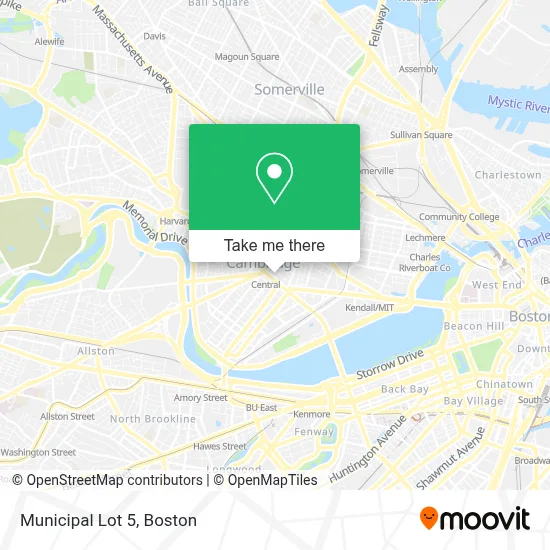
See Municipal Lot 5, Cambridge, on the map
Public Transit to Municipal Lot 5 in Cambridge
Wondering how to get to Municipal Lot 5 in Cambridge? Moovit helps you find the best way to get to Municipal Lot 5 with step-by-step directions from the nearest public transit station.
Moovit provides free maps and live directions to help you navigate through your city. View schedules, routes, timetables, and find out how long does it take to get to Municipal Lot 5 in real time.
Looking for the nearest stop or station to Municipal Lot 5? Check out this list of stops closest to your destination: Western Ave @ Green St; Green St @ Magazine St; Central; Massachusetts Ave @ Sidney St; Massachusetts Ave @ Prospect St; Massachusetts Ave @ Pearl St; Union Square; Boston Univ. East.
Bus: 1, 19, 47, 64, 70, 83, 91.Train: FRAMINGHAM/WORCESTER, NEEDHAM.Subway: RED LINE, GREEN LINE D, GREEN LINE E, GREEN LINE B.
Want to see if there’s another route that gets you there at an earlier time? Moovit helps you find alternative routes or times. Get directions from and directions to Municipal Lot 5 easily from the Moovit App or Website.
We make riding to Municipal Lot 5 easy, which is why over 1.7 million users, including users in Cambridge, trust Moovit as the best app for public transit. You don’t need to download an individual bus app or train app, Moovit is your all-in-one transit app that helps you find the best bus time or train time available.
For information on prices of bus, subway and train, costs and ride fares to Municipal Lot 5, please check the Moovit app.
Use the app to navigate to popular places including to the airport, hospital, stadium, grocery store, mall, coffee shop, school, college, and university.
Municipal Lot 5 Address: 70 Bishop Allen Dr street in Cambridge
- Graffiti Alley,
- H Mart (HMart),
- Boomerangs,
- H Mart,
- Vim Fitness,
- Paris Baguette,
- Hubba-Hubba,
- MBTA Bus Stop (Mass Ave @ Pearl St),
- Harvest Co-op Market,
- MEME,
- Target,
- Mexico,
- MBTA Bus 1 (Central Square),
- Blick Art Materials (Utrecht Art Supplies),
- Cambridge College,
- Shalimar India Food & Spices (Shalimar of India),
- Little Donkey,
- Wrca 1330 am Radio (Wrca-Wlyn Radio Station),
- The Phoenix Landing,
- Goodwill
Places Near Municipal Lot 5 (Cambridge)
- Faneuil Hall, Boston,
- Mgm Music Hall, Boston,
- Leader Bank Pavilion (Leader Bank Pavillion), Boston,
- Castle Island, Boston,
- Museum Of Science, Boston,
- Prudential Center, Boston,
- Cheers, Boston,
- Td Garden, Boston,
- Isabella Stewart Gardner Museum, Boston,
- Boston Children's Hospital, Boston,
- Boston Medical Center, Boston,
- North End, Boston,
- House Of Blues, Boston,
- Wilbur Theatre, Boston,
- Seaport District, Boston,
- Wang Theater, Boston,
- Boston Convention & Exhibition Center, Boston,
- Massachusetts General Hospital, Boston,
- Quincy Market, Boston,
- Boston Common, Boston
How to get to popular places in Boston with public transit
Get around Cambridge by public transit!
Traveling around Cambridge has never been so easy. See step by step directions as you travel to any attraction, street or major public transit station. View bus and train schedules, arrival times, service alerts and detailed routes on a map, so you know exactly how to get to anywhere in Cambridge.
When traveling to any destination around Cambridge use Moovit's Live Directions with Get Off Notifications to know exactly where and how far to walk, how long to wait for your line, and how many stops are left. Moovit will alert you when it's time to get off — no need to constantly re-check whether yours is the next stop.
Wondering how to use public transit in Cambridge or how to pay for public transit in Cambridge? Moovit public transit app can help you navigate your way with public transit easily, and at minimum cost. It includes public transit fees, ticket prices, and costs. Looking for a map of Cambridge public transit lines? Moovit public transit app shows all public transit maps in Cambridge with all Bus, Train, Subway and Ferry routes and stops on an interactive map.
Boston has 4 transit type(s), including: Bus, Train, Subway and Ferry, operated by several transit agencies, including MBTA, Southeastern Regional Transit Authority, MetroWest Regional Transit Authority, Rhode Island Public Transit Authority, WRTA, Lowell Regional Transit Authority, Merrimack Valley Transit, Montachusett Regional Transit Authority, Cape Cod Regional Transit Authority, Brockton Area Transit Authority, Martha's Vineyard Transit Authority, the WAVE - Nantucket Regional Transit Authority, GATRA, Cape Ann Transportation Authority and Massport