Directions to My Jove (Cambridge) with public transportation
The following transit lines have routes that pass near My Jove
 Bus: 1, 19, 64, 83, 91.
- Train: FITCHBURG, FRAMINGHAM/WORCESTER.
- Subway: RED LINE, GREEN LINE B, GREEN LINE D, GREEN LINE E.
How to get to My Jove by bus?
Click on the bus route to see step by step directions with maps, line arrival times and updated time schedules.
From Franklin Park Zoo, Boston
63 minFrom Moakley Us Courthouse, Boston
52 minFrom 7F Everett Street, Revere
84 minFrom Comfort Inn & Suites Logan International Airport, Revere
74 minFrom Boston Scientific, Quincy
168 minFrom Malden, MA, Malden
81 minFrom 240 Mount Vernon Street, Boston
53 minFrom VFW Parkway, Boston
70 minFrom Winchester, MA, Winchester
87 minFrom Embassy Suites Boston At Logan, Boston
64 min
How to get to My Jove by train?
Click on the train route to see step by step directions with maps, line arrival times and updated time schedules.
How to get to My Jove by subway?
Click on the subway route to see step by step directions with maps, line arrival times and updated time schedules.
Bus stops near My Jove in Cambridge
Subway stations near My Jove in Cambridge
Bus lines to My Jove in Cambridge
- 64, Kendall/MIT,VIEW
- 70, Central Square,VIEW
- 1, Harvard,VIEW
- 83, Central Square - Rindge Ave,VIEW
- 91, Central Square - Sullivan,VIEW
- 47, Broadway,VIEW
- RED LINE SHUTTLE, Harvard - Kendall/MIT (Loop),VIEW
- RED LINE SHUTTLE, Harvard - South Station,VIEW
- RED LINE SHUTTLE, Harvard - JFK/UMass via State Street,VIEW
- RED LINE SHUTTLE, Harvard - Park Street,VIEW
What are the closest stations to My Jove?
The closest stations to My Jove are:
- River St Opp Kinnaird St is 149 yards away, 2 min walk.
- Massachusetts Ave @ Dana St is 153 yards away, 3 min walk.
- River St @ Green St is 245 yards away, 4 min walk.
- Green St @ Magazine St is 327 yards away, 4 min walk.
- Massachusetts Ave @ Prospect St is 432 yards away, 6 min walk.
- Boston Univ. Central is 572 yards away, 7 min walk.
- Harvard Square is 802 yards away, 10 min walk.
- Union Square is 2257 yards away, 27 min walk.
Which bus lines stop near My Jove?
These bus lines stop near My Jove: 1, 19, 64, 83, 91.
Which train lines stop near My Jove?
These train lines stop near My Jove: FITCHBURG, FRAMINGHAM/WORCESTER.
Which subway line stops near My Jove?
RED LINE (Alewife)
What’s the nearest subway station to My Jove in Cambridge?
The nearest subway station to My Jove in Cambridge is Boston Univ. Central. It’s a 7 min walk away.
What’s the nearest bus station to My Jove in Cambridge?
The nearest bus station to My Jove in Cambridge is River St Opp Kinnaird St. It’s a 2 min walk away.
What time is the first subway to My Jove in Cambridge?
The GREEN LINE E is the first subway that goes to My Jove in Cambridge. It stops nearby at 4:50 AM.
What time is the last subway to My Jove in Cambridge?
The GREEN LINE B is the last subway that goes to My Jove in Cambridge. It stops nearby at 2:15 AM.
What time is the first bus to My Jove in Cambridge?
The 70 is the first bus that goes to My Jove in Cambridge. It stops nearby at 4:26 AM.
What time is the last bus to My Jove in Cambridge?
The 1 is the last bus that goes to My Jove in Cambridge. It stops nearby at 2:32 AM.
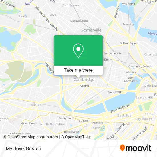
See My Jove, Cambridge, on the map
Public Transit to My Jove in Cambridge
Wondering how to get to My Jove in Cambridge? Moovit helps you find the best way to get to My Jove with step-by-step directions from the nearest public transit station.
Moovit provides free maps and live directions to help you navigate through your city. View schedules, routes, timetables, and find out how long does it take to get to My Jove in real time.
Looking for the nearest stop or station to My Jove? Check out this list of stops closest to your destination: River St Opp Kinnaird St; Massachusetts Ave @ Dana St; River St @ Green St; Green St @ Magazine St; Massachusetts Ave @ Prospect St; Boston Univ. Central; Harvard Square; Union Square.
Bus: 1, 19, 64, 83, 91, 70.Train: FITCHBURG, FRAMINGHAM/WORCESTER.Subway: RED LINE, GREEN LINE B, GREEN LINE D, GREEN LINE E.
Want to see if there’s another route that gets you there at an earlier time? Moovit helps you find alternative routes or times. Get directions from and directions to My Jove easily from the Moovit App or Website.
We make riding to My Jove easy, which is why over 1.7 million users, including users in Cambridge, trust Moovit as the best app for public transit. You don’t need to download an individual bus app or train app, Moovit is your all-in-one transit app that helps you find the best bus time or train time available.
For information on prices of subway, bus and train, costs and ride fares to My Jove, please check the Moovit app.
Use the app to navigate to popular places including to the airport, hospital, stadium, grocery store, mall, coffee shop, school, college, and university.
My Jove Address: 17 Sellers St street in Cambridge
- Cambridge YMCA,
- Lee St & Mass Ave,
- Progressive Insurance,
- Cambridge, Massachusetts,
- Massachusetts Ave @ Bigelow St (Bus Stop),
- Anisha Guria-Re/Max Destiny,
- Sangthip Therapeutic Thai Massage,
- Ace Hardware (Neighborhood Hardware Group),
- Lucky's Tattoo and Piercing,
- Sarah Notter,
- Dumpling House,
- Moishe HOUSE,
- Aleppo Palace (Moody's Falafel Palace),
- Wul,
- MBTA Bus Route 70a,
- MoneyGram,
- Project Prakash (Gay Men S Domestic Violen Project),
- Central Square,
- Carl Barron Plaza,
- Skyline Realty (Larue Barbara Skyline Properties Cambridge)
Places Near My Jove (Cambridge)
- Prudential Center, Boston,
- Wilbur Theatre, Boston,
- Mgm Music Hall, Boston,
- North End, Boston,
- Td Garden, Boston,
- Boston Children's Hospital, Boston,
- Seaport District, Boston,
- Cheers, Boston,
- Castle Island, Boston,
- Boston Convention & Exhibition Center, Boston,
- Massachusetts General Hospital, Boston,
- House Of Blues, Boston,
- Isabella Stewart Gardner Museum, Boston,
- Boston Common, Boston,
- Wang Theater, Boston,
- Boston Medical Center, Boston,
- Leader Bank Pavilion (Leader Bank Pavillion), Boston,
- Faneuil Hall, Boston,
- Museum Of Science, Boston,
- Quincy Market, Boston
How to get to popular places in Boston with public transit
Get around Cambridge by public transit!
Traveling around Cambridge has never been so easy. See step by step directions as you travel to any attraction, street or major public transit station. View bus and train schedules, arrival times, service alerts and detailed routes on a map, so you know exactly how to get to anywhere in Cambridge.
When traveling to any destination around Cambridge use Moovit's Live Directions with Get Off Notifications to know exactly where and how far to walk, how long to wait for your line, and how many stops are left. Moovit will alert you when it's time to get off — no need to constantly re-check whether yours is the next stop.
Wondering how to use public transit in Cambridge or how to pay for public transit in Cambridge? Moovit public transit app can help you navigate your way with public transit easily, and at minimum cost. It includes public transit fees, ticket prices, and costs. Looking for a map of Cambridge public transit lines? Moovit public transit app shows all public transit maps in Cambridge with all Bus, Train, Subway and Ferry routes and stops on an interactive map.
Boston has 4 transit type(s), including: Bus, Train, Subway and Ferry, operated by several transit agencies, including MBTA, Southeastern Regional Transit Authority, MetroWest Regional Transit Authority, Rhode Island Public Transit Authority, WRTA, Lowell Regional Transit Authority, Merrimack Valley Transit, Montachusett Regional Transit Authority, Cape Cod Regional Transit Authority, Brockton Area Transit Authority, Martha's Vineyard Transit Authority, the WAVE - Nantucket Regional Transit Authority, GATRA, Cape Ann Transportation Authority and Massport