How to get to PMGP Colony by bus?
Click on the bus route to see step by step directions with maps, line arrival times and updated time schedules.
From Bandra Kurla Complex-Family Court, Vandre East
39 minFrom Midc, Andheri (East), Andheri East
59 minFrom Sahara Star Hotel, Vile Parle
53 minFrom Ion Digital Zone, Bhandup West
59 minFrom Muhammad Ali Qureshi Chowk, Vandre West
48 minFrom M.L.Dahanukar College, Vile Parle
56 minFrom Solitaire Corporate Park, Andheri East
59 minFrom Holy Spirit Hospital, Andheri East
63 minFrom Icici Learning Center, Chandivali
46 minFrom Sathaye College, Vile Parle
55 min
How to get to PMGP Colony by train?
Click on the train route to see step by step directions with maps, line arrival times and updated time schedules.
Bus stops near PMGP Colony in Mumbai
Metro station near PMGP Colony in Mumbai
- Deonar, 14 min walk,VIEW
Train station near PMGP Colony in Mumbai
- Govandi, 15 min walk,VIEW
Bus lines to PMGP Colony in Mumbai
- AC-26, Shivaji Nagar Bus Station - Colaba Depot (Electric House),VIEW
- 106AC, Panvel Station (W) - World Trade Center,VIEW
- 107AC, CBD Belapur Bus Station - World Trade Center,VIEW
- 108AC, Nerul Sector 46/48 - World Trade Center,VIEW
- 110AC, Bank Of India Sector 35 Kharghar - World Trade Center,VIEW
- 114AC, Ghansoli Depot - World Trade Center,VIEW
- 115AC, Kharkopar Station - World Trade Center,VIEW
- 121AC, Ghansoli Depot - World Trade Center Via Worli,VIEW
- A-372, Trombay - Ghatkopar Bus Station,VIEW
- A-380, Trombay - Ghatkopar Station (E),VIEW
- A-458, Deonar Depot - Borivali Station (E),VIEW
- A-493, Deonar Depot - Maharana Pratap Chowk (Mulund Check Naka W),VIEW
- 501LTD, Kurla Bus Station (E) - Airoli Bus Station,VIEW
- A-502, Shivaji Nagar Bus Station - Nerul Sector 46/48,VIEW
- A-504, Shivaji Nagar Bus Station - Kharghar Jalvayu Vihar,VIEW
- C-505, Santacruz Depot - CBD Belapur Bus Station,VIEW
- C-521, Wadala Depot - Ghansoli Village,VIEW
- 501LTD, Umarshi Bappa Chowk,VIEW
- A-504, Deonar Depot,VIEW
- AC-53, Ghatkopar Bus Station - Kalamboli Bus Station,VIEW
What are the closest stations to PMGP Colony?
The closest stations to PMGP Colony are:
- Mankhurd Station (N) is 347 meters away, 5 min walk.
- Mohite Patil Nagar is 435 meters away, 6 min walk.
- Lallubhai Compound | Dr BR Ambedkar Chowk is 842 meters away, 11 min walk.
- Deonar is 1051 meters away, 14 min walk.
- Govandi is 1110 meters away, 15 min walk.
Which bus lines stop near PMGP Colony?
These bus lines stop near PMGP Colony: A-458, A-507, A-517, AC-53, C-505.
Which train line stops near PMGP Colony?
HR (Panvel (S))
What’s the nearest metro station to PMGP Colony in Mumbai?
The nearest metro station to PMGP Colony in Mumbai is Deonar. It’s a 14 min walk away.
What’s the nearest train station to PMGP Colony in Mumbai?
The nearest train station to PMGP Colony in Mumbai is Govandi. It’s a 15 min walk away.
What’s the nearest bus station to PMGP Colony in Mumbai?
The nearest bus station to PMGP Colony in Mumbai is Mankhurd Station (N). It’s a 5 min walk away.
What time is the first metro to PMGP Colony in Mumbai?
The LINE 2B is the first metro that goes to PMGP Colony in Mumbai. It stops nearby at 6:00 AM.
What time is the last metro to PMGP Colony in Mumbai?
The LINE 2B is the last metro that goes to PMGP Colony in Mumbai. It stops nearby at 10:40 PM.
What time is the first train to PMGP Colony in Mumbai?
The HR is the first train that goes to PMGP Colony in Mumbai. It stops nearby at 4:12 AM.
What time is the last train to PMGP Colony in Mumbai?
The HR is the last train that goes to PMGP Colony in Mumbai. It stops nearby at 1:46 AM.
What time is the first bus to PMGP Colony in Mumbai?
The A-507 is the first bus that goes to PMGP Colony in Mumbai. It stops nearby at 4:32 AM.
What time is the last bus to PMGP Colony in Mumbai?
The 501LTD is the last bus that goes to PMGP Colony in Mumbai. It stops nearby at 2:19 AM.
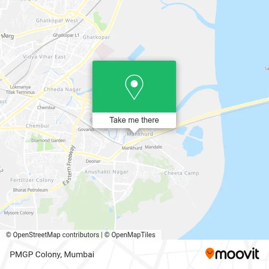
See PMGP Colony, Mumbai, on the map
Public Transit to PMGP Colony in Mumbai
Wondering how to get to PMGP Colony in Mumbai? Moovit helps you find the best way to get to PMGP Colony with step-by-step directions from the nearest public transit station.
Moovit provides free maps and live directions to help you navigate through your city. View schedules, routes, timetables, and find out how long does it take to get to PMGP Colony in real time.
Looking for the nearest stop or station to PMGP Colony? Check out this list of stops closest to your destination: Mankhurd Station (N); Mohite Patil Nagar; Lallubhai Compound | Dr BR Ambedkar Chowk; Deonar; Govandi.
Bus: A-458, A-507, A-517, AC-53, C-505, AC-26, 106AC, 107AC, 108AC, 110AC, 501LTD, A-504, C-55, A-533, A-377.Train: HR, BR, HR-AC, HR-AC, HR-AC.Metro: LINE 2B.
Want to see if there’s another route that gets you there at an earlier time? Moovit helps you find alternative routes or times. Get directions from and directions to PMGP Colony easily from the Moovit App or Website.
We make riding to PMGP Colony easy, which is why over 1.5 million users, including users in Mumbai, trust Moovit as the best app for public transit. You don’t need to download an individual bus app or train app, Moovit is your all-in-one transit app that helps you find the best bus time or train time available.
For information on prices of bus, train and metro, costs and ride fares to PMGP Colony, please check the Moovit app.
Use the app to navigate to popular places including to the airport, hospital, stadium, grocery store, mall, coffee shop, school, college, and university.
PMGP Colony Address: Mumbai 400043 MH street in Mumbai
- Shri Ganraj Medical & General Stores,
- Hira Jewellers,
- P M G P Colony 26-B,
- Siddhivinayak Chawl,
- PMG COLONY,
- Badge Rto Consultants,
- Shri Siddhivinayak Digital Photo Studio,
- Mahatma Gandhi Memorial High School,
- Mahatma Gandhi Memorial English Medium School,
- Dar-Ul-Madinah International Islamic English School in Govandi West,
- Gurukrupa Saree Center,
- Mankhurd,
- Vashi Panvel Highway,
- Mohite Patil Vidyalaya in Mankhurd,
- Vishwakarma Hospital,
- Sion Trombay Road,
- Dnyansampada High School in Govandi East,
- Mankhurd Railway Station,
- Jan Kalyan Society,
- Annabhau Sathe Nagar
Places Near PMGP Colony (Mumbai)
- Govardhan Ecovillage, Palghar (St),
- NESCO, Goregaon,
- Bombay Exhibition Center, Goregaon,
- Oberoi Mall, Dindoshi,
- Dome @ Nsci - Svp Stadium Mumbai, Worli,
- Juhu Beach,
- TCS Olympus, Thane,
- Ikea, Worli,
- Malabar Hill, Malabar Hill,
- Gateway Of India,
- Hinduja Hospital, Mahim,
- INFINITI Mall (Infinity Mall, andheri), Versova,
- Mumbai University, Kalina,
- J. J. Hospital, Byculla,
- R CITY MALL, Ghatkopar East,
- Inorbit Mall, Malad West,
- Rani Baug, Byculla,
- Oberoi Sky City, Borivali East,
- Bhaucha Dhakka,
- Worli Sea Face
How to get to popular places in Mumbai with public transit
Get around Mumbai by public transit!
Traveling around Mumbai has never been so easy. See step by step directions as you travel to any attraction, street or major public transit station. View bus and train schedules, arrival times, service alerts and detailed routes on a map, so you know exactly how to get to anywhere in Mumbai.
When traveling to any destination around Mumbai use Moovit's Live Directions with Get Off Notifications to know exactly where and how far to walk, how long to wait for your line, and how many stops are left. Moovit will alert you when it's time to get off — no need to constantly re-check whether yours is the next stop.
Wondering how to use public transit in Mumbai or how to pay for public transit in Mumbai? Moovit public transit app can help you navigate your way with public transit easily, and at minimum cost. It includes public transit fees, ticket prices, and costs. Looking for a map of Mumbai public transit lines? Moovit public transit app shows all public transit maps in Mumbai with all Bus, Train, Metro and Ferry routes and stops on an interactive map.
Mumbai has 4 transit type(s), including: Bus, Train, Metro and Ferry, operated by several transit agencies, including MMMOCL (Maha Mumbai Metro Operation Corporation Ltd.), NMM CIDCO (Navi Mumbai Metro Maha Metro), Reliance Mumbai Metro, MMRCL (Mumbai Metro Rail Corporation Ltd), BEST (Brihanmumbai Electricity Supply & Transport), BEST AC Services, A.C.Trains (Air-Conditioning Trains), W.R. (Western Railways), C.R. (Central Railways), C.R.MEMU (Central Railways Shuttle MEMU Trains), H.R. (Harbour Railways), T.R.(Trans Harbour Railways), U.R.(Uran-Ulwe Railways), I.R.(Indian Railways) and TMT (Thane Municipal Transport)