Directions to Peter Weinstein, Md (Boston) with public transportation
The following transit lines have routes that pass near Peter Weinstein, Md
 Bus: G2, T2, T4, T21, T3.
- Train: LAKE SHORE LIMITED, VERMONTER, AMTRAK HARTFORD LINE, NORTHEAST REGIONAL, VALLEY FLYER.
How to get to Peter Weinstein, Md by bus?
Click on the bus route to see step by step directions with maps, line arrival times and updated time schedules.
From Foxwoods, Worcester
134 minFrom Registry Of Motor Vehicles (Rmv) Branch Office, Worcester
108 minFrom Palladium, Worcester
109 minFrom Dcu Center, Worcester
106 minFrom Walmart Supercenter, Worcester
163 minFrom Worcester, MA, Worcester
104 minFrom Polar Park, Worcester
106 minFrom South High Community School, Worcester
201 min
How to get to Peter Weinstein, Md by train?
Click on the train route to see step by step directions with maps, line arrival times and updated time schedules.
Bus stops near Peter Weinstein, Md in Boston
Train station near Peter Weinstein, Md in Boston
- Springfield, 42 min walk,VIEW
Bus lines to Peter Weinstein, Md in Boston
What are the closest stations to Peter Weinstein, Md?
The closest stations to Peter Weinstein, Md are:
- Mercy Medical Center is 52 yards away, 2 min walk.
- Carew / Cass is 289 yards away, 4 min walk.
- Carew / Massasoit is 367 yards away, 5 min walk.
- Franklin / Saab is 505 yards away, 7 min walk.
- Chestnut / Carew is 630 yards away, 8 min walk.
- Springfield is 3469 yards away, 42 min walk.
Which bus line stops near Peter Weinstein, Md?
G2 (E Springfield Via Carew-Cottage)
Which train lines stop near Peter Weinstein, Md?
These train lines stop near Peter Weinstein, Md: LAKE SHORE LIMITED, VERMONTER.
What’s the nearest bus station to Peter Weinstein, Md in Boston?
The nearest bus station to Peter Weinstein, Md in Boston is Mercy Medical Center. It’s a 2 min walk away.
What time is the first train to Peter Weinstein, Md in Boston?
The NORTHEAST REGIONAL is the first train that goes to Peter Weinstein, Md in Boston. It stops nearby at 4:10 AM.
What time is the last train to Peter Weinstein, Md in Boston?
The LAKE SHORE LIMITED is the last train that goes to Peter Weinstein, Md in Boston. It stops nearby at 6:04 PM.
What time is the first bus to Peter Weinstein, Md in Boston?
The P21 is the first bus that goes to Peter Weinstein, Md in Boston. It stops nearby at 5:03 AM.
What time is the last bus to Peter Weinstein, Md in Boston?
The G2 is the last bus that goes to Peter Weinstein, Md in Boston. It stops nearby at 10:20 PM.
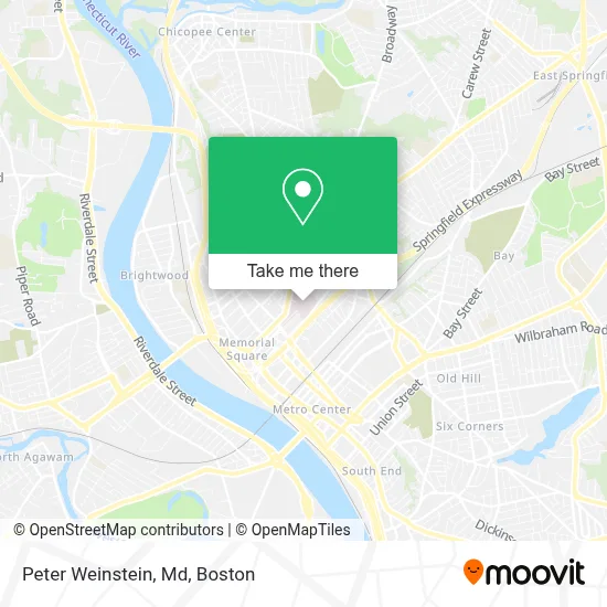
See Peter Weinstein, Md, Boston, on the map
Public Transit to Peter Weinstein, Md in Boston
Wondering how to get to Peter Weinstein, Md in Boston? Moovit helps you find the best way to get to Peter Weinstein, Md with step-by-step directions from the nearest public transit station.
Moovit provides free maps and live directions to help you navigate through your city. View schedules, routes, timetables, and find out how long does it take to get to Peter Weinstein, Md in real time.
Looking for the nearest stop or station to Peter Weinstein, Md? Check out this list of stops closest to your destination: Mercy Medical Center; Carew / Cass; Carew / Massasoit; Franklin / Saab; Chestnut / Carew; Springfield.
Bus: G2, T2, T4, T21, T3, G3, P21.Train: LAKE SHORE LIMITED, VERMONTER, AMTRAK HARTFORD LINE, NORTHEAST REGIONAL, VALLEY FLYER.
Want to see if there’s another route that gets you there at an earlier time? Moovit helps you find alternative routes or times. Get directions from and directions to Peter Weinstein, Md easily from the Moovit App or Website.
We make riding to Peter Weinstein, Md easy, which is why over 1.7 million users, including users in Boston, trust Moovit as the best app for public transit. You don’t need to download an individual bus app or train app, Moovit is your all-in-one transit app that helps you find the best bus time or train time available.
For information on prices of bus and train, costs and ride fares to Peter Weinstein, Md, please check the Moovit app.
Use the app to navigate to popular places including to the airport, hospital, stadium, grocery store, mall, coffee shop, school, college, and university.
Peter Weinstein, Md Address: 299 Carew St Ste 419 street in Boston
- Gerald MD Nash - Pathology Cytopathology,
- PPC,
- Pamela J. Haywood, Licsw,
- Audiological Services,
- Pardo Moris,
- Pioneer Neurology Sleep Rani,
- Beata Tyminska MD,
- Haines, Jas F,
- Murphy-Mancini Ellen A Associates,
- Mass Audiology,
- Sunoco,
- Carew& Cass and Desrosiers,
- Steven Holsten MD PC,
- 201 Cass St Parking,
- MMC Outpatient Reg,
- Western Health Services,
- Habib Shaikh do,
- Umassfive College Federal Credit Union,
- Mercy Hospital,
- Rita Luthra, MD
Places Near Peter Weinstein, Md (Boston)
- House Of Blues, Boston,
- Isabella Stewart Gardner Museum, Boston,
- North End, Boston,
- Prudential Center, Boston,
- Td Garden, Boston,
- Mgm Music Hall, Boston,
- Wilbur Theatre, Boston,
- Boston Common, Boston,
- Boston Medical Center, Boston,
- Boston Children's Hospital, Boston,
- Wang Theater, Boston,
- Massachusetts General Hospital, Boston,
- Castle Island, Boston,
- Faneuil Hall, Boston,
- Boston Convention & Exhibition Center, Boston,
- Seaport District, Boston,
- Cheers, Boston,
- Museum Of Science, Boston,
- Quincy Market, Boston,
- Leader Bank Pavilion (Leader Bank Pavillion), Boston
How to get to popular places in Boston with public transit
Get around Boston by public transit!
Traveling around Boston has never been so easy. See step by step directions as you travel to any attraction, street or major public transit station. View bus and train schedules, arrival times, service alerts and detailed routes on a map, so you know exactly how to get to anywhere in Boston.
When traveling to any destination around Boston use Moovit's Live Directions with Get Off Notifications to know exactly where and how far to walk, how long to wait for your line, and how many stops are left. Moovit will alert you when it's time to get off — no need to constantly re-check whether yours is the next stop.
Wondering how to use public transit in Boston or how to pay for public transit in Boston? Moovit public transit app can help you navigate your way with public transit easily, and at minimum cost. It includes public transit fees, ticket prices, and costs. Looking for a map of Boston public transit lines? Moovit public transit app shows all public transit maps in Boston with all Bus, Train, Subway and Ferry routes and stops on an interactive map.
Boston has 4 transit type(s), including: Bus, Train, Subway and Ferry, operated by several transit agencies, including MBTA, Southeastern Regional Transit Authority, MetroWest Regional Transit Authority, Rhode Island Public Transit Authority, WRTA, Lowell Regional Transit Authority, Merrimack Valley Transit, Montachusett Regional Transit Authority, Cape Cod Regional Transit Authority, Brockton Area Transit Authority, Martha's Vineyard Transit Authority, the WAVE - Nantucket Regional Transit Authority, GATRA, Cape Ann Transportation Authority and Massport