Directions to Ryan Miller Oral Health (Cambridge) with public transportation
The following transit lines have routes that pass near Ryan Miller Oral Health
 Bus: 1, 19, 501, 64, 70.
- Train: FITCHBURG, FRAMINGHAM/WORCESTER.
- Subway: RED LINE, GREEN LINE B.
How to get to Ryan Miller Oral Health by bus?
Click on the bus route to see step by step directions with maps, line arrival times and updated time schedules.
From Andrew Station - MBTA - Red Line, Boston
50 minFrom DoubleTree by Hilton Boston Logan Airport Chelsea, Chelsea
69 minFrom Winchester, MA, Winchester
92 minFrom Mount Ida College, Newton
71 minFrom Castle Island, Boston
73 minFrom Marina Bay, Quincy
156 minFrom Waltham, MA, Waltham
49 minFrom Uscis Biometrics Office, Revere
80 minFrom TownePlace Suites Boston Logan Airport/Chelsea, Chelsea
71 minFrom Hyatt Regency-Boston Harbor, Boston
50 min
How to get to Ryan Miller Oral Health by train?
Click on the train route to see step by step directions with maps, line arrival times and updated time schedules.
How to get to Ryan Miller Oral Health by subway?
Click on the subway route to see step by step directions with maps, line arrival times and updated time schedules.
Bus stops near Ryan Miller Oral Health in Cambridge
Subway stations near Ryan Miller Oral Health in Cambridge
Bus lines to Ryan Miller Oral Health in Cambridge
What are the closest stations to Ryan Miller Oral Health?
The closest stations to Ryan Miller Oral Health are:
- Western Ave @ Putnam Ave is 365 yards away, 5 min walk.
- Pearl St @ Putnam Ave is 416 yards away, 5 min walk.
- Harvard Square is 486 yards away, 6 min walk.
- River St @ Green St is 632 yards away, 8 min walk.
- Cambridgeport is 912 yards away, 11 min walk.
- Amory Street is 1270 yards away, 15 min walk.
Which bus lines stop near Ryan Miller Oral Health?
These bus lines stop near Ryan Miller Oral Health: 1, 19, 501, 64, 70, 91.
Which train lines stop near Ryan Miller Oral Health?
These train lines stop near Ryan Miller Oral Health: FITCHBURG, FRAMINGHAM/WORCESTER.
Which subway line stops near Ryan Miller Oral Health?
RED LINE (Alewife)
What’s the nearest subway station to Ryan Miller Oral Health in Cambridge?
The nearest subway station to Ryan Miller Oral Health in Cambridge is Harvard Square. It’s a 6 min walk away.
What’s the nearest bus station to Ryan Miller Oral Health in Cambridge?
The nearest bus stations to Ryan Miller Oral Health in Cambridge are Western Ave @ Putnam Ave and Pearl St @ Putnam Ave. The closest one is a 5 min walk away.
What time is the first subway to Ryan Miller Oral Health in Cambridge?
The GREEN LINE B is the first subway that goes to Ryan Miller Oral Health in Cambridge. It stops nearby at 5:20 AM.
What time is the last subway to Ryan Miller Oral Health in Cambridge?
The GREEN LINE B is the last subway that goes to Ryan Miller Oral Health in Cambridge. It stops nearby at 2:20 AM.
What time is the first bus to Ryan Miller Oral Health in Cambridge?
The 70 is the first bus that goes to Ryan Miller Oral Health in Cambridge. It stops nearby at 4:26 AM.
What time is the last bus to Ryan Miller Oral Health in Cambridge?
The 91 is the last bus that goes to Ryan Miller Oral Health in Cambridge. It stops nearby at 1:20 AM.
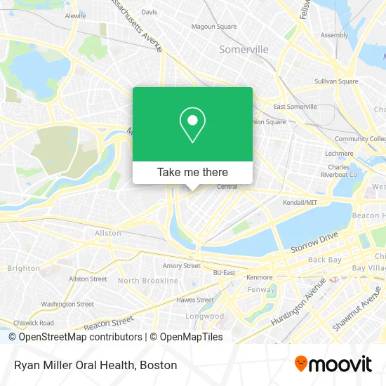
See Ryan Miller Oral Health, Cambridge, on the map
Public Transit to Ryan Miller Oral Health in Cambridge
Wondering how to get to Ryan Miller Oral Health in Cambridge? Moovit helps you find the best way to get to Ryan Miller Oral Health with step-by-step directions from the nearest public transit station.
Moovit provides free maps and live directions to help you navigate through your city. View schedules, routes, timetables, and find out how long does it take to get to Ryan Miller Oral Health in real time.
Looking for the nearest stop or station to Ryan Miller Oral Health? Check out this list of stops closest to your destination: Western Ave @ Putnam Ave; Pearl St @ Putnam Ave; Harvard Square; River St @ Green St; Cambridgeport; Amory Street.
Bus: 1, 19, 501, 64, 70, 91, 47, 83, EZRIDE, EZRIDE.Train: FITCHBURG, FRAMINGHAM/WORCESTER.Subway: RED LINE, GREEN LINE B.
Want to see if there’s another route that gets you there at an earlier time? Moovit helps you find alternative routes or times. Get directions from and directions to Ryan Miller Oral Health easily from the Moovit App or Website.
We make riding to Ryan Miller Oral Health easy, which is why over 1.7 million users, including users in Cambridge, trust Moovit as the best app for public transit. You don’t need to download an individual bus app or train app, Moovit is your all-in-one transit app that helps you find the best bus time or train time available.
For information on prices of bus, subway and train, costs and ride fares to Ryan Miller Oral Health, please check the Moovit app.
Use the app to navigate to popular places including to the airport, hospital, stadium, grocery store, mall, coffee shop, school, college, and university.
Ryan Miller Oral Health Address: 250 River St street in Cambridge
- Russell E Hoyt Field,
- Walgreens,
- WESTERN UNION,
- The Brotel,
- Riverside Technology Center,
- Cambridge Community Center (Cambridge Winter Farmers Market),
- Cambridge Community Center,
- Stephen Funk Pearson,
- 108,
- Sub Zero Nitrogen Ice Cream,
- Pleasant Street Condominiums,
- Moishe HOUSE,
- Head of the Charles Regatta,
- Science Club for Girls,
- Latin School Rindge School of Technical Arts,
- Putnam Avenue Upper School,
- Government Offices City Community Schools,
- Wofford John G,
- SADL- Head of the Charles,
- COURTYARD-Boston Cambridge (Cambridge Marriott)
Places Near Ryan Miller Oral Health (Cambridge)
- Wilbur Theatre, Boston,
- Cheers, Boston,
- Isabella Stewart Gardner Museum, Boston,
- Seaport District, Boston,
- Mgm Music Hall, Boston,
- Quincy Market, Boston,
- Wang Theater, Boston,
- Leader Bank Pavilion (Leader Bank Pavillion), Boston,
- Td Garden, Boston,
- Boston Medical Center, Boston,
- House Of Blues, Boston,
- Boston Children's Hospital, Boston,
- Faneuil Hall, Boston,
- Museum Of Science, Boston,
- Boston Common, Boston,
- Boston Convention & Exhibition Center, Boston,
- Castle Island, Boston,
- North End, Boston,
- Prudential Center, Boston,
- Massachusetts General Hospital, Boston
How to get to popular places in Boston with public transit
Get around Cambridge by public transit!
Traveling around Cambridge has never been so easy. See step by step directions as you travel to any attraction, street or major public transit station. View bus and train schedules, arrival times, service alerts and detailed routes on a map, so you know exactly how to get to anywhere in Cambridge.
When traveling to any destination around Cambridge use Moovit's Live Directions with Get Off Notifications to know exactly where and how far to walk, how long to wait for your line, and how many stops are left. Moovit will alert you when it's time to get off — no need to constantly re-check whether yours is the next stop.
Wondering how to use public transit in Cambridge or how to pay for public transit in Cambridge? Moovit public transit app can help you navigate your way with public transit easily, and at minimum cost. It includes public transit fees, ticket prices, and costs. Looking for a map of Cambridge public transit lines? Moovit public transit app shows all public transit maps in Cambridge with all Bus, Train, Subway and Ferry routes and stops on an interactive map.
Boston has 4 transit type(s), including: Bus, Train, Subway and Ferry, operated by several transit agencies, including MBTA, Southeastern Regional Transit Authority, MetroWest Regional Transit Authority, Rhode Island Public Transit Authority, WRTA, Lowell Regional Transit Authority, Merrimack Valley Transit, Montachusett Regional Transit Authority, Cape Cod Regional Transit Authority, Brockton Area Transit Authority, Martha's Vineyard Transit Authority, the WAVE - Nantucket Regional Transit Authority, GATRA, Cape Ann Transportation Authority and Massport