Directions to Software2 (Cambridge) with public transportation
The following transit lines have routes that pass near Software2
 Bus: 1, 47, 64, 91, RED LINE SHUTTLE.
- Train: FRAMINGHAM/WORCESTER.
- Subway: RED LINE, GREEN LINE B.
How to get to Software2 by bus?
Click on the bus route to see step by step directions with maps, line arrival times and updated time schedules.
From Aloft-Boston Seaport Dist, Boston
49 minFrom West Roxbury, Boston
76 minFrom Lower Mills, Boston
89 minFrom Commonwealth Pier, Boston
52 minFrom Four Points by Sheraton Boston Logan Airport, Revere
99 minFrom Best Western Adams Inn Quincy - Boston, Quincy
99 minFrom Dorchester District Court, Boston
71 minFrom Market Basket, Revere
98 minFrom Codman Square, Boston
74 min
How to get to Software2 by train?
Click on the train route to see step by step directions with maps, line arrival times and updated time schedules.
How to get to Software2 by subway?
Click on the subway route to see step by step directions with maps, line arrival times and updated time schedules.
Bus stops near Software2 in Cambridge
Subway stations near Software2 in Cambridge
Bus lines to Software2 in Cambridge
- 1, Harvard,VIEW
- RED LINE SHUTTLE, Kendall/MIT (Loop Shuttle),VIEW
- RED LINE SHUTTLE, Harvard (Shuttle),VIEW
- RED LINE SHUTTLE, Jfk/Umass (Shuttle),VIEW
- RED LINE SHUTTLE, Park Street (Shuttle),VIEW
- 64, Kendall/MIT - Oak Square,VIEW
- 70, University Park - Market Place Dr,VIEW
- 83, Central Square - Rindge Ave,VIEW
- 91, Central Square - Sullivan,VIEW
- 47, Broadway,VIEW
- RED LINE SHUTTLE, Alewife (Shuttle),VIEW
- RED LINE SHUTTLE, Alewife (Local Shuttle),VIEW
What are the closest stations to Software2?
The closest stations to Software2 are:
- Massachusetts Ave @ Prospect St is 87 yards away, 2 min walk.
- Western Ave @ Green St is 128 yards away, 2 min walk.
- Green St @ Magazine St is 141 yards away, 2 min walk.
- Massachusetts Ave @ Pearl St is 197 yards away, 3 min walk.
- Blandford Street is 400 yards away, 5 min walk.
- Kendall/MIT is 991 yards away, 12 min walk.
Which bus lines stop near Software2?
These bus lines stop near Software2: 1, 47, 64, 91.
Which train line stops near Software2?
FRAMINGHAM/WORCESTER (#525 | Worcester)
Which subway line stops near Software2?
RED LINE (Alewife)
What’s the nearest subway station to Software2 in Cambridge?
The nearest subway station to Software2 in Cambridge is Blandford Street. It’s a 5 min walk away.
What’s the nearest bus station to Software2 in Cambridge?
The nearest bus stations to Software2 in Cambridge are Massachusetts Ave @ Prospect St, Western Ave @ Green St and Green St @ Magazine St. The closest one is a 2 min walk away.
What time is the first subway to Software2 in Cambridge?
The RED LINE is the first subway that goes to Software2 in Cambridge. It stops nearby at 5:25 AM.
What time is the last subway to Software2 in Cambridge?
The GREEN LINE B is the last subway that goes to Software2 in Cambridge. It stops nearby at 2:15 AM.
What time is the first bus to Software2 in Cambridge?
The 70 is the first bus that goes to Software2 in Cambridge. It stops nearby at 4:25 AM.
What time is the last bus to Software2 in Cambridge?
The 1 is the last bus that goes to Software2 in Cambridge. It stops nearby at 2:30 AM.
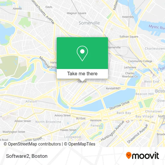
See Software2, Cambridge, on the map
Public Transit to Software2 in Cambridge
Wondering how to get to Software2 in Cambridge? Moovit helps you find the best way to get to Software2 with step-by-step directions from the nearest public transit station.
Moovit provides free maps and live directions to help you navigate through your city. View schedules, routes, timetables, and find out how long does it take to get to Software2 in real time.
Looking for the nearest stop or station to Software2? Check out this list of stops closest to your destination: Massachusetts Ave @ Prospect St; Western Ave @ Green St; Green St @ Magazine St; Massachusetts Ave @ Pearl St; Blandford Street; Kendall/MIT.
Bus: 1, 47, 64, 91, RED LINE SHUTTLE, RED LINE SHUTTLE, RED LINE SHUTTLE, RED LINE SHUTTLE, 70, 83, RED LINE SHUTTLE, RED LINE SHUTTLE, RED LINE SHUTTLE, RED LINE SHUTTLE.Train: FRAMINGHAM/WORCESTER.Subway: RED LINE, GREEN LINE B.
Want to see if there’s another route that gets you there at an earlier time? Moovit helps you find alternative routes or times. Get directions from and directions to Software2 easily from the Moovit App or Website.
We make riding to Software2 easy, which is why over 1.7 million users, including users in Cambridge, trust Moovit as the best app for public transit. You don’t need to download an individual bus app or train app, Moovit is your all-in-one transit app that helps you find the best bus time or train time available.
For information on prices of bus, subway, train and ferry, costs and ride fares to Software2, please check the Moovit app.
Use the app to navigate to popular places including to the airport, hospital, stadium, grocery store, mall, coffee shop, school, college, and university.
Software2 Address: Software2 Northern States Office, 203 Franklin St street in Cambridge
- McCormack Wellness Centre,
- Lee Robert G,
- Seal A Deck,
- Shawmut Design and Construction,
- Embondeiro Capoeira Boston (Flamenco Boston),
- Wrca 1330 am Radio (Wrca-Wlyn Radio Station),
- Yamba Market,
- Shalimar India Food & Spices (Shalimar of India),
- Cambridge College,
- Target,
- The Massachusetts Institute of Technology,
- Goodwill,
- Harvest Co-op Market,
- Sonia,
- The Goodwill Store,
- MBTA Bus 1 (Central Square),
- Hubba-Hubba,
- Green Street,
- The Phoenix Landing,
- The Middle East Downstairs
Places Near Software2 (Cambridge)
- Castle Island, Boston,
- Wang Theater, Boston,
- House Of Blues, Boston,
- Boston Children's Hospital, Boston,
- Seaport District, Boston,
- Wilbur Theatre, Boston,
- Leader Bank Pavilion (Leader Bank Pavillion), Boston,
- Boston Common, Boston,
- North End, Boston,
- Td Garden, Boston,
- Prudential Center, Boston,
- Quincy Market, Boston,
- Museum Of Science, Boston,
- Massachusetts General Hospital, Boston,
- Mgm Music Hall, Boston,
- Boston Medical Center, Boston,
- Isabella Stewart Gardner Museum, Boston,
- Boston Convention & Exhibition Center, Boston,
- Faneuil Hall, Boston,
- Cheers, Boston
How to get to popular places in Boston with public transit
Get around Cambridge by public transit!
Traveling around Cambridge has never been so easy. See step by step directions as you travel to any attraction, street or major public transit station. View bus and train schedules, arrival times, service alerts and detailed routes on a map, so you know exactly how to get to anywhere in Cambridge.
When traveling to any destination around Cambridge use Moovit's Live Directions with Get Off Notifications to know exactly where and how far to walk, how long to wait for your line, and how many stops are left. Moovit will alert you when it's time to get off — no need to constantly re-check whether yours is the next stop.
Wondering how to use public transit in Cambridge or how to pay for public transit in Cambridge? Moovit public transit app can help you navigate your way with public transit easily, and at minimum cost. It includes public transit fees, ticket prices, and costs. Looking for a map of Cambridge public transit lines? Moovit public transit app shows all public transit maps in Cambridge with all Bus, Train, Subway and Ferry routes and stops on an interactive map.
Boston has 4 transit type(s), including: Bus, Train, Subway and Ferry, operated by several transit agencies, including MBTA, Southeastern Regional Transit Authority, MetroWest Regional Transit Authority, Rhode Island Public Transit Authority, WRTA, Lowell Regional Transit Authority, Merrimack Valley Transit, Montachusett Regional Transit Authority, Cape Cod Regional Transit Authority, Brockton Area Transit Authority, Martha's Vineyard Transit Authority, the WAVE - Nantucket Regional Transit Authority, GATRA, Cape Ann Transportation Authority and Massport