Directions to Spafford Leasing Associates (Boston) with public transportation
The following transit lines have routes that pass near Spafford Leasing Associates
 Bus: B7, G5, PETER PAN, B17, B6.
- Train: LAKE SHORE LIMITED, VERMONTER, AMTRAK HARTFORD LINE, NORTHEAST REGIONAL, VALLEY FLYER.
How to get to Spafford Leasing Associates by bus?
Click on the bus route to see step by step directions with maps, line arrival times and updated time schedules.
From Worcester, MA, Worcester
84 minFrom Dcu Center, Worcester
86 minFrom Foxwoods, Worcester
113 minFrom South High Community School, Worcester
181 minFrom Polar Park, Worcester
85 minFrom Walmart Supercenter, Worcester
143 minFrom Palladium, Worcester
89 minFrom Registry Of Motor Vehicles (Rmv) Branch Office, Worcester
88 min
How to get to Spafford Leasing Associates by train?
Click on the train route to see step by step directions with maps, line arrival times and updated time schedules.
Bus stops near Spafford Leasing Associates in Boston
Train station near Spafford Leasing Associates in Boston
- Springfield, 58 min walk,VIEW
Bus lines to Spafford Leasing Associates in Boston
- B17, 16 Acres Via Wilbraham Rd / Worthington St,VIEW
- B6, Ludlow via Bay St,VIEW
- B7, Wilbraham Big Y-State St-Boston Rd,VIEW
- G1, Chicopee / Sumner-Allen-Canon Circle,VIEW
- G2, Carew-East Springfield / Belmont-Dwight Rd,VIEW
- G3, Spfld Plaza via Liberty / King-Westford,VIEW
- G5, Dickinson-Jewish Home-Longmeadow,VIEW
- R10, Westfield/West Springfield via Route 20,VIEW
- R14, Feeding Hills-Springfield,VIEW
- T1, Tripper 1 Helper Service,VIEW
- T2, Tripper 2 Helper Service,VIEW
- T3, Tripper 3 Helper Service,VIEW
- T4, Tripper 4 Helper Service,VIEW
- T5, Tripper 5 Helper Service,VIEW
- T6, Tripper 6 Helper Service,VIEW
- T92, Tripper 92 Helper Service,VIEW
- X90, Inner Crosstown,VIEW
- X92, Mid City Crosstown,VIEW
- T21, State Street Blunt Park Rd. To Bay Street,VIEW
What are the closest stations to Spafford Leasing Associates?
The closest stations to Spafford Leasing Associates are:
- Worthington / Main is 39 yards away, 1 min walk.
- Main / Worthington is 75 yards away, 1 min walk.
- Main / Bridge is 147 yards away, 2 min walk.
- Springfield is 4897 yards away, 58 min walk.
Which bus lines stop near Spafford Leasing Associates?
These bus lines stop near Spafford Leasing Associates: B7, G5, PETER PAN.
Which train lines stop near Spafford Leasing Associates?
These train lines stop near Spafford Leasing Associates: LAKE SHORE LIMITED, VERMONTER.
What’s the nearest bus station to Spafford Leasing Associates in Boston?
The nearest bus stations to Spafford Leasing Associates in Boston are Worthington / Main and Main / Worthington. The closest one is a 1 min walk away.
What time is the first train to Spafford Leasing Associates in Boston?
The NORTHEAST REGIONAL is the first train that goes to Spafford Leasing Associates in Boston. It stops nearby at 4:10 AM.
What time is the last train to Spafford Leasing Associates in Boston?
The LAKE SHORE LIMITED is the last train that goes to Spafford Leasing Associates in Boston. It stops nearby at 6:04 PM.
What time is the first bus to Spafford Leasing Associates in Boston?
The R10 is the first bus that goes to Spafford Leasing Associates in Boston. It stops nearby at 5:00 AM.
What time is the last bus to Spafford Leasing Associates in Boston?
The R10 is the last bus that goes to Spafford Leasing Associates in Boston. It stops nearby at 11:21 PM.
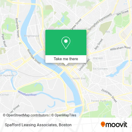
See Spafford Leasing Associates, Boston, on the map
Public Transit to Spafford Leasing Associates in Boston
Wondering how to get to Spafford Leasing Associates in Boston? Moovit helps you find the best way to get to Spafford Leasing Associates with step-by-step directions from the nearest public transit station.
Moovit provides free maps and live directions to help you navigate through your city. View schedules, routes, timetables, and find out how long does it take to get to Spafford Leasing Associates in real time.
Looking for the nearest stop or station to Spafford Leasing Associates? Check out this list of stops closest to your destination: Worthington / Main; Main / Worthington; Main / Bridge; Springfield.
Bus: B7, G5, PETER PAN, B17, B6, G1, G2, G3, T21.Train: LAKE SHORE LIMITED, VERMONTER, AMTRAK HARTFORD LINE, NORTHEAST REGIONAL, VALLEY FLYER.
Want to see if there’s another route that gets you there at an earlier time? Moovit helps you find alternative routes or times. Get directions from and directions to Spafford Leasing Associates easily from the Moovit App or Website.
We make riding to Spafford Leasing Associates easy, which is why over 1.7 million users, including users in Boston, trust Moovit as the best app for public transit. You don’t need to download an individual bus app or train app, Moovit is your all-in-one transit app that helps you find the best bus time or train time available.
For information on prices of bus and train, costs and ride fares to Spafford Leasing Associates, please check the Moovit app.
Use the app to navigate to popular places including to the airport, hospital, stadium, grocery store, mall, coffee shop, school, college, and university.
Spafford Leasing Associates Address: 1500 Main St street in Boston
- J W's Steakhouse,
- Serres,
- Big Y Express Fresh Market,
- Springfield Wine Exchange,
- Bank Properties of Western Mass,
- Massmutual,
- Seeley Investments,
- Farm Credit Financial Partners, Inc.,
- Worthington Investment Counsel,
- Teksystems,
- Collette Tours,
- Springfield Boys & Girls Club Festival of Trees Courtesy of Tower Square,
- Advanced Plumbing,
- Kester Tracie M,
- Tessier Associates,
- Osem Home Health Care Agency,
- Emerald City Travel,
- Martin Bradford R Jr,
- McCarthy Frederica H Attorney,
- Moore Wealth Management of Raymond James
Places Near Spafford Leasing Associates (Boston)
- Museum Of Science, Boston,
- Quincy Market, Boston,
- Faneuil Hall, Boston,
- Td Garden, Boston,
- Mgm Music Hall, Boston,
- Prudential Center, Boston,
- Seaport District, Boston,
- North End, Boston,
- Cheers, Boston,
- Boston Medical Center, Boston,
- Isabella Stewart Gardner Museum, Boston,
- Boston Common, Boston,
- Boston Children's Hospital, Boston,
- Leader Bank Pavilion (Leader Bank Pavillion), Boston,
- Castle Island, Boston,
- Boston Convention & Exhibition Center, Boston,
- Wilbur Theatre, Boston,
- Massachusetts General Hospital, Boston,
- Wang Theater, Boston,
- House Of Blues, Boston
How to get to popular places in Boston with public transit
Get around Boston by public transit!
Traveling around Boston has never been so easy. See step by step directions as you travel to any attraction, street or major public transit station. View bus and train schedules, arrival times, service alerts and detailed routes on a map, so you know exactly how to get to anywhere in Boston.
When traveling to any destination around Boston use Moovit's Live Directions with Get Off Notifications to know exactly where and how far to walk, how long to wait for your line, and how many stops are left. Moovit will alert you when it's time to get off — no need to constantly re-check whether yours is the next stop.
Wondering how to use public transit in Boston or how to pay for public transit in Boston? Moovit public transit app can help you navigate your way with public transit easily, and at minimum cost. It includes public transit fees, ticket prices, and costs. Looking for a map of Boston public transit lines? Moovit public transit app shows all public transit maps in Boston with all Bus, Train, Subway and Ferry routes and stops on an interactive map.
Boston has 4 transit type(s), including: Bus, Train, Subway and Ferry, operated by several transit agencies, including MBTA, Southeastern Regional Transit Authority, MetroWest Regional Transit Authority, Rhode Island Public Transit Authority, WRTA, Lowell Regional Transit Authority, Merrimack Valley Transit, Montachusett Regional Transit Authority, Cape Cod Regional Transit Authority, Brockton Area Transit Authority, Martha's Vineyard Transit Authority, the WAVE - Nantucket Regional Transit Authority, GATRA, Cape Ann Transportation Authority and Massport