Directions to Springfield Public Schools (Boston) with public transportation
The following transit lines have routes that pass near Springfield Public Schools
 Bus: G73E, GREYHOUND US0171, PETER PAN, B6, B17.
- Train: LAKE SHORE LIMITED, VERMONTER, AMTRAK HARTFORD LINE, NORTHEAST REGIONAL, VALLEY FLYER.
How to get to Springfield Public Schools by bus?
Click on the bus route to see step by step directions with maps, line arrival times and updated time schedules.
From Worcester, MA, Worcester
83 minFrom Polar Park, Worcester
84 minFrom Registry Of Motor Vehicles (Rmv) Branch Office, Worcester
87 minFrom Foxwoods, Worcester
112 minFrom Palladium, Worcester
88 minFrom Walmart Supercenter, Worcester
141 minFrom Dcu Center, Worcester
85 minFrom South High Community School, Worcester
179 min
How to get to Springfield Public Schools by train?
Click on the train route to see step by step directions with maps, line arrival times and updated time schedules.
Bus stops near Springfield Public Schools in Boston
Train station near Springfield Public Schools in Boston
- Springfield, 48 min walk,VIEW
Bus lines to Springfield Public Schools in Boston
- B6, Ludlow Big Y Via Bay/Berkshire,VIEW
- B17, 16 Acres Via Wilbraham Rd / Worthington St,VIEW
- G3, Springfield Plaza To Rmv Via Union Station,VIEW
- G5, Union Station Via Jewish Home,VIEW
- R10, Union Station,VIEW
- R14, Agawam Industrial Park,VIEW
- T6, Post Office,VIEW
- X90, State And Federal To Union Station,VIEW
- B7, Colonial Estates Via Independence House,VIEW
- G1, Five Town Plaza Via Bicentennial,VIEW
- G2, E Springfield Via Union Station-Mercy,VIEW
- T1, State Street Bunt Pk Rd,VIEW
- T2, Post Office Via Main Street / South End,VIEW
- T3, Post Office,VIEW
- T4, State Street Blunt Pk Rd To Bay St,VIEW
- T5, Belmont To the X,VIEW
- T92, Orange To the X,VIEW
- X92, Memorial Industrial Park Via Senior Center And Roosevelt,VIEW
- PETER PAN, AMHERST - NORTHAMPTON - SPRINGFIELD - HARTFORD - NEW YORK Express Service,VIEW
- PETER PAN, BOSTON - WORCESTER - SPRINGFIELD - NORTHAMPTON - AMHERST,VIEW
What are the closest stations to Springfield Public Schools?
The closest stations to Springfield Public Schools are:
- Harrison Avenue is 61 yards away, 1 min walk.
- Main / Harrison is 94 yards away, 2 min walk.
- Union Station Springfield is 112 yards away, 2 min walk.
- Main / Bridge is 222 yards away, 3 min walk.
- Springfield Union Station is 341 yards away, 5 min walk.
- Springfield is 3987 yards away, 48 min walk.
Which bus lines stop near Springfield Public Schools?
These bus lines stop near Springfield Public Schools: G73E, GREYHOUND US0171, PETER PAN.
Which train lines stop near Springfield Public Schools?
These train lines stop near Springfield Public Schools: LAKE SHORE LIMITED, VERMONTER.
What’s the nearest bus station to Springfield Public Schools in Boston?
The nearest bus station to Springfield Public Schools in Boston is Harrison Avenue. It’s a 1 min walk away.
What time is the first train to Springfield Public Schools in Boston?
The NORTHEAST REGIONAL is the first train that goes to Springfield Public Schools in Boston. It stops nearby at 4:10 AM.
What time is the last train to Springfield Public Schools in Boston?
The LAKE SHORE LIMITED is the last train that goes to Springfield Public Schools in Boston. It stops nearby at 6:04 PM.
What time is the first bus to Springfield Public Schools in Boston?
The FLIXBUS N2615 is the first bus that goes to Springfield Public Schools in Boston. It stops nearby at 3:00 AM.
What time is the last bus to Springfield Public Schools in Boston?
The FLIXBUS N2605 is the last bus that goes to Springfield Public Schools in Boston. It stops nearby at 5:40 AM.
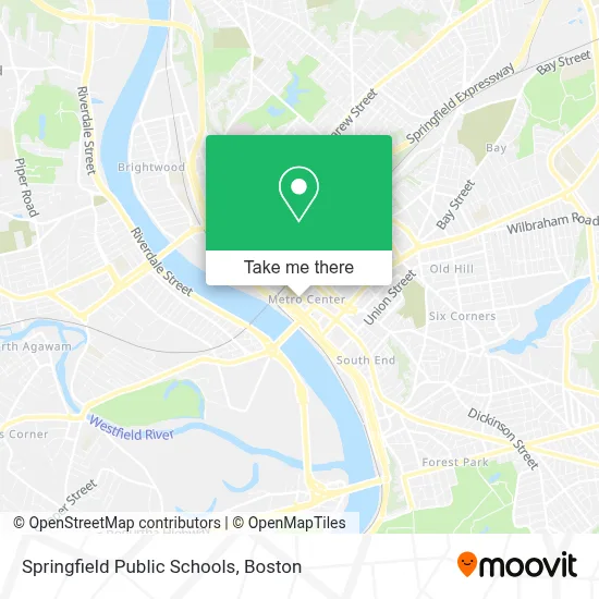
See Springfield Public Schools, Boston, on the map
Public Transit to Springfield Public Schools in Boston
Wondering how to get to Springfield Public Schools in Boston? Moovit helps you find the best way to get to Springfield Public Schools with step-by-step directions from the nearest public transit station.
Moovit provides free maps and live directions to help you navigate through your city. View schedules, routes, timetables, and find out how long does it take to get to Springfield Public Schools in real time.
Looking for the nearest stop or station to Springfield Public Schools? Check out this list of stops closest to your destination: Harrison Avenue; Main / Harrison; Union Station Springfield; Main / Bridge; Springfield Union Station; Springfield.
Bus: G73E, GREYHOUND US0171, PETER PAN, B6, B17, G3, G5, R10, B7, G1, G2, T1, T2, T21, FLIXBUS 2610, FLIXBUS 2619, FLIXBUS 2691, FLIXBUS N2605, FLIXBUS N2615.Train: LAKE SHORE LIMITED, VERMONTER, AMTRAK HARTFORD LINE, NORTHEAST REGIONAL, VALLEY FLYER.
Want to see if there’s another route that gets you there at an earlier time? Moovit helps you find alternative routes or times. Get directions from and directions to Springfield Public Schools easily from the Moovit App or Website.
We make riding to Springfield Public Schools easy, which is why over 1.7 million users, including users in Boston, trust Moovit as the best app for public transit. You don’t need to download an individual bus app or train app, Moovit is your all-in-one transit app that helps you find the best bus time or train time available.
For information on prices of bus and train, costs and ride fares to Springfield Public Schools, please check the Moovit app.
Use the app to navigate to popular places including to the airport, hospital, stadium, grocery store, mall, coffee shop, school, college, and university.
Springfield Public Schools Address: 1550 Main St street in Boston
- Social Security Administration,
- 1550 Main,
- United STTS Attorneys, Exctve Offce,
- Columbus Center,
- 1600 Main Biergarden,
- US Navy Recruiting Office,
- Asylum (Closed),
- Ymca Of Greater Springfield,
- Columbus Center Parking Garage,
- Commonwealth of Massachusetts Western Regional and Area Offices,
- Cohen Philip J,
- WESTERN UNION,
- Community Groom Room,
- Worthington Apartments,
- Legends Barber Shop,
- Vox Church Springfield Ma,
- Rad Bike,
- Precise Cuts,
- Metro Center,
- Bowles Building
Places Near Springfield Public Schools (Boston)
- Massachusetts General Hospital, Boston,
- Boston Children's Hospital, Boston,
- Mgm Music Hall, Boston,
- Isabella Stewart Gardner Museum, Boston,
- Boston Common, Boston,
- Castle Island, Boston,
- Leader Bank Pavilion (Leader Bank Pavillion), Boston,
- Wilbur Theatre, Boston,
- Seaport District, Boston,
- Quincy Market, Boston,
- Boston Convention & Exhibition Center, Boston,
- House Of Blues, Boston,
- Td Garden, Boston,
- Prudential Center, Boston,
- Museum Of Science, Boston,
- Boston Medical Center, Boston,
- Wang Theater, Boston,
- Cheers, Boston,
- Faneuil Hall, Boston,
- North End, Boston
How to get to popular places in Boston with public transit
Get around Boston by public transit!
Traveling around Boston has never been so easy. See step by step directions as you travel to any attraction, street or major public transit station. View bus and train schedules, arrival times, service alerts and detailed routes on a map, so you know exactly how to get to anywhere in Boston.
When traveling to any destination around Boston use Moovit's Live Directions with Get Off Notifications to know exactly where and how far to walk, how long to wait for your line, and how many stops are left. Moovit will alert you when it's time to get off — no need to constantly re-check whether yours is the next stop.
Wondering how to use public transit in Boston or how to pay for public transit in Boston? Moovit public transit app can help you navigate your way with public transit easily, and at minimum cost. It includes public transit fees, ticket prices, and costs. Looking for a map of Boston public transit lines? Moovit public transit app shows all public transit maps in Boston with all Bus, Train, Subway and Ferry routes and stops on an interactive map.
Boston has 4 transit type(s), including: Bus, Train, Subway and Ferry, operated by several transit agencies, including MBTA, Southeastern Regional Transit Authority, MetroWest Regional Transit Authority, Rhode Island Public Transit Authority, WRTA, Lowell Regional Transit Authority, Merrimack Valley Transit, Montachusett Regional Transit Authority, Cape Cod Regional Transit Authority, Brockton Area Transit Authority, Martha's Vineyard Transit Authority, the WAVE - Nantucket Regional Transit Authority, GATRA, Cape Ann Transportation Authority and Massport
Public transit lines with stations closest to Springfield Public Schools in Boston
Train lines with stations closest to Springfield Public Schools in Boston
Bus lines with stations closest to Springfield Public Schools in Boston
Union Station Springfield
- PETER PANAMHERST - NORTHAMPTON - SPRINGFIELD - HARTFORD - NEW YORK Express Service
- PETER PANBOSTON - WORCESTER - SPRINGFIELD - NORTHAMPTON - AMHERST
- PETER PANNEW YORK - HARTFORD - SPRINGFIELD - NORTHAMPTON - AMHERST Express Service
- PETER PANAMHERST - NORTHAMPTON - SPRINGFIELD - WORCESTER - BOSTON
- PETER PANPROVIDENCE - SPRINGFIELD - ALBANY