Directions to The Job Connector by Mit (Cambridge) with public transportation
The following transit lines have routes that pass near The Job Connector by Mit
 Bus: 1, 70, 85, EZRIDE.
- Train: NEEDHAM, NEWBURYPORT/ROCKPORT, NORTHEAST REGIONAL.
- Subway: RED LINE, GREEN LINE B, GREEN LINE C, GREEN LINE D, GREEN LINE E.
How to get to The Job Connector by Mit by bus?
Click on the bus route to see step by step directions with maps, line arrival times and updated time schedules.
From Best Western Adams Inn Quincy - Boston, Quincy
97 minFrom Belle Isle Lobster & Seafood, Winthrop Town
84 minFrom West Roxbury, Boston
73 minFrom Sunrise Shuttle Pick Up, Boston
62 minFrom Chelsea District Court, Chelsea
49 minFrom Spaulding Rehab, Boston
68 minFrom Boston Black Falcon Cruise Terminal, Boston
59 minFrom Market Basket, Revere
93 minFrom VFW Parkway, Boston
79 minFrom Lower Mills, Boston
86 min
How to get to The Job Connector by Mit by train?
Click on the train route to see step by step directions with maps, line arrival times and updated time schedules.
How to get to The Job Connector by Mit by subway?
Click on the subway route to see step by step directions with maps, line arrival times and updated time schedules.
Subway stations near The Job Connector by Mit in Cambridge
Bus stops near The Job Connector by Mit in Cambridge
Bus lines to The Job Connector by Mit in Cambridge
- 85, Ruggles,VIEW
- 1, Harvard,VIEW
- 70, Market Place Dr,VIEW
- 64, Kendall/MIT - Oak Square,VIEW
- 68, Kendall/MIT - Harvard,VIEW
- 47, Central Square,VIEW
- EZRIDE, Inbound To North Station Via Kendall And Lechmere,VIEW
- EZRIDE, Outbound To Erie St From North Station,VIEW
- EZRIDE, Inbound To North Station From Erie St,VIEW
- EZRIDE, Outbound North Station To Erie St Via Lechmere And Kendall,VIEW
What are the closest stations to The Job Connector by Mit?
The closest stations to The Job Connector by Mit are:
- Central is 177 yards away, 3 min walk.
- Vassar St @ Massachusetts Ave is 211 yards away, 3 min walk.
- Massachusetts Ave @ Sidney St is 222 yards away, 3 min walk.
- Broadway @ Windsor St is 276 yards away, 4 min walk.
- Brookline St @ Green St is 327 yards away, 4 min walk.
- Albany St./Osborn St. is 385 yards away, 5 min walk.
- Kenmore is 431 yards away, 6 min walk.
- Landsdowne/Mass Ave is 498 yards away, 6 min walk.
- Albany St. /Edgerton House is 529 yards away, 7 min walk.
- Union Square is 1556 yards away, 19 min walk.
Which bus lines stop near The Job Connector by Mit?
These bus lines stop near The Job Connector by Mit: 1, 70, 85, EZRIDE.
Which train lines stop near The Job Connector by Mit?
These train lines stop near The Job Connector by Mit: NEEDHAM, NEWBURYPORT/ROCKPORT, NORTHEAST REGIONAL.
Which subway line stops near The Job Connector by Mit?
RED LINE (Alewife)
What’s the nearest subway station to The Job Connector by Mit in Cambridge?
The nearest subway station to The Job Connector by Mit in Cambridge is Central. It’s a 3 min walk away.
What’s the nearest bus station to The Job Connector by Mit in Cambridge?
The nearest bus stations to The Job Connector by Mit in Cambridge are Vassar St @ Massachusetts Ave and Massachusetts Ave @ Sidney St. The closest one is a 3 min walk away.
What time is the first subway to The Job Connector by Mit in Cambridge?
The GREEN LINE E is the first subway that goes to The Job Connector by Mit in Cambridge. It stops nearby at 4:50 AM.
What time is the last subway to The Job Connector by Mit in Cambridge?
The GREEN LINE D is the last subway that goes to The Job Connector by Mit in Cambridge. It stops nearby at 2:18 AM.
What time is the first bus to The Job Connector by Mit in Cambridge?
The 70 is the first bus that goes to The Job Connector by Mit in Cambridge. It stops nearby at 4:25 AM.
What time is the last bus to The Job Connector by Mit in Cambridge?
The 1 is the last bus that goes to The Job Connector by Mit in Cambridge. It stops nearby at 2:28 AM.
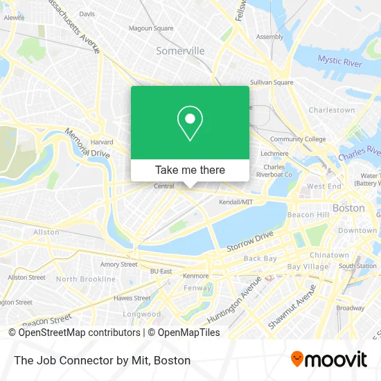
See The Job Connector by Mit, Cambridge, on the map
Public Transit to The Job Connector by Mit in Cambridge
Wondering how to get to The Job Connector by Mit in Cambridge? Moovit helps you find the best way to get to The Job Connector by Mit with step-by-step directions from the nearest public transit station.
Moovit provides free maps and live directions to help you navigate through your city. View schedules, routes, timetables, and find out how long does it take to get to The Job Connector by Mit in real time.
Looking for the nearest stop or station to The Job Connector by Mit? Check out this list of stops closest to your destination: Central; Vassar St @ Massachusetts Ave; Massachusetts Ave @ Sidney St; Broadway @ Windsor St; Brookline St @ Green St; Albany St./Osborn St.; Kenmore; Landsdowne/Mass Ave; Albany St. /Edgerton House; Union Square.
Bus: 1, 70, 85, EZRIDE.Train: NEEDHAM, NEWBURYPORT/ROCKPORT, NORTHEAST REGIONAL.Subway: RED LINE, GREEN LINE B, GREEN LINE C, GREEN LINE D, GREEN LINE E.
Want to see if there’s another route that gets you there at an earlier time? Moovit helps you find alternative routes or times. Get directions from and directions to The Job Connector by Mit easily from the Moovit App or Website.
We make riding to The Job Connector by Mit easy, which is why over 1.7 million users, including users in Cambridge, trust Moovit as the best app for public transit. You don’t need to download an individual bus app or train app, Moovit is your all-in-one transit app that helps you find the best bus time or train time available.
For information on prices of bus, subway and train, costs and ride fares to The Job Connector by Mit, please check the Moovit app.
Use the app to navigate to popular places including to the airport, hospital, stadium, grocery store, mall, coffee shop, school, college, and university.
The Job Connector by Mit Address: 792 Main St street in Cambridge
- Windsor Inn (Windsor Hotel Cambridge),
- Endicott World Music Room (N52-199),
- Mit Museum,
- U-Haul,
- The Mit Press Bookstore,
- Windsor Street Dental Clinic,
- A4cade,
- Roxy's Grilled Cheese (Roxys - Area 4cad),
- Takeda Pharmaceuticals,
- LabCentral,
- Pagu,
- Blue Owl Rooftop Bar,
- K B Aruda Construction,
- Wing Chun Kung Fu Academy,
- Novartis Institutes For Biomedical Research,
- Nibr Novartis,
- KNL,
- 250 Mass Ave,
- Le Meridien Boston Cambridge,
- Pisani Center
Places Near The Job Connector by Mit (Cambridge)
- Boston Convention & Exhibition Center, Boston,
- Leader Bank Pavilion (Leader Bank Pavillion), Boston,
- Prudential Center, Boston,
- House Of Blues, Boston,
- Mgm Music Hall, Boston,
- Boston Children's Hospital, Boston,
- Boston Medical Center, Boston,
- Wang Theater, Boston,
- Faneuil Hall, Boston,
- Massachusetts General Hospital, Boston,
- Td Garden, Boston,
- Boston Common, Boston,
- Cheers, Boston,
- Museum Of Science, Boston,
- Quincy Market, Boston,
- North End, Boston,
- Isabella Stewart Gardner Museum, Boston,
- Wilbur Theatre, Boston,
- Castle Island, Boston,
- Seaport District, Boston
How to get to popular places in Boston with public transit
Get around Cambridge by public transit!
Traveling around Cambridge has never been so easy. See step by step directions as you travel to any attraction, street or major public transit station. View bus and train schedules, arrival times, service alerts and detailed routes on a map, so you know exactly how to get to anywhere in Cambridge.
When traveling to any destination around Cambridge use Moovit's Live Directions with Get Off Notifications to know exactly where and how far to walk, how long to wait for your line, and how many stops are left. Moovit will alert you when it's time to get off — no need to constantly re-check whether yours is the next stop.
Wondering how to use public transit in Cambridge or how to pay for public transit in Cambridge? Moovit public transit app can help you navigate your way with public transit easily, and at minimum cost. It includes public transit fees, ticket prices, and costs. Looking for a map of Cambridge public transit lines? Moovit public transit app shows all public transit maps in Cambridge with all Bus, Train, Subway and Ferry routes and stops on an interactive map.
Boston has 4 transit type(s), including: Bus, Train, Subway and Ferry, operated by several transit agencies, including MBTA, Southeastern Regional Transit Authority, MetroWest Regional Transit Authority, Rhode Island Public Transit Authority, WRTA, Lowell Regional Transit Authority, Merrimack Valley Transit, Montachusett Regional Transit Authority, Cape Cod Regional Transit Authority, Brockton Area Transit Authority, Martha's Vineyard Transit Authority, the WAVE - Nantucket Regional Transit Authority, GATRA, Cape Ann Transportation Authority and Massport