Directions to Northgate Dental (Boston) with public transportation
The following transit lines have routes that pass near Northgate Dental
 Bus: G73E, GREYHOUND US0171, PETER PAN, G3, P21E.
- Train: LAKE SHORE LIMITED, VERMONTER, AMTRAK HARTFORD LINE, NORTHEAST REGIONAL, VALLEY FLYER.
How to get to Northgate Dental by bus?
Click on the bus route to see step by step directions with maps, line arrival times and updated time schedules.
From Dcu Center, Worcester
84 minFrom Foxwoods, Worcester
111 minFrom Registry Of Motor Vehicles (Rmv) Branch Office, Worcester
86 minFrom South High Community School, Worcester
179 minFrom Polar Park, Worcester
83 minFrom Worcester, MA, Worcester
82 minFrom Palladium, Worcester
87 minFrom Walmart Supercenter, Worcester
141 min
How to get to Northgate Dental by train?
Click on the train route to see step by step directions with maps, line arrival times and updated time schedules.
Bus stops near Northgate Dental in Boston
Train station near Northgate Dental in Boston
- Springfield, 53 min walk,VIEW
Bus lines to Northgate Dental in Boston
- G3, Springfield Plaza To Rmv Via Union Station,VIEW
- G73E, Northampton Via Holyoke Mall,VIEW
- P21E, Holyoke Trans Center Via I-391 Express,VIEW
- P21, Union Station Via Chicopee Center,VIEW
- T21, State Street Blunt Park Rd. To Bay Street,VIEW
- B4, Union Station,VIEW
- G1, Five Town Plaza Via Bicentennial,VIEW
- G2, E Springfield Via Union Station-Mercy,VIEW
- P20, Holyoke Trans. Ctr. Via Holyoke Mall,VIEW
- T1, State Street Bunt Pk Rd,VIEW
- T2, Post Office Via Main Street / South End,VIEW
- T3, Liberty/Carew Roosevelt To State St,VIEW
- T4, Carew Street Roosevelt To State St,VIEW
- T5, Belmont To the X,VIEW
- T6, Post Office,VIEW
- T92, Orange To the X,VIEW
- B6, Ludlow Big Y Via Bay/Berkshire,VIEW
- B7, Colonial Estates Via Independence House,VIEW
- B12, Union Station Springfield,VIEW
- B17, 16 Acres Via Wilbraham Rd / Worthington St,VIEW
What are the closest stations to Northgate Dental?
The closest stations to Northgate Dental are:
- Liberty / Dwight is 4 yards away, 1 min walk.
- Dwight / Congress is 117 yards away, 3 min walk.
- Springfield Post Office is 168 yards away, 3 min walk.
- Springfield Union Station is 293 yards away, 4 min walk.
- Union Station Springfield is 422 yards away, 6 min walk.
- Springfield is 4426 yards away, 53 min walk.
Which bus lines stop near Northgate Dental?
These bus lines stop near Northgate Dental: G73E, GREYHOUND US0171, PETER PAN.
Which train lines stop near Northgate Dental?
These train lines stop near Northgate Dental: LAKE SHORE LIMITED, VERMONTER.
What’s the nearest bus station to Northgate Dental in Boston?
The nearest bus station to Northgate Dental in Boston is Liberty / Dwight. It’s a 1 min walk away.
What time is the first train to Northgate Dental in Boston?
The NORTHEAST REGIONAL is the first train that goes to Northgate Dental in Boston. It stops nearby at 4:10 AM.
What time is the last train to Northgate Dental in Boston?
The LAKE SHORE LIMITED is the last train that goes to Northgate Dental in Boston. It stops nearby at 6:04 PM.
What time is the first bus to Northgate Dental in Boston?
The FLIXBUS N2615 is the first bus that goes to Northgate Dental in Boston. It stops nearby at 3:00 AM.
What time is the last bus to Northgate Dental in Boston?
The FLIXBUS N2605 is the last bus that goes to Northgate Dental in Boston. It stops nearby at 5:40 AM.
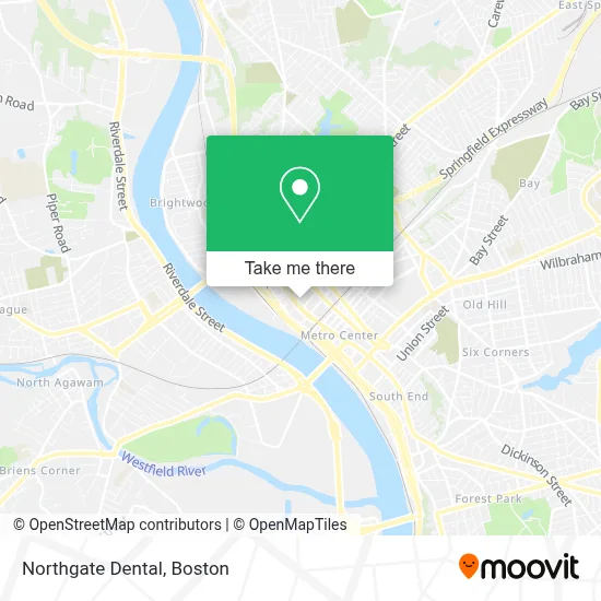
See Northgate Dental, Boston, on the map
Public Transit to Northgate Dental in Boston
Wondering how to get to Northgate Dental in Boston? Moovit helps you find the best way to get to Northgate Dental with step-by-step directions from the nearest public transit station.
Moovit provides free maps and live directions to help you navigate through your city. View schedules, routes, timetables, and find out how long does it take to get to Northgate Dental in real time.
Looking for the nearest stop or station to Northgate Dental? Check out this list of stops closest to your destination: Liberty / Dwight; Dwight / Congress; Springfield Post Office; Springfield Union Station; Union Station Springfield; Springfield.
Bus: G73E, GREYHOUND US0171, PETER PAN, G3, P21E, P21, T21, B4, G1, G2, P20, T1, B6, B7, B12, B17, G5, FLIXBUS 2610, FLIXBUS 2619, FLIXBUS 2691, FLIXBUS N2605, FLIXBUS N2615.Train: LAKE SHORE LIMITED, VERMONTER, AMTRAK HARTFORD LINE, NORTHEAST REGIONAL, VALLEY FLYER.
Want to see if there’s another route that gets you there at an earlier time? Moovit helps you find alternative routes or times. Get directions from and directions to Northgate Dental easily from the Moovit App or Website.
We make riding to Northgate Dental easy, which is why over 1.7 million users, including users in Boston, trust Moovit as the best app for public transit. You don’t need to download an individual bus app or train app, Moovit is your all-in-one transit app that helps you find the best bus time or train time available.
For information on prices of bus and train, costs and ride fares to Northgate Dental, please check the Moovit app.
Use the app to navigate to popular places including to the airport, hospital, stadium, grocery store, mall, coffee shop, school, college, and university.
Northgate Dental Address: 1985 Main St street in Boston
- Dough Show,
- BHN North Gate Center,
- Foreign & Domestic Auto Repair Auto Repair,
- New England Business Associates,
- Gandara Center Substance Abuse Service,
- Asm G,
- Umass Extention,
- Extra Space Storage,
- Restoration & Flips,
- Ffic,
- Springfield Post Office Main Street Station,
- Tracy Viola,
- Leena's Professional Bartending and Catering Services,
- Vietnam Veterans of America - Chapter 111,
- City Mosaic,
- Elite Customs,
- Laurel Hall,
- Chef Wayne's Big Mamou,
- Trolley Park,
- Springfield MA Locksmith Store
Places Near Northgate Dental (Boston)
- Castle Island, Boston,
- Boston Convention & Exhibition Center, Boston,
- Seaport District, Boston,
- Prudential Center, Boston,
- Wilbur Theatre, Boston,
- Museum Of Science, Boston,
- Mgm Music Hall, Boston,
- Wang Theater, Boston,
- Faneuil Hall, Boston,
- Td Garden, Boston,
- Quincy Market, Boston,
- Massachusetts General Hospital, Boston,
- Boston Medical Center, Boston,
- North End, Boston,
- Leader Bank Pavilion (Leader Bank Pavillion), Boston,
- Cheers, Boston,
- Boston Children's Hospital, Boston,
- House Of Blues, Boston,
- Boston Common, Boston,
- Isabella Stewart Gardner Museum, Boston
How to get to popular places in Boston with public transit
Get around Boston by public transit!
Traveling around Boston has never been so easy. See step by step directions as you travel to any attraction, street or major public transit station. View bus and train schedules, arrival times, service alerts and detailed routes on a map, so you know exactly how to get to anywhere in Boston.
When traveling to any destination around Boston use Moovit's Live Directions with Get Off Notifications to know exactly where and how far to walk, how long to wait for your line, and how many stops are left. Moovit will alert you when it's time to get off — no need to constantly re-check whether yours is the next stop.
Wondering how to use public transit in Boston or how to pay for public transit in Boston? Moovit public transit app can help you navigate your way with public transit easily, and at minimum cost. It includes public transit fees, ticket prices, and costs. Looking for a map of Boston public transit lines? Moovit public transit app shows all public transit maps in Boston with all Bus, Train, Subway and Ferry routes and stops on an interactive map.
Boston has 4 transit type(s), including: Bus, Train, Subway and Ferry, operated by several transit agencies, including MBTA, Southeastern Regional Transit Authority, MetroWest Regional Transit Authority, Rhode Island Public Transit Authority, WRTA, Lowell Regional Transit Authority, Merrimack Valley Transit, Montachusett Regional Transit Authority, Cape Cod Regional Transit Authority, Brockton Area Transit Authority, Martha's Vineyard Transit Authority, the WAVE - Nantucket Regional Transit Authority, GATRA, Cape Ann Transportation Authority and Massport