Directions to Overland Lofts Springfield (Boston) with public transportation
The following transit lines have routes that pass near Overland Lofts Springfield
 Bus: G73E, GREYHOUND US0171, PETER PAN, B17, T3.
- Train: LAKE SHORE LIMITED, VERMONTER, AMTRAK HARTFORD LINE, NORTHEAST REGIONAL, VALLEY FLYER.
How to get to Overland Lofts Springfield by bus?
Click on the bus route to see step by step directions with maps, line arrival times and updated time schedules.
From Polar Park, Worcester
86 minFrom South High Community School, Worcester
181 minFrom Registry Of Motor Vehicles (Rmv) Branch Office, Worcester
88 minFrom Foxwoods, Worcester
114 minFrom Worcester, MA, Worcester
84 minFrom Dcu Center, Worcester
86 minFrom Palladium, Worcester
89 minFrom Walmart Supercenter, Worcester
143 min
How to get to Overland Lofts Springfield by train?
Click on the train route to see step by step directions with maps, line arrival times and updated time schedules.
Bus stops near Overland Lofts Springfield in Boston
Train station near Overland Lofts Springfield in Boston
- Springfield, 40 min walk,VIEW
Bus lines to Overland Lofts Springfield in Boston
- B17, 16 Acres Via Wilbraham Rd / Worthington St,VIEW
- B6, Ludlow Big Y Via Bay/Berkshire,VIEW
- G3, Springfield Plaza To Rmv Via Union Station,VIEW
- G5, Union Station Via Jewish Home,VIEW
- R10, Union Station,VIEW
- R14, Agawam Industrial Park,VIEW
- T6, Post Office,VIEW
- X90, State And Federal To Union Station,VIEW
- T3, Liberty/Armory To Carew To N Main,VIEW
- T21, Plainfield Via Carew,VIEW
- B4, Union Station,VIEW
- B7, Colonial Estates Via Independence House,VIEW
- B12, Union Station Springfield,VIEW
- G1, Five Town Plaza Via Bicentennial,VIEW
- G2, E Springfield Via Union Station-Mercy,VIEW
- G73E, Northampton Via Holyoke Mall,VIEW
- P20, Holyoke Trans. Ctr. Via Holyoke Mall,VIEW
- P21, Union Station Via Chicopee Center,VIEW
- P21E, Holyoke Trans Center Via I-391 Express,VIEW
- PS, Palmer Big Y,VIEW
What are the closest stations to Overland Lofts Springfield?
The closest stations to Overland Lofts Springfield are:
- Worthington / Main is 198 yards away, 4 min walk.
- Harrison Avenue (Out) is 225 yards away, 4 min walk.
- Harrison Avenue is 259 yards away, 4 min walk.
- Chestnut / Edwards is 288 yards away, 4 min walk.
- Springfield Union Station is 307 yards away, 4 min walk.
- Springfield is 3384 yards away, 40 min walk.
Which bus lines stop near Overland Lofts Springfield?
These bus lines stop near Overland Lofts Springfield: G73E, GREYHOUND US0171, PETER PAN.
Which train lines stop near Overland Lofts Springfield?
These train lines stop near Overland Lofts Springfield: LAKE SHORE LIMITED, VERMONTER.
What’s the nearest bus station to Overland Lofts Springfield in Boston?
The nearest bus stations to Overland Lofts Springfield in Boston are Worthington / Main, Harrison Avenue (Out), Harrison Avenue, Chestnut / Edwards and Springfield Union Station. The closest one is a 4 min walk away.
What time is the first train to Overland Lofts Springfield in Boston?
The NORTHEAST REGIONAL is the first train that goes to Overland Lofts Springfield in Boston. It stops nearby at 4:10 AM.
What time is the last train to Overland Lofts Springfield in Boston?
The LAKE SHORE LIMITED is the last train that goes to Overland Lofts Springfield in Boston. It stops nearby at 6:04 PM.
What time is the first bus to Overland Lofts Springfield in Boston?
The R10 is the first bus that goes to Overland Lofts Springfield in Boston. It stops nearby at 5:00 AM.
What time is the last bus to Overland Lofts Springfield in Boston?
The R10 is the last bus that goes to Overland Lofts Springfield in Boston. It stops nearby at 11:22 PM.
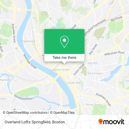
See Overland Lofts Springfield, Boston, on the map
Public Transit to Overland Lofts Springfield in Boston
Wondering how to get to Overland Lofts Springfield in Boston? Moovit helps you find the best way to get to Overland Lofts Springfield with step-by-step directions from the nearest public transit station.
Moovit provides free maps and live directions to help you navigate through your city. View schedules, routes, timetables, and find out how long does it take to get to Overland Lofts Springfield in real time.
Looking for the nearest stop or station to Overland Lofts Springfield? Check out this list of stops closest to your destination: Worthington / Main; Harrison Avenue (Out); Harrison Avenue; Chestnut / Edwards; Springfield Union Station; Springfield.
Bus: G73E, GREYHOUND US0171, PETER PAN, B17, T3, T21, B6, G3, G5, B4, B7, B12, G1, G2, R10, R14, T6, X90.Train: LAKE SHORE LIMITED, VERMONTER, AMTRAK HARTFORD LINE, NORTHEAST REGIONAL, VALLEY FLYER.
Want to see if there’s another route that gets you there at an earlier time? Moovit helps you find alternative routes or times. Get directions from and directions to Overland Lofts Springfield easily from the Moovit App or Website.
We make riding to Overland Lofts Springfield easy, which is why over 1.7 million users, including users in Boston, trust Moovit as the best app for public transit. You don’t need to download an individual bus app or train app, Moovit is your all-in-one transit app that helps you find the best bus time or train time available.
For information on prices of bus and train, costs and ride fares to Overland Lofts Springfield, please check the Moovit app.
Use the app to navigate to popular places including to the airport, hospital, stadium, grocery store, mall, coffee shop, school, college, and university.
Overland Lofts Springfield Address: 151 Chestnut St street in Boston
- Square One,
- Iglesia Union Cristiana Misionera Boaz,
- Kleen Rite Janitorial Service,
- El Sazon Criollo,
- Herbalife Johnalys Jael Nutrition Club,
- Guillermo's Barber Shop,
- Apremont Triangle Historic District,
- Fabulous Cuts Barbershop,
- Reyes Barbershop,
- Nicolai Law Group PC,
- GCQ Net,
- Acme Graphics,
- Vci Solutions,
- Group Insurance Management,
- Apremont Triangle,
- A To Z Supermarket,
- WESTERN UNION,
- East Coast Terminals,
- Karoun Yoga,
- Our Journey
Places Near Overland Lofts Springfield (Boston)
- Boston Common, Boston,
- Leader Bank Pavilion (Leader Bank Pavillion), Boston,
- Wang Theater, Boston,
- Massachusetts General Hospital, Boston,
- Boston Convention & Exhibition Center, Boston,
- Prudential Center, Boston,
- Wilbur Theatre, Boston,
- Museum Of Science, Boston,
- Td Garden, Boston,
- North End, Boston,
- Boston Medical Center, Boston,
- Mgm Music Hall, Boston,
- Cheers, Boston,
- Castle Island, Boston,
- Faneuil Hall, Boston,
- House Of Blues, Boston,
- Quincy Market, Boston,
- Boston Children's Hospital, Boston,
- Seaport District, Boston,
- Isabella Stewart Gardner Museum, Boston
How to get to popular places in Boston with public transit
Get around Boston by public transit!
Traveling around Boston has never been so easy. See step by step directions as you travel to any attraction, street or major public transit station. View bus and train schedules, arrival times, service alerts and detailed routes on a map, so you know exactly how to get to anywhere in Boston.
When traveling to any destination around Boston use Moovit's Live Directions with Get Off Notifications to know exactly where and how far to walk, how long to wait for your line, and how many stops are left. Moovit will alert you when it's time to get off — no need to constantly re-check whether yours is the next stop.
Wondering how to use public transit in Boston or how to pay for public transit in Boston? Moovit public transit app can help you navigate your way with public transit easily, and at minimum cost. It includes public transit fees, ticket prices, and costs. Looking for a map of Boston public transit lines? Moovit public transit app shows all public transit maps in Boston with all Bus, Train, Subway and Ferry routes and stops on an interactive map.
Boston has 4 transit type(s), including: Bus, Train, Subway and Ferry, operated by several transit agencies, including MBTA, Southeastern Regional Transit Authority, MetroWest Regional Transit Authority, Rhode Island Public Transit Authority, WRTA, Lowell Regional Transit Authority, Merrimack Valley Transit, Montachusett Regional Transit Authority, Cape Cod Regional Transit Authority, Brockton Area Transit Authority, Martha's Vineyard Transit Authority, the WAVE - Nantucket Regional Transit Authority, GATRA, Cape Ann Transportation Authority and Massport