Directions to Springfield Tire & Auto Service (Boston) with public transportation
The following transit lines have routes that pass near Springfield Tire & Auto Service
 Bus: G73E, GREYHOUND US0171, PETER PAN, G3, T3.
- Train: LAKE SHORE LIMITED, VERMONTER, AMTRAK HARTFORD LINE, NORTHEAST REGIONAL, VALLEY FLYER.
How to get to Springfield Tire & Auto Service by bus?
Click on the bus route to see step by step directions with maps, line arrival times and updated time schedules.
From Registry Of Motor Vehicles (Rmv) Branch Office, Worcester
85 minFrom Palladium, Worcester
86 minFrom Walmart Supercenter, Worcester
139 minFrom Foxwoods, Worcester
110 minFrom Dcu Center, Worcester
83 minFrom South High Community School, Worcester
177 minFrom Polar Park, Worcester
82 minFrom Worcester, MA, Worcester
81 min
How to get to Springfield Tire & Auto Service by train?
Click on the train route to see step by step directions with maps, line arrival times and updated time schedules.
Bus stops near Springfield Tire & Auto Service in Boston
Train station near Springfield Tire & Auto Service in Boston
- Springfield, 28 min walk,VIEW
Bus lines to Springfield Tire & Auto Service in Boston
- G3, Springfield Plaza To Rmv Via Union Station,VIEW
- T3, Liberty/Carew Roosevelt To State St,VIEW
- T21, Carew And Armory To Chestnut Glenwood Circle,VIEW
- G73E, Northampton Via Holyoke Mall,VIEW
- P21E, Holyoke Trans Center Via I-391 Express,VIEW
- P21, Union Station Via Chicopee Center,VIEW
- B4, Plainfield Street,VIEW
- B6, Ludlow via Bay St,VIEW
- B7, Wilbraham Big Y-State St-Boston Rd,VIEW
- B12, Stonybrook Express,VIEW
- B17, Wilbraham Big Y-Worthington St-Wilbraham Rd,VIEW
- G1, Chicopee / Sumner-Allen-Canon Circle,VIEW
- G2, Carew-East Springfield / Belmont-Dwight Rd,VIEW
- G5, Dickinson-Jewish Home-Longmeadow,VIEW
- P20, Holyoke-Springfield via Holyoke Mall,VIEW
- PS, Palmer Shuttle,VIEW
- R10, Westfield/West Springfield via Route 20,VIEW
- R14, Feeding Hills-Springfield,VIEW
- X90, Inner Crosstown,VIEW
- X92, Mid City Crosstown,VIEW
What are the closest stations to Springfield Tire & Auto Service?
The closest stations to Springfield Tire & Auto Service are:
- Liberty / Chestnut (1) is 82 yards away, 2 min walk.
- Liberty / Dwight is 215 yards away, 4 min walk.
- Springfield Union Station is 234 yards away, 4 min walk.
- Union Station Springfield is 364 yards away, 5 min walk.
- Main / Worthington is 1193 yards away, 14 min walk.
- Springfield is 2355 yards away, 28 min walk.
Which bus lines stop near Springfield Tire & Auto Service?
These bus lines stop near Springfield Tire & Auto Service: G73E, GREYHOUND US0171, PETER PAN.
Which train lines stop near Springfield Tire & Auto Service?
These train lines stop near Springfield Tire & Auto Service: LAKE SHORE LIMITED, VERMONTER.
What’s the nearest train station to Springfield Tire & Auto Service in Boston?
The nearest train station to Springfield Tire & Auto Service in Boston is Springfield. It’s a 28 min walk away.
What’s the nearest bus station to Springfield Tire & Auto Service in Boston?
The nearest bus station to Springfield Tire & Auto Service in Boston is Liberty / Chestnut (1). It’s a 2 min walk away.
What time is the first train to Springfield Tire & Auto Service in Boston?
The NORTHEAST REGIONAL is the first train that goes to Springfield Tire & Auto Service in Boston. It stops nearby at 4:10 AM.
What time is the last train to Springfield Tire & Auto Service in Boston?
The LAKE SHORE LIMITED is the last train that goes to Springfield Tire & Auto Service in Boston. It stops nearby at 6:04 PM.
What time is the first bus to Springfield Tire & Auto Service in Boston?
The FLIXBUS N2615 is the first bus that goes to Springfield Tire & Auto Service in Boston. It stops nearby at 3:00 AM.
What time is the last bus to Springfield Tire & Auto Service in Boston?
The FLIXBUS N2605 is the last bus that goes to Springfield Tire & Auto Service in Boston. It stops nearby at 5:40 AM.
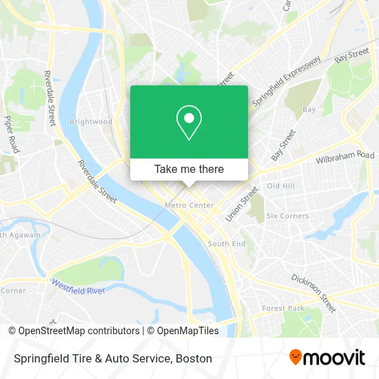
See Springfield Tire & Auto Service, Boston, on the map
Public Transit to Springfield Tire & Auto Service in Boston
Wondering how to get to Springfield Tire & Auto Service in Boston? Moovit helps you find the best way to get to Springfield Tire & Auto Service with step-by-step directions from the nearest public transit station.
Moovit provides free maps and live directions to help you navigate through your city. View schedules, routes, timetables, and find out how long does it take to get to Springfield Tire & Auto Service in real time.
Looking for the nearest stop or station to Springfield Tire & Auto Service? Check out this list of stops closest to your destination: Liberty / Chestnut (1); Liberty / Dwight; Springfield Union Station; Union Station Springfield; Main / Worthington; Springfield.
Bus: G73E, GREYHOUND US0171, PETER PAN, G3, T3, T21, P21E, B4, B6, B7, B12, B17, P21, FLIXBUS 2610, FLIXBUS 2619, FLIXBUS 2691, FLIXBUS N2605, FLIXBUS N2615.Train: LAKE SHORE LIMITED, VERMONTER, AMTRAK HARTFORD LINE, NORTHEAST REGIONAL, VALLEY FLYER.
Want to see if there’s another route that gets you there at an earlier time? Moovit helps you find alternative routes or times. Get directions from and directions to Springfield Tire & Auto Service easily from the Moovit App or Website.
We make riding to Springfield Tire & Auto Service easy, which is why over 1.7 million users, including users in Boston, trust Moovit as the best app for public transit. You don’t need to download an individual bus app or train app, Moovit is your all-in-one transit app that helps you find the best bus time or train time available.
For information on prices of bus and train, costs and ride fares to Springfield Tire & Auto Service, please check the Moovit app.
Use the app to navigate to popular places including to the airport, hospital, stadium, grocery store, mall, coffee shop, school, college, and university.
Springfield Tire & Auto Service Address: 435 Dwight St street in Boston
- All American Sports Bar,
- Creepsheek Studio LLC,
- Mardi Gras Gentlemen's Club,
- Ma Comm for Blind,
- Massachusetts State Office Building,
- Haymond Law Firm,
- Odessy 54,
- Lucky S,
- Loophole Brewing,
- Mulberry Law Group,
- Southern Baptist Convention,
- Ebenezer Health Care Services,
- Home Adaptions,
- Springfield Stretching and Massage Therapy,
- Lessard Property Management Services,
- Focus Adjusters,
- McKenna Green Electric,
- LPM Services,
- City of Firsts Bathroom Experts,
- Strictly
Places Near Springfield Tire & Auto Service (Boston)
- Museum Of Science, Boston,
- North End, Boston,
- Wang Theater, Boston,
- Cheers, Boston,
- Faneuil Hall, Boston,
- Boston Common, Boston,
- Boston Medical Center, Boston,
- Boston Children's Hospital, Boston,
- Leader Bank Pavilion (Leader Bank Pavillion), Boston,
- House Of Blues, Boston,
- Isabella Stewart Gardner Museum, Boston,
- Seaport District, Boston,
- Castle Island, Boston,
- Boston Convention & Exhibition Center, Boston,
- Prudential Center, Boston,
- Mgm Music Hall, Boston,
- Td Garden, Boston,
- Massachusetts General Hospital, Boston,
- Wilbur Theatre, Boston,
- Quincy Market, Boston
How to get to popular places in Boston with public transit
Get around Boston by public transit!
Traveling around Boston has never been so easy. See step by step directions as you travel to any attraction, street or major public transit station. View bus and train schedules, arrival times, service alerts and detailed routes on a map, so you know exactly how to get to anywhere in Boston.
When traveling to any destination around Boston use Moovit's Live Directions with Get Off Notifications to know exactly where and how far to walk, how long to wait for your line, and how many stops are left. Moovit will alert you when it's time to get off — no need to constantly re-check whether yours is the next stop.
Wondering how to use public transit in Boston or how to pay for public transit in Boston? Moovit public transit app can help you navigate your way with public transit easily, and at minimum cost. It includes public transit fees, ticket prices, and costs. Looking for a map of Boston public transit lines? Moovit public transit app shows all public transit maps in Boston with all Bus, Train, Subway and Ferry routes and stops on an interactive map.
Boston has 4 transit type(s), including: Bus, Train, Subway and Ferry, operated by several transit agencies, including MBTA, Southeastern Regional Transit Authority, MetroWest Regional Transit Authority, Rhode Island Public Transit Authority, WRTA, Lowell Regional Transit Authority, Merrimack Valley Transit, Montachusett Regional Transit Authority, Cape Cod Regional Transit Authority, Brockton Area Transit Authority, Martha's Vineyard Transit Authority, the WAVE - Nantucket Regional Transit Authority, GATRA, Cape Ann Transportation Authority and Massport